 Cre8Travel
CRE8TRAVEL · NEW YORK PLACES
Wilmington Wild Forest
Wilmington Wild Forest: Woodland Loops and River Observation
Discover
Wilmington Wild Forest brings several woodland trail systems into the West Branch Ausable River landscape of the Adirondacks. Its broader network offers many possible outings, while a focused visit can begin with a short loop or a viewing area close to a trailhead. The Beaver Brook and Flume networks give different ways to experience the forest. Choose a particular approach and let its combination of ground, tree cover and water views set the pace.
The Beaver Brook network is reached from the Hardy Road area. On the east side of the road, the Coniferous Loop Trail makes a 0.6-mile circuit with little elevation change. Its modest length gives the outing a clear shape, leaving room to pay attention to the woodland along the route. A short loop can be especially satisfying when the purpose is observation: compare the forms of trees, the texture of the ground and the way light reaches different layers of vegetation.
A separate accessible route serves another kind of visit. From the Hardy Road trailhead, the Beaver Brook View Trail extends 0.3 mile one way toward a viewing area. DEC describes a firm crushed-stone surface, a minimum width of three feet and a maximum slope of eight percent, with a privy also identified at this approach. These specifications apply to that particular feature. Consult the current map to connect the chosen starting point with the experience that best suits the day.
Other Beaver Brook trails add more substantial changes in terrain. The All In loop extends three miles on the east side of Hardy Road and climbs more than 750 feet toward a small peak. On the west side, Good Luck Trail is reached using Double Time Trail and supplies a described 1.5-mile loop with mountain views. These choices have different shapes from the short Coniferous Loop. Consider the approach, the climb and the return together before choosing a combination.
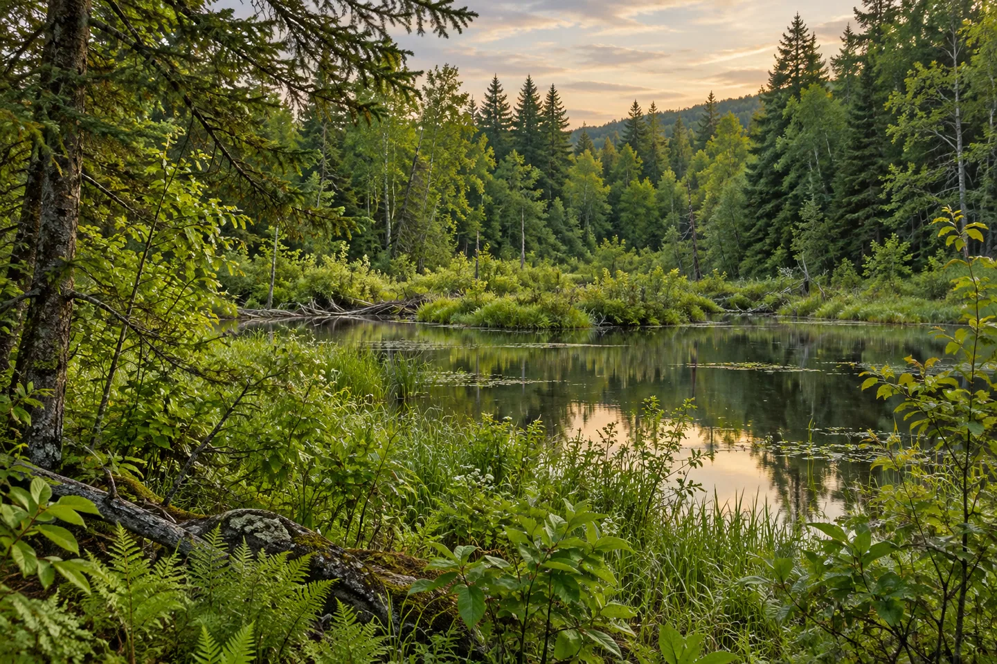
The Flume network offers a separate relationship with the river. From the west trailhead, a viewing pad overlooking a beaver pond is about 400 feet away along the River Trail. DEC also identifies accessible viewing features from this starting area. A pause there can concentrate on the relation between water, lower vegetation and surrounding woodland. The setting can be interesting through the forms and textures visible even when a wildlife encounter does not take place.
The wider Flume and Beaver Brook systems are shared by walkers and mountain bikers on designated routes. Some connections in the Flume area lead toward trails reserved for hiking, so the map's activity distinctions matter. The forest's variety makes a defined plan particularly useful: a short woodland circuit, a viewing-area visit and a longer climbing route are different outings, each worth choosing deliberately rather than combining by accident at a junction.
Check the current DEC map, access notices and the rules for the selected route before travelling. Give the chosen outing time, with space to pause at suitable public positions and appreciate the layers of the landscape. Wilmington Wild Forest rewards that focus. A conifer-lined circuit, a broader woodland network or a pond-side observation stop can each reveal a different relationship between forest, ground and water in the Ausable Valley setting.
Fun facts
- The Coniferous Loop in the Beaver Brook network is 0.6 mile long.
- The separate Beaver Brook View Trail is 0.3 mile one way.
- The All In loop climbs more than 750 feet over three miles.
- A beaver-pond viewing pad is about 400 feet from the Flume West trailhead.
Before you go
- Distinguish the Coniferous Loop from the separate accessible Beaver Brook View Trail.
- Match the route’s actual climb and approach to the intended outing.
- Observe the mapped activity distinctions on shared and hiking-only trails.
Capture
- From the selected woodland route, use layers of conifer branches and tree trunks to give the frame depth.
- At the designated viewing area, compare a wider water-and-woodland composition with a closer reflection study.
- Use softer light to retain texture in both shaded vegetation and brighter water from suitable public access.
 Debar Mountain Wild Forest
 Hammond Pond Wild Forest
 Carl Schurz Park
Social
Wilmington Wild Forest offers several ways to explore woodland near the Ausable Valley. #Cre8Travel
Beaver Brook’s Coniferous Loop makes a short 0.6-mile circuit.
The separate Beaver Brook View Trail serves a different accessible outing.
All In adds a longer loop and a substantial climb.
The Flume West approach reaches a nearby beaver-pond viewing area.
Designated routes have different shared-use arrangements.
Choose one mapped approach and leave time for observation.
Would you begin with a woodland loop or a water-side viewing stop?
Hashtags