 Cre8Travel
CRE8TRAVEL · NEW YORK PLACES
Hammond Pond Wild Forest
Hammond Pond Wild Forest: Woodland Routes to Inland Water
Discover
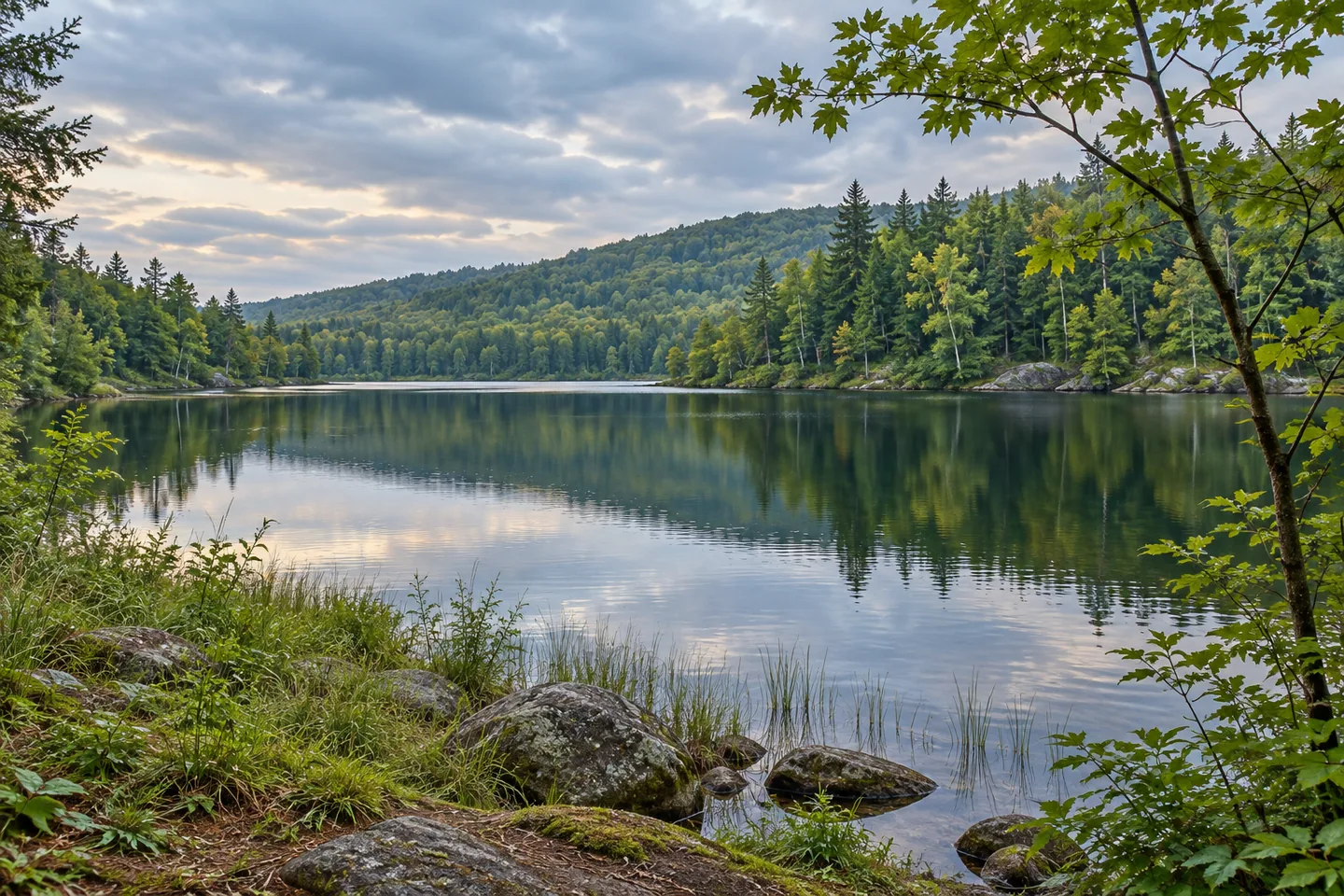
Hammond Pond Wild Forest connects many separate pieces of the eastern Adirondack landscape through a shared character of woods, brooks and inland water. Its Forest Preserve parcels include a range of pond approaches, with different routes giving a visit different scales. A short walk toward Hammond Pond, a longer line along an old logging road or a connection between several waters can each become a focused outing. The key is choosing the approach before the day begins.
The Hammond Pond Trail supplies a relatively concise introduction. DEC describes a 0.9-mile route toward the pond's western shore, with gently undulating terrain and about 45 feet of elevation change between the trailhead and the water. That combination gives a walk a clear destination while leaving the woodland approach as part of the experience. Notice how tree trunks frame the view ahead and how the character of the ground changes as the route moves toward the pond.
Crowfoot Pond has a different approach. Its trail extends 2.5 miles from Tracy Road, climbing about 505 feet along an old logging road toward a gate at the private-land boundary on the pond's northern shore. The road history adds another dimension to the walk. A line once associated with moving forest resources now provides a way into the woodland, with the climb and the return journey both forming important parts of the plan.
The boundary also helps define the experience. The route reaches a particular public approach to the pond, with neighboring ownership continuing beyond it. Plan around the mapped destination and appreciate the views available from appropriate access. The interest can lie as much in the journey as in the water: a route following the ground, changes in the surrounding tree cover and the gradual sense of arriving at a different part of the landscape.
The East Mill Flow–Round Pond connection offers a longer sequence. It extends 5.2 miles between the Round Pond trailhead and Sharp Bridge Campground, crossing mostly gently undulating terrain with a more pronounced descent toward the campground end. Measured from the Round Pond starting area, the route passes Trout Pond after about half a mile and Round Pond at 1.5 miles, then crosses East Mill Brook farther along. These distances describe a connection between starting areas, making return arrangements important.
Berrymill Flow provides another woodland-and-water theme from its own approach. The named trail extends 1.4 miles with a steady ascent of about 145 feet toward the flow. The broader network also reaches Moose Mountain Pond, where a lean-to adds a backcountry feature to the shore. Separate trail choices allow the forest to be explored over several visits, with each outing giving enough time to the wooded route and the water setting it serves.
Use the current DEC map and notices to choose the intended trailhead, distance and return plan. Some approaches involve separate campground access arrangements, while the forest's many parcels make a single clear destination especially useful. Stay with the chosen public route and leave room for observation. Hammond Pond Wild Forest rewards that approach: a small opening toward water, a brook beside the way, an old road through the trees and the changing relationship between woodland and pond.
Fun facts
- The Hammond Pond Trail extends 0.9 mile toward the western shore.
- Crowfoot Pond Trail follows an old logging road.
- The East Mill Flow–Round Pond route links two starting areas over 5.2 miles.
- Berrymill Flow Trail has a steady ascent toward a separate water setting.
Before you go
- Choose the intended trailhead and plan the actual return distance.
- Observe the mapped private-land boundary at the Crowfoot Pond approach.
- Check current access arrangements where a route starts within a campground.
Capture
- Use foreground trees to add depth to a pond view from suitable public access.
- Compare the shape of a woodland route with the surrounding layers of trunks and branches.
- Use soft light to retain detail in shaded woodland and reflected water while staying on the selected route.
 Wilmington Wild Forest
 Carl Schurz Park
 Duane Park
Social
Hammond Pond Wild Forest offers several woodland approaches to inland water. #Cre8Travel
Its namesake pond has a concise 0.9-mile trail approach.
Crowfoot Pond Trail follows an old logging road.
East Mill Flow–Round Pond links several waters on a longer connection.
Berrymill Flow adds another distinct woodland destination.
The separate approaches can be explored through focused visits.
Choose the actual trailhead, return plan and access arrangements.
Would you follow the old road or begin with a shorter pond walk?
Hashtags