 Cre8Travel
CRE8TRAVEL · NEW YORK PLACES
Trout Lake State Forest
Trout Lake State Forest: Two Lakes and Four Different Approaches
Discover
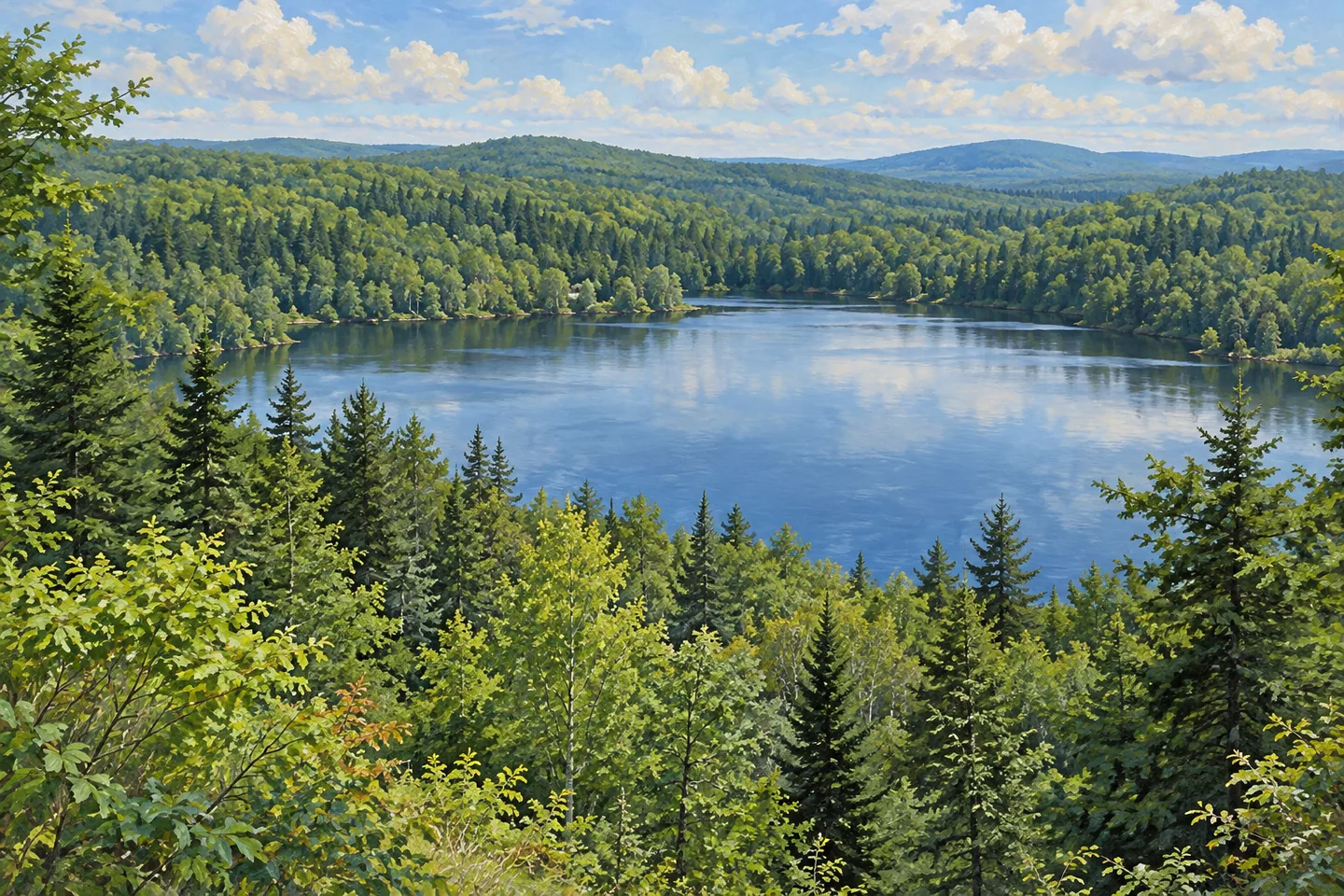
Trout Lake State Forest contains several ways to approach water within 1,087 acres of hilly woodland in Hermon and Edwards, St. Lawrence County. Trout Lake and Cedar Lake give the property two distinct water settings, served by different short routes. Thin soils, rocky ridges, planted conifers and wetter woodland add interest between the destinations. The appeal is in choosing a particular relationship to the lakes: a walk toward a picnic area, a connecting trail or a viewpoint above the water.
The Trout Lake Trail leads north from the Cedar Lake Public Forest Access Road for 0.8 mile, ending at a picnic area beside Trout Lake. A wooded approach followed by a pause at the water gives that route a clear shape. The named road can be confusing at first: its reference to Cedar Lake does not change the destination of this particular trail. Use the current map to relate the starting point to the intended lakeside stop.
The Campbell Trail offers a different connection. It branches east from the Trout Lake Trail and runs 0.9 mile to a parking area on the Campbell Public Forest Access Road. That arrangement gives the trail system more than one approach, with route choices best considered before setting out. The distances describe individual links. A visitor can select the connection that suits the planned outing and its return travel, leaving time to appreciate the woodland along the way.
Cedar Lake has its own features. The Cedar Lake Trail is only a tenth of a mile, but DEC describes the descent from its parking area to the water as short and steep. The separate 0.3-mile Cedar Lake Overlook Trail leads to viewpoints above the lake. The St. Lawrence County Youth Conservation Corps established the overlook route in the 1980s, giving this walking feature a particular local stewardship history as well as a scenic purpose.
The woodland around those routes changes with the ground. Better upland sites support northern hardwoods, hemlock and white pine, while drier ground carries red oak, eastern hophornbeam and hickories. Pine and spruce plantations reflect former fields and pastures. Flatter areas include wetlands and shrub swamps, with swamp hardwoods in seasonally flooded places. These forms of cover make the journey between parking and water more than a simple approach to a view.
A historical personal account on Hiking the Trail to Yesterday describes the two lakes as having different atmospheres, with Cedar Lake quieter than Trout Lake during the writer's experience. The account is useful as an individual perspective on what drew attention during a visit, rather than a forecast of boat activity or solitude. The same landscape can interest different visitors for different reasons: a woodland setting, the water itself or the relation between the two.
Plan around the actual route and access that matter to the day. The very short Cedar Lake descent is not automatically the easiest option, while winter trails are not groomed for cross-country skiing. A visit can remain modest in distance and still have a strong theme. Choose one lake approach, notice the changes in tree cover, and give the destination time when it comes into view. The combination of different water settings and a locally built overlook trail gives Trout Lake State Forest a character beyond its name.
Fun facts
- Trout Lake State Forest covers 1,087 acres in Hermon and Edwards.
- The 0.8-mile Trout Lake Trail ends at a lakeside picnic area.
- The 0.9-mile Campbell Trail connects with a separate parking approach.
- The County Youth Conservation Corps established the Cedar Lake Overlook Trail in the 1980s.
Before you go
- Choose one mapped lake approach and plan return travel before setting out.
- Account for the short but steep Cedar Lake Trail instead of judging the route by distance alone.
- Check the intended season and activity; the trails are not groomed for cross-country skiing.
Visitor perspectives
Hiking the Trail to Yesterday, by hikingtheTrailtoYesterday: in a historical personal account, the writer described Cedar Lake as quieter than Trout Lake during the visit. This reflects one visitor’s experience rather than present conditions.
Capture
- At suitable public access, use woodland in the foreground to give a lake view depth.
- Compare the forms of trees on drier and wetter ground without leaving the selected route for a composition.
- Try both a wider lake-and-woodland frame and a closer reflection study from the same suitable public position.
 Toothaker Creek State Forest
 Whippoorwill Corners State Forest
 Whiskey Flats State Forest
Social
Trout Lake State Forest brings two lake settings into 1,087 acres of woodland. #Cre8Travel
The Trout Lake Trail runs 0.8 mile to a lakeside picnic area.
The Campbell Trail supplies a separate 0.9-mile connection toward another parking approach.
Cedar Lake has its own short descent and overlook route.
The County Youth Conservation Corps established the overlook trail in the 1980s.
Hardwood slopes, planted conifers and wetter woodland add interest between the water settings.
A tenth of a mile can still be steep: choose the actual route, not just a distance.
Which would shape your outing: a lakeside pause or a woodland approach toward a view?
Hashtags