 Cre8Travel
CRE8TRAVEL · NEW YORK PLACES
Whiskey Flats State Forest
Whiskey Flats: A Forest Told Through Planting Records
Discover
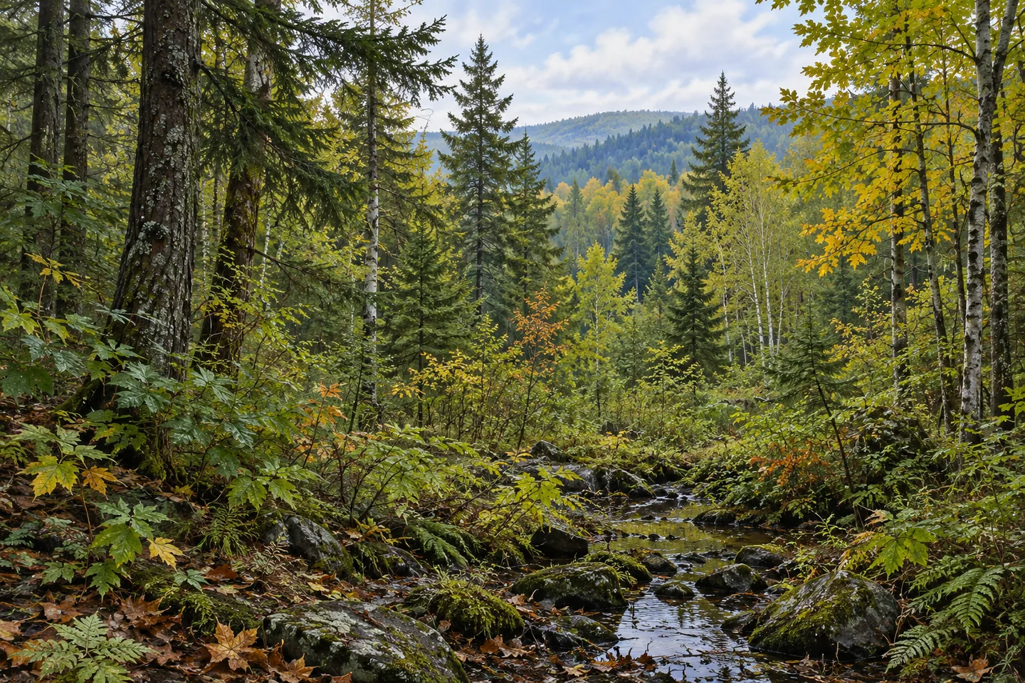
Whiskey Flats State Forest carries an unusually detailed planting history. Its 2,533 acres in Parishville and Hopkinton, St. Lawrence County, include land assembled from thirty parcels between 1932 and 1962. Roads and trails cross a landscape of planted conifers, naturally developed woodland and wetter communities. The forest's character becomes especially interesting when those visible forms are connected with the people and programs that helped establish them.
Three Civilian Conservation Corps camps contributed to the early work: S-95 in Brasher Falls, S-120 in Brushton and S-134 in Pierrepont. Between 1935 and 1940, crews planted more than 1,862,000 trees on 1,014 acres. White pine, red pine and Scotch pine were the main species. Other choices included jack pine, red spruce, Douglas fir, Japanese larch and willow. The record describes a substantial, varied planting effort across part of the present property.
The work also included 10.2 miles of fireline clearing and maintenance and the construction of twelve waterholes for fire control. These tasks show another side of establishing woodland on acquired ground. Planting seedlings was accompanied by practical efforts to protect the developing forest. The measurements give the historical program a tangible scale, while the present recreation network has its own routes and purposes to consider when planning a visit.
A later project brought younger participants into that story. From 1953 to 1965, the New York Grange sponsored a Juvenile Grange Forestry Project, with seedlings supplied by the Conservation Department and planting carried out by junior members. At Whiskey Flats, Japanese larch and red pine plantations were established in 1959. The local example connects a stand of trees with a broader effort to interest children in forestry and conservation through practical work.
The forest also has a history of responding to insect damage. Pine false webworm was reported locally in 1981, with a particularly large outbreak between 1987 and 1996. Some pine stands suffered substantial defoliation. DEC's account describes salvage across Whiskey Flats and neighboring Catherineville, followed by the development of hardwood regeneration. Red maple, paper birch and sugar maple became part of that later growth. The sequence gives changing tree cover another explanation alongside the earlier planting programs.
Terrain and moisture add further variety. Uplands support northern hardwoods, hemlock and white pine, while flatter areas include wetlands and shrub swamps grading toward swamp hardwoods and white cedar. Former fields and pastures hold pine, larch and spruce plantations. Where these forms are visible along an outing, compare the spacing and shape of the trees. Different patterns can make the forest's several histories easier to imagine while keeping the actual age of a particular stand an open question.
For recreation, DEC identifies 12.3 miles of multiple-use trails, unpaved roads and snowmobile routes, with several road approaches serving the property. Choose a route and return journey using the current official map and the conditions relevant to the planned activity. A visit can follow one modest objective while carrying a much larger story: parcels assembled over decades, work by three CCC camps, a youth planting project and woodland that continued to change afterward. Whiskey Flats offers a particularly concrete way to connect trees with the records behind them.
Fun facts
- Thirty parcels purchased between 1932 and 1962 make up the forest.
- CCC crews planted more than 1,862,000 trees on 1,014 acres between 1935 and 1940.
- Three camps contributed to that planting program.
- Junior Grange participants established Japanese larch and red pine plantations here in 1959.
Before you go
- Choose one route from the current official map and match it to the intended activity and season.
- Use visible stand patterns as an observation theme while keeping individual tree ages uncertain.
- Keep the shared Catherineville insect-damage history separate from claims about every present stand at Whiskey Flats.
Capture
- Compare the visible forms of conifers and younger mixed woodland from appropriate access.
- Use a woodland edge or damp vegetation margin to give a composition depth.
- Use gentle side light to separate overlapping tree trunks and reveal the texture of low vegetation from the selected route.
 Whippoorwill Corners State Forest
 Yellow Lake State Forest
 Williamsbridge Oval
Social
Whiskey Flats State Forest has a particularly detailed planting history. #Cre8Travel
Its thirty parcels were acquired between 1932 and 1962.
Three CCC camps contributed to work here between 1935 and 1940.
Crews planted more than 1,862,000 trees on 1,014 acres.
A later Junior Grange project established Japanese larch and red pine plantations in 1959.
Insect damage and later hardwood regeneration added another chapter to the woodland story.
Uplands, plantations and wetter communities now form different parts of the setting.
Choose one mapped route and notice the tree cover. Which part of its history would you want to learn more about?
Hashtags