 Cre8Travel
CRE8TRAVEL · NEW YORK PLACES
Toothaker Creek State Forest
Toothaker Creek: Woodland Growth After a North Country Storm
Discover
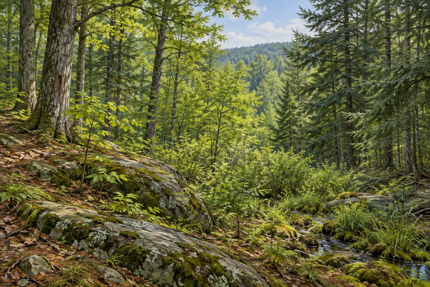
Toothaker Creek State Forest brings several kinds of North Country woodland into 709 acres in Pitcairn, St. Lawrence County. Rocky uplands carry thin soils, while flatter ground supports wetter vegetation. Pine and spruce plantations occupy former agricultural ground alongside naturally developed trees. These contrasts give the forest its character: the interest lies in how vegetation responds to different settings, and in how an event in the 1990s added another chapter to an already changing landscape.
On better upland sites, DEC describes a mixture of northern hardwoods, hemlock and white pine. Drier, less fertile ground supports red oak, eastern hophornbeam and hickories among other trees. The distinction invites a close look at the relationship between the ground and the canopy. Notice differences in tree form and spacing as they become visible, taking the woodland as a collection of settings rather than one continuous stand with a single history.
The lower ground supplies another part of that collection. Open wetlands and shrub swamps grade into swamp hardwoods where flooding occurs seasonally. Vegetation changes are an interesting subject in their own right: a damp margin, a shrubby opening and denser woodland can give an outing several different visual rhythms. Observe them from appropriate ground, leaving wetland plants in place. An attentive look at the cover is worthwhile even when the animals associated with it remain out of sight.
The plantations connect the present forest with earlier farming. Pine and spruce were established on former fields and pastures, adding deliberate planting to the naturally growing woodland. Where a regular stand pattern is visible, it offers a starting point for thinking about that change in land use. The ground beneath the trees has carried several purposes, and the contrast between plantation forms and mixed woodland gives that history a physical expression.
A later event affected the whole region. On July 15, 1995, a severe windstorm crossed northern New York, becoming known locally as the 1995 Microburst. Toothaker Creek was one of four Pitcairn state forests that suffered heavy wind damage, together with California Road, Cold Spring Brook and Greenwood Creek. The story places this small public holding within a much larger landscape event, with effects that varied from damaged branches to areas of fallen trees.
During the following three years, salvage operations covered a combined 1,100 acres across those four forests. DEC describes many harvested areas developing dense hardwood seedlings and saplings afterward. The sequence adds a different timescale to the planting story: land use established some tree cover, a storm changed parts of the woodland, and later growth followed. It is a useful background for observing varied stand structures, while the condition of any particular patch should be judged from what is actually visible.
Fullerville and Garrison roads provide approaches, with named access trails associated with them. Choose the intended route using the current official map; the property has no trails maintained specifically for bicycles and no groomed cross-country ski trails. For a walking visit, the strongest theme is the landscape itself. Rocky ground, wet margins, planted conifers and naturally developing hardwoods each add a layer to Toothaker Creek, making a modest stretch of woodland worth looking at carefully.
Fun facts
- Toothaker Creek State Forest covers 709 acres in Pitcairn, St. Lawrence County.
- The forest combines rocky uplands, wetter ground, plantations and naturally developed woodland.
- It was one of four Pitcairn state forests heavily affected by the July 15, 1995 windstorm.
- Post-storm salvage covered a combined 1,100 acres across the four forests.
Before you go
- Use the current official map to choose the Fullerville or Garrison approach serving the intended outing.
- Observe wetland vegetation from suitable ground and leave plants in place.
- Keep the four-forest storm history distinct from the condition of individual stands encountered today.
Capture
- Use the change between rocky upland woodland and damp vegetation as a subject where visible from legitimate access.
- Compare plantation forms with mixed trees, without dating a particular stand.
- Use side light to show differences in tree form and rocky ground while keeping your position on the chosen route.
 Taylor Creek State Forest
 Trout Lake State Forest
 Whippoorwill Corners State Forest
Social
Toothaker Creek State Forest covers 709 acres in Pitcairn. #Cre8Travel
Rocky uplands and wetter ground support different woodland forms.
Pine and spruce plantations connect parts of the forest with former farm fields and pastures.
Natural hardwoods, hemlock and white pine contribute another layer.
The July 15, 1995 windstorm heavily affected Toothaker Creek and three other Pitcairn forests.
Salvage and later hardwood growth added a further chapter to the regional story.
Fullerville and Garrison roads provide different approaches to plan with the current map.
Look closely at tree cover and ground conditions. Which landscape contrast would make you pause?
Hashtags