 Cre8Travel
CRE8TRAVEL · NEW YORK PLACES
Whippoorwill Corners State Forest
Whippoorwill Corners: Woodland and the Changing Rhythm of Plumb Brook
Discover
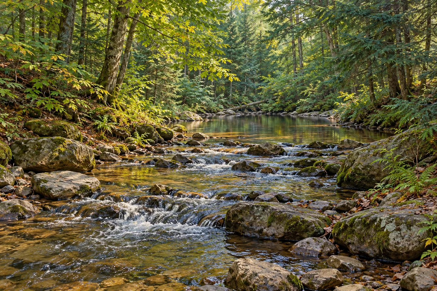
Plumb Brook gives Whippoorwill Corners State Forest a thread to follow through its varied woodland. The stream runs through the center of the 1,281-acre property in Russell, St. Lawrence County, with pools, riffles and cascades among its features. The Brookview trail provides access to more than a mile of this water setting. Around it, planted conifers, naturally developed woodland and wetter ground create a forest whose character changes with the landscape.
Moving water provides several different subjects for observation. A pool holds reflections, a riffle breaks the surface into smaller patterns, and a cascade draws attention to the shape of the channel. The brook's interest is in those changes as much as in any single named feature. Where the chosen public route allows a view, pause to notice the relationship between rock, water and the woodland above it. The scene can reward attention at the scale of one small section.
The surrounding uplands support northern hardwoods, hemlock and white pine. On former fields and pastures, pine and spruce plantations add a different form of tree cover. Regular-looking stands and mixed woodland invite comparison: spacing, canopy shape and the amount of light reaching the ground all become useful observation themes. These visible forms connect the present forest with an agricultural past and the later effort to establish trees on open ground.
Flatter areas introduce wetlands and shrub swamps, grading into swamp hardwoods where flooding occurs seasonally. That variety gives the property more than one ecological setting. A woodland edge and a damp opening can contribute different textures along an outing, while the stream supplies a continuing point of reference. Take the variety as a reason to look closely at the cover, rather than to measure the visit by a list of wildlife encountered.
The forest's name is said to recall the whip-poor-wills that once sang in the area during summer. DEC connects these birds with young forest and shrubland used for breeding and feeding. The story adds another way to think about changing vegetation: former agricultural ground can pass through a shrubby stage before becoming more mature woodland. The name and habitat account give context to the landscape, while any actual bird observation belongs to the circumstances of a particular visit.
A historical visitor account gives a more personal perspective on the brook. In a September 2017 Windswept Adventure post, Bill and dogs described disappointment with a northern outing before finding the southern brook scenery more appealing. The writer also reported rocky going and questioned whether waterfall was the best word for the water features. That combination of appreciation and discomfort is useful: the attraction of flowing water and the experience of reaching a view can be different parts of the same day.
Plan a particular approach with the current official map. Parking references along Burnell Road and County Route 17 serve different points near Plumb Brook, while designated primitive campsites are listed on Burnell and Loop access roads. The brook's wider course is not all public access, and a waterside destination need not become a continuous shoreline walk. Choose the section that fits the intended outing and allow time for the small changes in water and woodland that give Whippoorwill Corners its distinctive rhythm.
Fun facts
- Plumb Brook flows through the center of the 1,281-acre forest.
- The Brookview trail provides access to more than a mile of the brook.
- Pine and spruce plantations occupy former fields and pastures alongside naturally developed woodland.
- Designated primitive campsites are listed on Burnell and Loop access roads.
Before you go
- Choose a specific brookside approach with the current official map and plan return travel.
- Use public access rather than assuming the brook’s entire course is available for walking.
- Consider terrain as well as scenery when choosing a route; historical visitor accounts describe rocky sections.
Visitor perspectives
Windswept Adventure, Bill and dogs, September 9, 2017: after a disappointing northern outing, the writer preferred the southern brook scenery, but described rocky going and thought “waterfall” overstated some features. This is a historical personal account.
Capture
- From suitable public access, compare still reflections with the patterns of riffles and cascades.
- Frame water with ordinary woodland to show the relationship between stream and surrounding trees.
- Use softer light to hold detail in both shaded streamside trees and brighter water, keeping the camera on appropriate public access.
 Trout Lake State Forest
 Whiskey Flats State Forest
 Yellow Lake State Forest
Social
Plumb Brook gives Whippoorwill Corners State Forest a flowing-water theme. #Cre8Travel
The 1,281-acre property lies in Russell, St. Lawrence County.
Pools, riffles and cascades offer different subjects along the brook.
The Brookview trail provides access to more than a mile of this water setting.
Natural hardwoods, hemlock and white pine share the landscape with plantations on former fields.
Wetlands and shrub swamps introduce another form of vegetation.
The forest’s name is said to recall whip-poor-wills, adding a story about changing woodland habitats.
Choose one mapped section and take time with it. Which would catch your eye first: a still pool or moving water?
Hashtags