 Cre8Travel
CRE8TRAVEL · NEW YORK PLACES
Tri-County State Forest
Tri-County State Forest: A Closer Look
Discover
Private boundaries are part of the landscape at Tri-County State Forest, not a detail to leave until after choosing a walk. Small private parcels are interspersed with state land across this 1,290-acre property in Florence and Redfield. The public forest belongs to the wider 46-Corners network, but adjacency does not create unrestricted travel through every piece of ground. Start with a current property map and an approach that remains on public land.
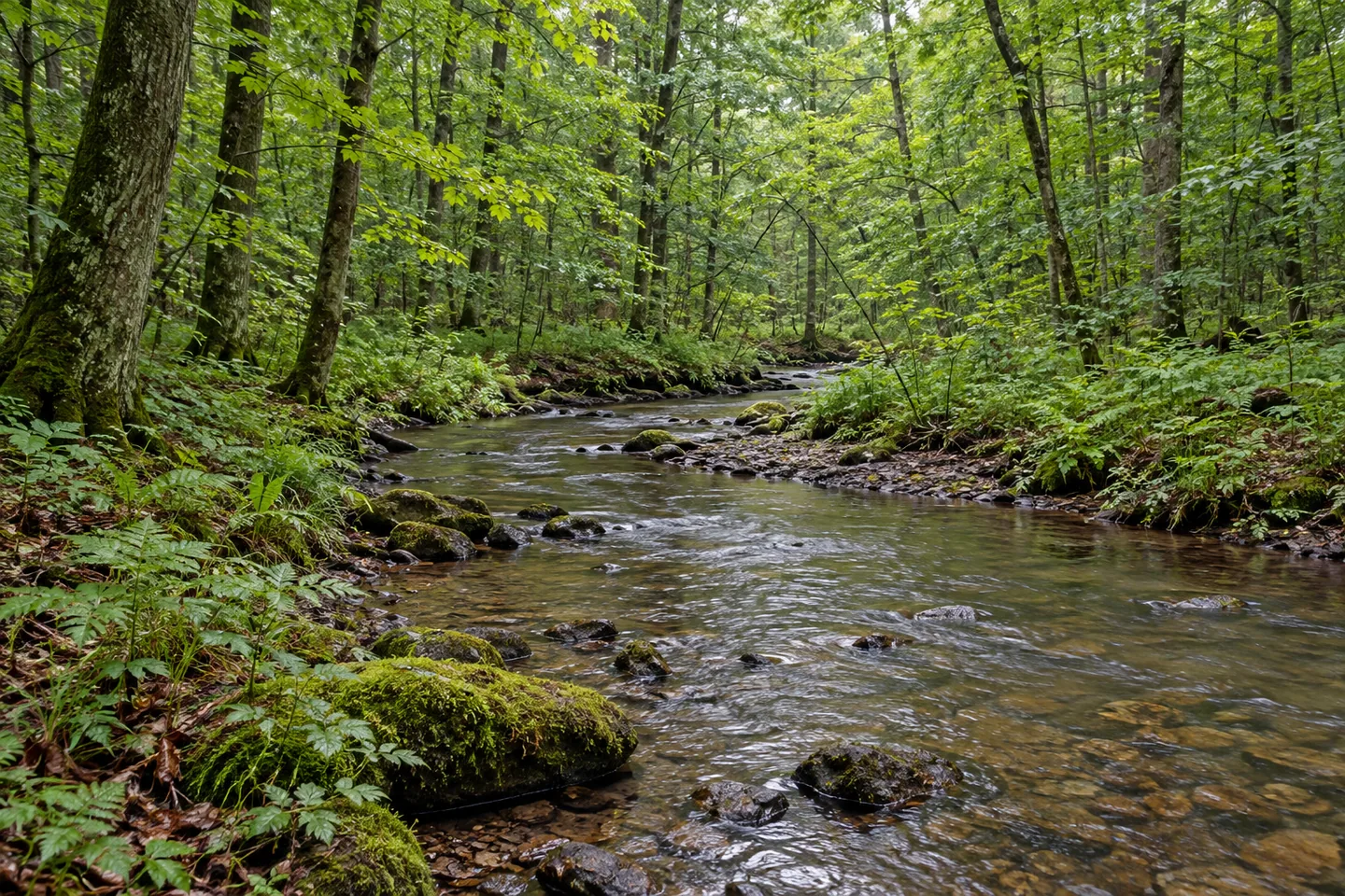
The terrain is relatively flat, with streams and wetlands distributed through the area. That description gives a different picture from a steep summit forest, without making access automatically easy. Wet ground and property boundaries still shape the practical outing. A place can have modest relief while requiring careful route selection, particularly where an old lane or road appears to continue beyond the land open to visitors.
Five protected trout streams cross the forest: Perry Brook, Spellicy Brook, Little River, Maloney Brook and Smith Brook. Parts of Smith Brook, Maloney Brook and Little River pass through protected wetlands and may be difficult to access. Keep that qualification with the water names. They explain the landscape without becoming a stream-to-stream itinerary or a guarantee of a maintained bank-side route.
There are no designated hiking trails. Old farm lanes and skid routes from timber work provide walking possibilities instead. The New York State Department of Environmental Conservation (DEC) manages the forest for water quality, recreation, habitat and timber, giving those practical routes a connection with the land's uses. A former lane can be an interesting surface to consider without assuming a surviving farm structure beside it.
Access also needs care because road names change around county boundaries and Florence, and some roads lack signs. Graves and Osceola roads are the main approach references, with Houlahan Road providing a pull-off location in DEC's information. Match the actual point to the current map before traveling. A written place name should be used for orientation, rather than as a substitute for knowing where the public boundary begins.
Most roads through the area are not plowed in winter. Heavy snowfall is part of the setting, so check the chosen approach before committing to an outing. A route shown on the map is not a promise of a winter drive to the same starting point used in another season. The public-land network and the road arrangement need to be understood together, at the scale of the visit being planned.
The 46-Corners Unit Management Plan provides the wider framework. Within that context, Tri-County's local story can be the relationship between relatively level woodland, wetland and several named watercourses. For photographs, a close woodland or vegetation composition may be the subject available from an appropriate route. There is no need to enter wet ground or cross private land to make the landscape specific.
Follow posted conditions and Leave No Trace guidance, remaining on state land unless separate permission has been obtained. Let the actual access determine the outing rather than trying to connect every feature. Tri-County can be understood as part of a larger public forest mosaic while retaining its own practical limits, with boundaries, streams and seasonal roads all part of an honest plan.
Fun facts
- Tri-County State Forest covers 1,290 acres within the wider 46-Corners network.
- Private parcels are interspersed with state land.
- Five protected streams include Perry Brook, Spellicy Brook, Little River, Maloney Brook and Smith Brook.
- There are no designated hiking trails; old lanes and skid routes provide walking possibilities.
- Most area roads are unplowed in winter, and road naming/signage can complicate access.
Before you go
- Use a current property map and remain on public land.
- Do not assume adjacent state forests make one unrestricted walking route.
- Account for wetland access difficulties along some streams.
- Match Graves, Osceola or Houlahan road references to actual mapped locations.
- Check seasonal road conditions and follow Leave No Trace guidance.
Capture
- Use the woodland and vegetation available from an appropriate public route.
- Photograph water only where access actually provides a suitable position.
- A close composition can show the level woodland character without crossing private land or entering wetland.
 Swancott Hill State Forest
 Webster Hill State Forest
 West Branch State Forest
Social
Tri-County State Forest covers 1,290 acres within the wider 46-Corners public-land network. #Cre8Travel
Private parcels are interspersed with Tri-County's state land. Keep boundaries central to route planning. #Cre8Travel
Five protected trout streams are part of Tri-County's landscape. Some sections have difficult wetland access. #Cre8Travel
No designated hiking trails are listed at Tri-County; old lanes and skid routes provide walking opportunities. #Cre8Travel
Road names and missing signs can complicate a Tri-County approach. Use a current map. #Cre8Travel
Most roads through Tri-County are not plowed in winter. Check the actual starting point before traveling. #Cre8Travel
A connected public-land mosaic does not automatically create one connected visitor route. #Cre8Travel
At Tri-County, a woodland detail can tell the story without reaching every stream on the map. #Cre8Travel
Hashtags