 Cre8Travel
CRE8TRAVEL · NEW YORK PLACES
Webster Hill State Forest
Webster Hill State Forest: A Closer Look
Discover
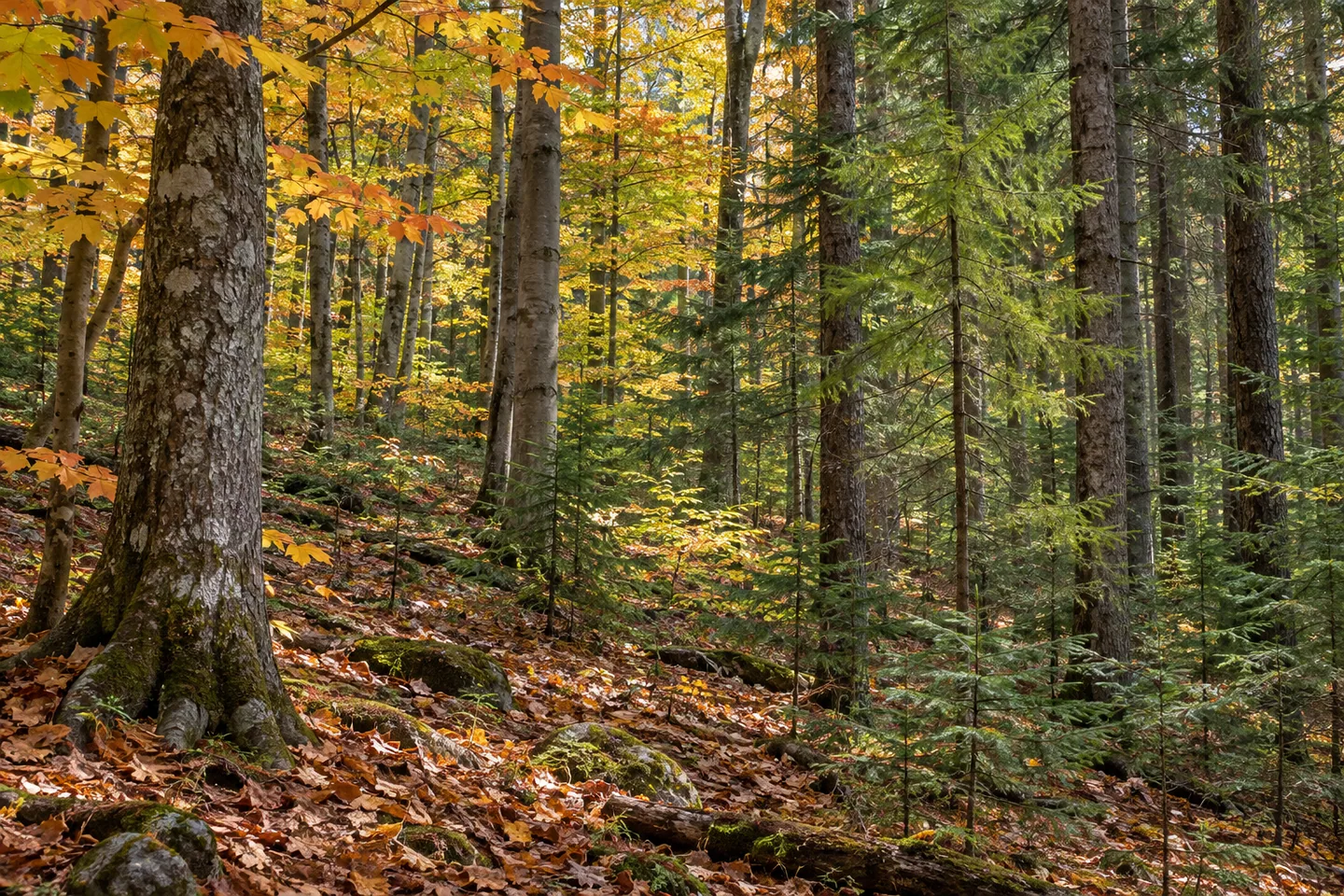
A short foot trail offers one way into Webster Hill State Forest's much larger land-use story. The route is 0.26 mile long in the eastern part, with a trailhead off Route 46. Around it lie 1,064 acres in Western and Ava, Oneida County, with steep ground in places, streams, a small pond and different kinds of woodland. Choose a visit at the scale of the actual route rather than assuming a developed forest-wide circuit.
The state purchased the land in the 1930s and early 1940s as exhausted farmland with little or no tree cover. Reforestation, erosion control and reducing wildfire risk were early priorities. That beginning makes a useful comparison with the woods described today. The present setting has a public-land history, rather than being a scene in which trees and visitors have always occupied the same arrangement.
The New York State Department of Environmental Conservation (DEC) manages the property for reforestation, wildlife, timber, recreation and watershed protection. Those purposes provide context for the mixture of stands, but do not guarantee a particular ecological outcome in every part. A visit can consider how a working forest serves several interests without treating the landscape as either an untouched wilderness or a display of timber alone.
Plantations include white, red and Scotch pine, Japanese and European larch, Norway and white spruce, and Douglas fir. Natural forest includes eastern hemlock, black cherry, red and sugar maple, beech and white ash. Looking at tree forms and woodland textures can give an outing a specific focus. The lists describe the property broadly, not a promise that all those trees will be visible from one short trail.
Streams and a small pond add water to the landscape description. Use the current property map and actual public access before making a water view central to the visit. Their presence does not establish a shoreline path or a streamside extension from the eastern foot trail. A wooded scene can remain a worthwhile subject even when the water feature shown on a map is not part of the route selected.
Infrastructure is limited. The named Route 46 trailhead provides a reference, but does not make the whole state forest a prepared visitor area with facilities at every turn. Assess the route and present conditions for the outing you intend. In particular, the steep terrain described elsewhere in the forest should not be converted into either a guaranteed viewpoint or a blanket claim that the short trail is difficult or easy.
The Oneida Hills Unit Management Plan supplies the management framework. For photographs, a close woodland composition can connect to the reforestation story without an invented summit panorama. A planted-tree pattern or the contrast between conifers and natural woodland, where actually visible, can be enough to make the scene particular. Let the actual route determine the detail available for observation.
Follow posted conditions and Leave No Trace guidance, leaving vegetation and earlier land-use traces undisturbed. Webster Hill offers a grounded account of former farmland, reforestation and a varied present forest, with one modest foot-trail reference to begin planning. There is no need to enlarge that into an extensive route network for the place to have a story worth considering.
Fun facts
- Webster Hill State Forest covers 1,064 acres in Western and Ava, Oneida County.
- The land was purchased in the 1930s and early 1940s as farmland with little tree cover.
- A 0.26-mile foot trail is in the eastern part, with a Route 46 trailhead.
- The terrain includes steep areas, streams and a small pond.
- Plantations and natural woodland are both part of the property.
Before you go
- Plan around the actual eastern trail rather than assuming a forest-wide circuit.
- Use the Route 46 trailhead reference with a current property map.
- Assess actual terrain and conditions without assuming all routes share one difficulty.
- Do not infer a pond loop or streamside extension from the landscape description.
- Follow posted conditions and Leave No Trace guidance.
Capture
- Use woodland textures visible from the actual trail as a subject.
- Compare planted and natural tree forms without assuming a particular stand at a viewpoint.
- Include water only if an appropriate public position actually provides a view.
 Tri-County State Forest
 West Branch State Forest
 Woodhull State Forest
Social
Webster Hill State Forest covers 1,064 acres across Western and Ava in Oneida County. #Cre8Travel
Former farmland purchased in the 1930s and early 1940s began Webster Hill's state-forest chapter. #Cre8Travel
A 0.26-mile foot trail in eastern Webster Hill has a trailhead off Route 46. #Cre8Travel
Limited infrastructure helps define Webster Hill; the short trail is not a forest-wide walking network. #Cre8Travel
Pine, spruce, larch and Douglas fir plantations add to Webster Hill's natural woodland mixture. #Cre8Travel
Streams and a small pond are landscape features, not proof of a linked waterside circuit. #Cre8Travel
A woodland detail can tell Webster Hill's reforestation story without a distant panorama. #Cre8Travel
At Webster Hill, how would the earlier farmland history shape a closer look at the trees? #Cre8Travel
Hashtags