 Cre8Travel
CRE8TRAVEL · NEW YORK PLACES
Swancott Hill State Forest
Swancott Hill State Forest: A Closer Look
Discover
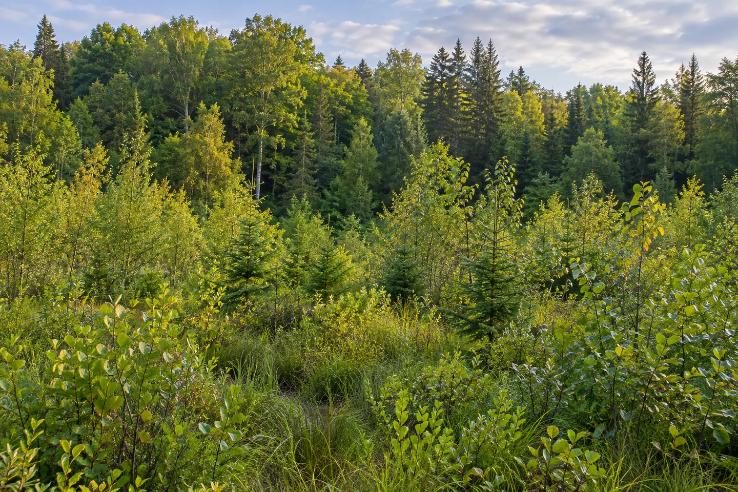
Young growth, brushy fields and wetlands make Swancott Hill State Forest more than a single picture of mature trees. Its 2,024 acres span Florence in Oneida County and Lewis in Lewis County, with natural forest and plantations among the different cover types. That variety offers a useful subject for a visit: look at how the structure of vegetation changes, rather than judging the woodland only by the height of its trees.
The state acquired the land in pieces from 1936 to 1972. Plantation establishment, by contrast, is described for 1936–1938. The narrower planting period and longer acquisition history belong to different aspects of the property. Keeping them distinct gives the present forest more depth, without assuming that every parcel was purchased and planted at the same time or has followed an identical path since then.
The New York State Department of Environmental Conservation (DEC) identifies American basswood, beech, black ash, black cherry, eastern hemlock, red maple, red spruce, white ash and yellow birch among the principal natural-forest trees. Plantations include Japanese larch, jack pine, Norway spruce, red and white pine, and white spruce. These mixtures provide particular forms to observe where they are visible along the route, not a species list guaranteed beside one starting point.
Wetland descriptions include open and alder-covered ground, while brushy fields and seedling-sapling cover add other textures. A low-growing or open scene is not an interruption to the forest story; it is part of the property as described. Compare the relation between those areas and taller woodland from an appropriate position. A photograph can concentrate on that contrast without a rare plant, an animal or a distant vista.
There are no formal hiking trails. Old skid routes and dirt roads provide walking opportunities, with the property map and actual conditions guiding the choice. A skid route has a forestry origin, another practical connection between woodland management and the surface now being walked. Do not turn those different routes into an assumed signed loop or a promise that every wetland and plantation is linked conveniently.
CCC Road is among the access references in DEC's approach information, while Tower Road has an unmaintained pull-off reference. No maintained parking areas are listed. Check the current map and stopping arrangement before traveling rather than expecting a developed visitor lot. A road name also does not establish a public tower or a viewpoint, so the woodland itself should remain the focus of a plan based on the information available.
Management follows the 46-Corners Unit Management Plan, with water quality, recreation, habitat and timber among the forest's purposes. Those interests provide context rather than proof of an achieved balance in every part of the woods. For an outing, it can be enough to give a short section sustained attention, noticing which vegetation types are actually present rather than trying to collect all of them.
Follow posted conditions and Leave No Trace guidance, leaving vegetation undisturbed. Swancott Hill's particular story is the combination of a long land-assembly period, early plantations and different stages of natural cover. Let a mapped, road-based outing bring those layers into view without adding a formal trail network, an invented tower stop or a promised wildlife encounter.
Fun facts
- Swancott Hill State Forest covers 2,024 acres across Oneida and Lewis counties.
- Land was acquired in pieces from 1936 to 1972.
- Plantations were established in 1936–1938.
- The forest includes open and alder wetlands, brushy fields and seedling-sapling cover.
- There are no formal hiking trails or maintained parking areas.
Before you go
- Choose a route using the map and actual dirt-road or skid-route conditions.
- Resolve the unmaintained pull-off approach before visiting.
- Do not infer a public tower from the Tower Road name.
- Observe wetland and young-growth cover from an appropriate route.
- Follow posted conditions and Leave No Trace guidance.
Capture
- Compare taller woodland with brushy or seedling-sapling cover visible from your route.
- Use alder or open-wetland texture only where appropriate access provides the view.
- Show the present woodland rather than an invented tower or historical scene.
 Rome Wildlife Management Area
 Tri-County State Forest
 Webster Hill State Forest
Social
Swancott Hill State Forest covers 2,024 acres across Florence and Lewis in two counties. #Cre8Travel
Swancott Hill land was acquired from 1936 to 1972, while plantations date to 1936–1938. #Cre8Travel
Natural trees and planted pine, spruce and Japanese larch give Swancott Hill different woodland textures. #Cre8Travel
Open and alder wetlands are part of Swancott Hill's cover mixture. #Cre8Travel
Seedling-sapling growth and brushy fields belong to the forest story as much as taller trees. #Cre8Travel
No formal hiking trails or maintained parking areas are listed at Swancott Hill. #Cre8Travel
Tower Road is a map reference, not proof of a public observation tower. #Cre8Travel
At Swancott Hill, what would you notice in the contrast between young growth and taller woodland? #Cre8Travel
Hashtags