 Cre8Travel
CRE8TRAVEL · NEW YORK PLACES
West Branch State Forest
West Branch State Forest: A Closer Look
Discover
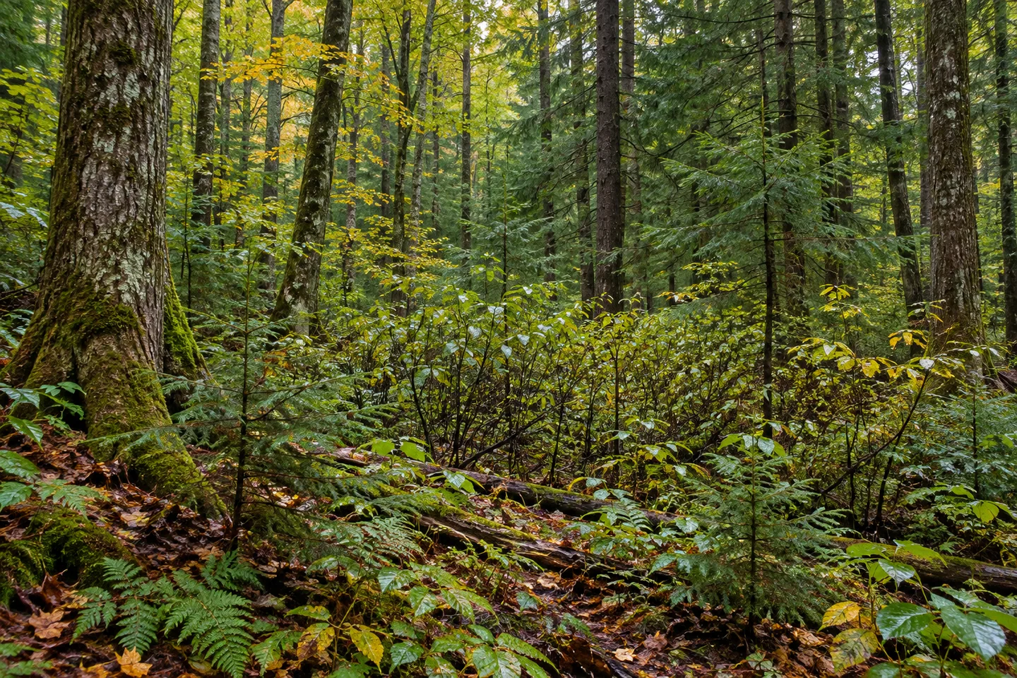
White pine appears on both sides of the woodland story at West Branch State Forest. It is included among plantation trees and among the natural forest species described for this 527-acre property in Lee, Oneida County. That small detail makes a useful starting point for a visit: a tree's name alone does not explain how a particular stand developed. Look at the forest as a mixture of histories rather than one uniform kind of woodland.
The state acquired West Branch in 1939 for reforestation, wildlife, timber, recreation and watershed protection. Its rolling ground now contains plantations, natural woodland and wetlands. The acquisition date anchors the public-land chapter without providing a planting date for every stand. A current boundary can hold several different forms of vegetation even when the property is modest in acreage.
The New York State Department of Environmental Conservation (DEC) identifies white and red pine, Japanese and European larch, Scotch pine, Norway spruce, red oak and white cedar in the plantation mixture. Red oak is a reminder that planted woodland need not be described only as conifers. Natural forest includes hemlock, black cherry, red maple, white pine and beech. Compare forms where the route provides a suitable view, rather than trying to find the whole list at once.
Low ground includes alder swamps, with water and rich soils supporting the wetland setting. Their presence gives the rolling woodland another texture to consider. A view into wetland vegetation can be interesting without entering it or expecting a particular animal. The difference between taller woodland and alder-covered ground may be a subject available from the route, but no viewing platform or boardwalk should be assumed.
There are no marked foot trails. A 0.47-mile north-south designated recreational route may be used for hiking, with a trailhead and pull-off reference in DEC's visitor information. Plan the approach and return from the property map and present conditions. That short route description does not establish a loop through every forest type or a prepared path beside the swamp.
The arrangement suits a visit focused on a specific section rather than a long checklist. Give the woodland actually visible time to hold attention: tree shape, the structure of a stand, or the contrast between an access corridor and the surrounding growth. Those observations do not require a rare species or a wide panorama. They connect directly to the property's planted, natural and wetland mixture.
Management follows the Oneida Hills Unit Management Plan. Check posted conditions and the actual pull-off arrangement before traveling, rather than expecting a developed visitor lot. The forest's name is a location identifier, not evidence of a particular riverside route. Keep water, boundaries and walking access tied to the map instead of filling in features that the name might suggest.
Follow Leave No Trace guidance and leave vegetation undisturbed. For photographs, work with a composition available from an appropriate position, without pushing into the alder swamp for a better angle. West Branch offers a small-scale way to think about how planted and natural trees share public land, with its modest access kept central to the outing rather than expanded into an imagined trail system.
Fun facts
- West Branch State Forest covers 527 acres in Lee, Oneida County, acquired in 1939.
- Rolling woodland includes plantations, natural forest and wetlands.
- Alder swamps occur in the lowland areas.
- There are no marked foot trails; a 0.47-mile north-south route may be used for hiking.
- White pine is listed in both plantation and natural-forest mixtures.
Before you go
- Use the current map to choose the short route and return.
- Do not infer a riverside itinerary from the forest name.
- Keep to appropriate access rather than entering alder wetland for a photograph.
- Check the actual pull-off arrangement and posted conditions.
- Follow Leave No Trace guidance and leave vegetation undisturbed.
Capture
- Compare plantation texture with natural woodland where actually visible along the route.
- Use alder wetland as a subject only from an appropriate position.
- A close tree composition can illustrate the mixed forest without an invented water view.
 Webster Hill State Forest
 Woodhull State Forest
 Cicero Swamp Wildlife Management Area
Social
West Branch State Forest covers 527 acres in Lee, Oneida County, acquired in 1939. #Cre8Travel
Plantations, natural woodland and wetlands share West Branch's rolling ground. #Cre8Travel
Alder swamps add a lowland habitat texture to West Branch State Forest. #Cre8Travel
A 0.47-mile north-south route may be hiked, without a marked foot-trail system. #Cre8Travel
White pine appears in both the plantation and natural-forest lists for West Branch. #Cre8Travel
The plantation mixture includes red oak as well as conifers, adding a detail to the planting story. #Cre8Travel
A modest route can leave time for woodland observation without needing a panoramic viewpoint. #Cre8Travel
At West Branch, how would you compare the different origins of trees sharing one forest? #Cre8Travel
Hashtags