 Cre8Travel
CRE8TRAVEL · NEW YORK PLACES
Three Mile Bay Wildlife Management Area
Three Mile Bay: Wetland History on Oneida Lake
Discover
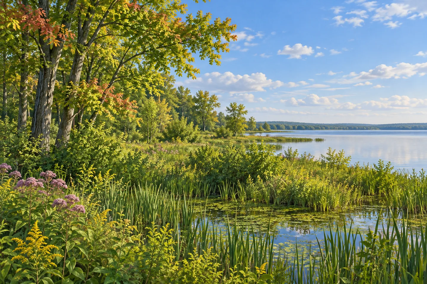
Three Mile Bay Wildlife Management Area occupies 3,966 acres along the northern shore of Oneida Lake in Oswego County. In West Monroe and Constantia, a landscape once known as Toad Harbor Swamp brings together wooded wetlands, higher ground and the lake beyond. Its character comes from that meeting of water and land. A visit focused on habitat observation can follow the differences between low woodland, former fields and a broader lake view, with the history of the property explaining how those settings developed.
The ground is generally low and flat, interrupted by ridges and islands. Much of it stands less than thirty feet above Oneida Lake. That modest variation matters to the vegetation. Peat and muck support swamp hardwoods dominated by silver and red maple, while acidic sandy ground contributes another influence. Higher areas carry a mixture that includes maple, white pine, white cedar, ash, oak and hickory. A change in elevation can therefore correspond with a change in the trees that shape the view.
Former farmland adds a different texture. DEC describes old fields colonized by plants such as spirea, highbush cranberry and dogwood, together with pioneer trees including aspen, pin cherry and birch. These areas help explain why the property is more than a single kind of swamp forest. Lower vegetation, young trees and mature woodland create different forms of cover. Observing their boundaries gives a visitor something specific to look for even when birds remain distant or hidden.
The wetland also carries a land-use history. DEC's historical pamphlet describes attempts at muck farming in the 1920s, followed by abandonment during the 1930s. Beaver activity subsequently flooded former fields. That sequence connects agriculture, changing water conditions and the return of wetland habitat. The setting visible today belongs to a continuing landscape story, in which earlier human uses and the activity of wildlife have both influenced the pattern of open and wooded ground.
Conservation acquisition began in the 1950s, with further additions supported by the 1962 Recreation Bond Act. Providing waterfowl habitat was an important purpose. The area is now part of a Bird Conservation Area, with habitat used by waterfowl during migration and by some breeding birds. Spring and autumn give migration a seasonal context, while the vegetation itself remains worth studying throughout a suitable visit. Individual species and numbers vary, so patient observation is more useful than arriving with a checklist of guaranteed sightings.
Phillips Point supplies a defined public access focus for looking across Oneida Lake. The lake's broad surface offers a different scale from close woodland, allowing attention to move between nearby habitat and distant water. Choose a suitable public position and give the view time. Changes in light can make the relationship between water, vegetation and the shoreline easier to appreciate, even during an outing centered on scenery rather than a particular bird.
DEC's habitat management work aims to maintain varied cover and the resources wildlife needs. Consult the current official map and access notices when choosing an approach; this is a habitat property, with specific public access points rather than an assumed continuous walking circuit. Three Mile Bay rewards a focused visit: read the tree cover, notice the old-field transition and let the lake place those smaller details within a much larger wetland setting.
Fun facts
- The wildlife area covers 3,966 acres on the north shore of Oneida Lake.
- The property was formerly known as Toad Harbor Swamp.
- Muck farming in the 1920s forms part of its documented land-use history.
- State acquisition began in the 1950s to support waterfowl habitat.
Before you go
- Use the current official map to choose a public approach, including Phillips Point where appropriate.
- Observe changes between wet woodland, higher ground and former fields.
- Allow time for quiet observation; seasonal bird use does not guarantee a particular sighting.
Capture
- At suitable Phillips Point public access, use the lake horizon to give a broad water composition structure.
- Compare the vertical lines of swamp woodland with lower vegetation visible from the chosen public position.
- In soft light, frame contrasting tree layers while keeping a little open water or sky for scale.
 John Jay Park (Manhattan)
 Independence River Wild Forest
 Jessup River Wild Forest
Social
Three Mile Bay Wildlife Management Area meets the north shore of Oneida Lake. #Cre8Travel
Its 3,966 acres include wet woodland, higher ground and former fields.
The landscape was once known as Toad Harbor Swamp.
Peat, muck and sandy ground help explain its varied vegetation.
Documented muck farming adds a 1920s chapter to the wetland story.
Conservation acquisition began in the 1950s.
Phillips Point provides a defined public focus for observing the lake.
Would you begin with woodland details or the broad water view?
Hashtags