 Cre8Travel
CRE8TRAVEL · NEW YORK PLACES
Stewart State Forest
Stewart State Forest: A Closer Look
Discover
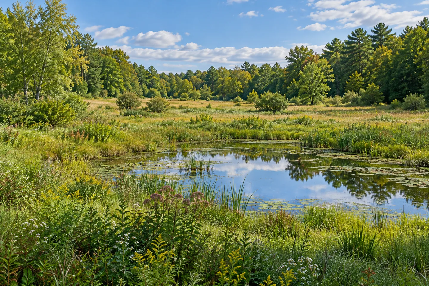
Fields, wetlands and forest give Stewart State Forest a landscape of transitions. Its 6,700 acres in northeastern Orange County contain gravel roads, major trails and several ponds, offering different ways to look at the relationship between open ground and woodland. Before choosing a route, however, check the seasonal access rules: general recreational entry is restricted during the regular deer season. The plan for a walk begins with the calendar as well as the map.
The forest lies west of Newburgh and Stewart International Airport, across New Windsor, Montgomery and Newburgh. The New York State Department of Environmental Conservation (DEC) describes 18 miles of gravel roads and more than 22 miles of major trails. Those are different route categories, not one continuous circuit. Choose a section and return suited to the visit intended, rather than trying to turn the entire network into a single outing.
The Great Swamp boardwalk is one particular walking feature, connecting the east and west sides of the swamp with an island trail. DEC's approach from Ridge Road uses Maple Avenue before reaching the walkway. Use the current map and actual trail designations to select that route, rather than assuming the boardwalk starts at every parking location. It provides a defined way to consider wetland vegetation without entering it for a closer view.
Beyond the swamp, meadows, fields and woodland create other observation possibilities. The forest's habitat account includes grassland and shrub settings for birds and butterflies, open sandy ground for other wildlife, and small wetlands among woods and fields. Those contrasts are the interest: a view can change character over a modest distance without requiring a summit or a dramatic landform to become distinctive.
Several larger ponds and many smaller ones add water to the picture. Whalenburgh, Wilkens and Rowes ponds are named in DEC's description. A pond reference is useful orientation, but not proof of a continuous shoreline route linking all of them. Let the actual trail provide the view, whether that is water, vegetation along an edge or the relationship between a field and its woodland background.
Most trails are shared-use unless specifically posted for walking only. Keep that arrangement in mind when choosing a route and responding to posted conditions. The broad network serves different users, so a trail line should not automatically be described as a quiet pedestrian-only path. A considered photograph can use what is available from the route without stopping on a crossing or approaching wildlife.
General visitors use exterior parking areas; vehicle entry to the interior requires the applicable permission or access arrangement. Ridge, Weed and Barron roads provide different parking references. Check the current DEC map, the specific approach and seasonal public-entry restrictions before traveling. A forest road on the map is not an invitation to drive through a gate or assume year-round entry for a walking outing.
The Stewart State Forest Unit Management Plan supplies the wider framework. Follow posted rules and Leave No Trace guidance, leaving vegetation undisturbed. A visit can focus on one landscape transition rather than collecting every pond or route. Stewart's character comes from the meeting of open cover, wetland and woodland within a substantial public property, with the route, shared uses and actual access conditions shaping which parts are available to enjoy.
Fun facts
- Stewart State Forest covers 6,700 acres in northeastern Orange County.
- The network includes 18 miles of gravel roads and more than 22 miles of major trails.
- A Great Swamp boardwalk connects the swamp's east and west sides.
- Most trails are multiple-use unless specifically posted as foot trails.
- General recreation has seasonal entry restrictions during the regular deer season; interior vehicle access is controlled.
Before you go
- Check current seasonal public-entry restrictions before planning a walk.
- Choose a mapped route and return rather than adding road and trail totals into one circuit.
- Use exterior parking unless the applicable interior vehicle permission has been confirmed.
- Respect shared-route designations and posted conditions.
- Follow Leave No Trace guidance and leave wetland vegetation undisturbed.
Capture
- Frame field-to-woodland or wetland-to-forest contrasts from an established route.
- Use the boardwalk only as actual access provides; do not enter vegetation for another angle.
- A pond view can be a subject without implying a linked shoreline circuit.
 Huckleberry Ridge State Forest
 Canacadea State Forest
 Line Brook State Forest
Social
Stewart State Forest covers 6,700 acres of fields, wetlands and woodland in Orange County. #Cre8Travel
Check Stewart's seasonal public-entry restrictions before setting out for a walking visit. #Cre8Travel
Road and major-trail mileages describe different parts of Stewart's network, not one declared loop. #Cre8Travel
The Great Swamp boardwalk provides a defined route across part of the wetland landscape. #Cre8Travel
Most Stewart trails are shared-use unless posted as foot trails. Let the designation guide the outing. #Cre8Travel
Whalenburgh, Wilkens and Rowes are among the named ponds in Stewart's landscape. #Cre8Travel
Exterior parking and controlled interior vehicle access are different arrangements at Stewart. #Cre8Travel
At Stewart, which landscape transition would you give a closer look: field to forest, or wetland to woodland? #Cre8Travel
Hashtags