 Cre8Travel
CRE8TRAVEL · NEW YORK PLACES
Line Brook State Forest
Line Brook State Forest: A Closer Look
Discover
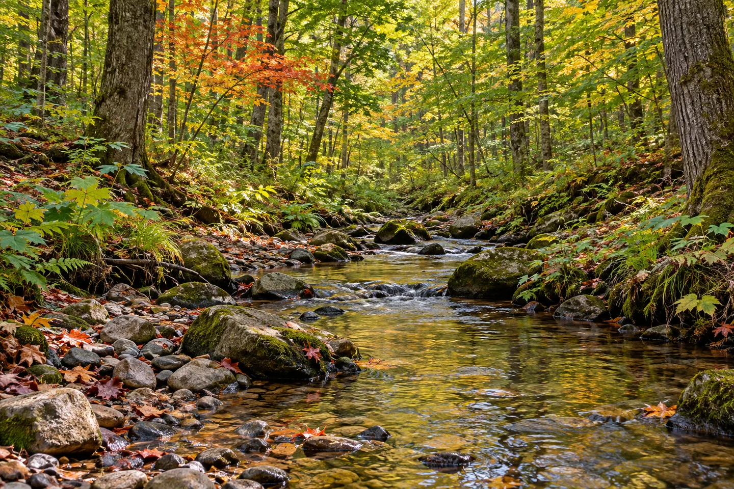
Several stream names help distinguish the landscape at Line Brook State Forest. The namesake watercourse runs north to south through the property, while Stony Brook crosses its eastern portion and Mill Stream fishing access lies to the north. Across 1,116 acres in Redfield and Osceola, the forest's water and woodland offer related subjects for a visit without needing to turn every stream into one connected walking itinerary.
The property spans Oswego and Lewis counties. The New York State Department of Environmental Conservation (DEC) describes much of its cover as a relatively mature mixture of hard maple, red maple, black cherry and white ash. Those tree names give a more specific starting point than a generic forest scene. Where the route provides an appropriate view, compare woodland form and texture rather than expecting every species in a single frame.
The state forest was established for reforestation, wildlife, timber, recreation and watershed protection. Those purposes connect the tree cover with the streams rather than treating water as a separate attraction. A visit can consider how a working woodland and its waterways share the same public property, without claiming that every management goal has already produced a particular ecological result.
For walking, one short trail of 0.11 mile provides access to Stony Brook. Other parts of the property can be explored by unpaved roads. Keep the short trail's destination distinct from Line Brook, the namesake stream running through the forest. A small difference in names matters when matching a route to a map, especially where several watercourses occupy different portions of the same property.
The Jackson Road parking reference uses another name as well: Millstream Road. That road name should not be confused with Mill Stream itself or the separate fishing-access site to the north. Select the correct location and return for the visit intended, rather than assuming the word stream on several map labels means one common entrance or an easy connection between features.
DEC identifies trout opportunities in Line Brook, Stony Brook and tributaries of Mill Stream. Those references describe the waters, not fish guaranteed to be visible from a trail. Public fishing rights are also mapped separately. Respect actual access and boundaries, letting a water view become a subject where the route appropriately provides one rather than following a bank beyond the land open for the outing.
The Tug Hill East Unit Management Plan supplies the wider framework. Check the current map and posted conditions, and use the approach that fits the chosen section. A short trail can still leave time for observation, while a road-based walk offers a different view of the mature woodland. Neither needs to be expanded into a loop around every named watercourse for the forest to have a particular character.
Follow Leave No Trace guidance and leave vegetation undisturbed. For photographs, the relationship between a stream and its surrounding trees may be enough, with no waterfall or viewing platform added to the scene. Line Brook offers a grounded combination of relatively mature woodland, several distinct waters and modest access, with the exact route deciding which of those elements can be observed during a visit.
Fun facts
- Line Brook State Forest covers 1,116 acres across Oswego and Lewis counties.
- Line Brook runs north to south through the property.
- The 0.11-mile short trail leads to Stony Brook, not the namesake stream.
- Much of the cover is a relatively mature maple,cherry and ash mixture.
- Jackson Road is also called Millstream Road, while Mill Stream fishing access is a separate northern reference.
Before you go
- Match the short Stony Brook trail to the correct watercourse.
- Distinguish Jackson/Millstream Road from Mill Stream itself.
- Choose the approach and return with current maps and boundaries in mind.
- Do not infer a connected bank-side circuit from several stream names.
- Follow posted conditions and Leave No Trace guidance.
Capture
- Frame stream and woodland from an appropriate actual access point.
- Use mature-tree texture visible along the chosen route without assuming a landmark tree.
- A close water-and-vegetation composition can work without an invented waterfall or platform.
 Canacadea State Forest
 Lower Salmon River State Forest
 Orton Hollow State Forest
Social
Line Brook State Forest covers 1,116 acres across Redfield and Osceola in two counties. #Cre8Travel
Line Brook runs north to south, while Stony Brook crosses the forest's eastern portion. #Cre8Travel
The short 0.11-mile trail accesses Stony Brook, a different watercourse from the forest's namesake. #Cre8Travel
Maples, black cherry and white ash characterize much of Line Brook's relatively mature woodland. #Cre8Travel
Jackson Road is also known as Millstream Road, distinct from the named stream and fishing-access site. #Cre8Travel
Water names help explain Line Brook's setting without creating a linked waterside visitor circuit. #Cre8Travel
A short route can leave time for a closer look at water and surrounding tree textures. #Cre8Travel
At Line Brook, which would guide your observations: the waterways or the mature woodland mixture? #Cre8Travel
Hashtags