 Cre8Travel
CRE8TRAVEL · NEW YORK PLACES
Huckleberry Ridge State Forest
Huckleberry Ridge State Forest: A Closer Look
Discover
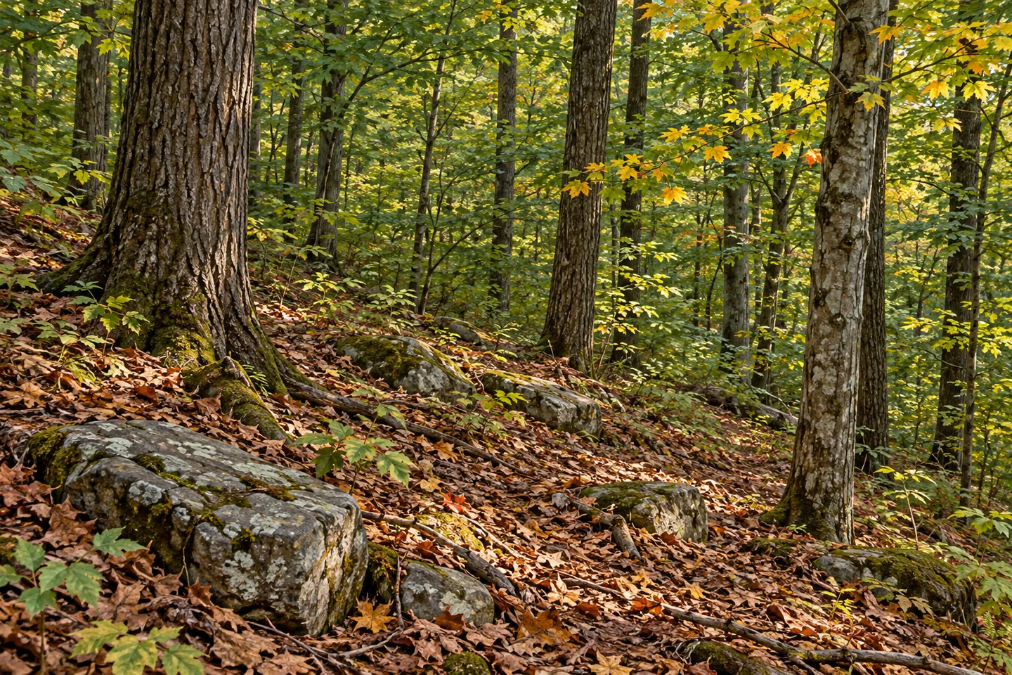
Huckleberry Ridge State Forest is best read as a group of parcels joined by routes rather than one uninterrupted block of public land. Its 1,450 acres are divided into 11 segments in Deerpark and Greenville, Orange County. Hiking trails cross between them, and some marked sections use private property by agreement. The map and those access arrangements are part of the outing from the start, not a detail to consider only at a boundary.
The New York State Department of Environmental Conservation (DEC) identifies views of the Neversink River Valley among the forest's attractions. The ridge setting gives a visit a wider landscape context, without meaning every trail segment has the same outlook. Choose the route for the terrain and access actually described, letting a view be part of what the route provides rather than a promise attached to the entire acreage.
Several routes bring different scales to the map. The Minisink Trail is listed at 3.2 miles, Lenape Ridge at 4.3 miles and the White Trail at 1.4 miles. Those figures are individual route descriptions, not distances to add together into one convenient loop. Match the approach and return to the selected trail before deciding how far to go, especially where a route crosses between parcels.
Nearly seven miles of the Shawangunk Ridge Trail cross the unit, with about a mile of the Long Path also represented. These are local portions of longer networks, not their full lengths. A broader trail name can add context to an outing while the actual local section remains the basis for planning. There is no need to undertake a long-distance journey to appreciate a ridge and its place above the valley.
Where marked trails cross private land, access is maintained through agreements involving the New York-New Jersey Trail Conference and landowners. Remain on the permitted route and respect the surrounding property. An agreement allowing a trail does not make all adjacent land available for wandering, picnicking or a different approach to a photograph. The public forest's segmented shape makes that distinction particularly important here.
Parking references include Raymond Drive, Greenville Turnpike, Route 6 and Old Greenville Turnpike. Match the chosen lot to the exact route on the current map rather than treating these locations as interchangeable entrances. A different starting point can change the distance, return and parcel boundaries involved, even when the same state-forest name appears across the plan.
The forest's wildlife description includes varied birds, mammals, reptiles and amphibians. Treat that as habitat context rather than a promised sighting or an invitation to approach an animal. For photographs, a valley view available from an appropriate trail position or ordinary woodland texture can provide a grounded subject. No cliff-edge approach or rare-species encounter is needed to give the scene a sense of place.
The Shawangunk Ridge planning framework supplies the management context. Follow posted conditions and Leave No Trace guidance, staying on the appropriate routes through both public and agreed private sections. Huckleberry Ridge offers a particular meeting of parcel boundaries, local trail choices and larger walking networks, with the Neversink Valley giving the surrounding landscape a name. Let that real structure shape the visit instead of simplifying it into one unrestricted forest loop.
Fun facts
- Huckleberry Ridge State Forest covers 1,450 acres in 11 segmented parcels.
- Some marked trails cross private land by agreement.
- Minisink, Lenape Ridge and White trails are listed at 3.2, 4.3 and 1.4 miles respectively.
- Nearly seven miles of the Shawangunk Ridge Trail and about one mile of the Long Path cross the unit.
- The ridge trails provide views associated with the Neversink River Valley.
Before you go
- Choose a local trail and return using the current map.
- Do not add separate route mileages into an assumed loop.
- Remain on permitted routes across private land.
- Match the parking location to the exact trail and parcel arrangement.
- Follow posted conditions and Leave No Trace guidance.
Capture
- Use a valley view only from an appropriate position along the chosen trail.
- Woodland detail can carry a composition when a wider view is not available.
- Respect private boundaries instead of leaving the permitted route for another angle.
 Cameron State Forest
 Stewart State Forest
 Canacadea State Forest
Social
Huckleberry Ridge State Forest covers 1,450 acres divided among 11 parcels. #Cre8Travel
Some marked routes cross private land by agreement. Respect the route and surrounding property. #Cre8Travel
Minisink, Lenape Ridge and White trails provide separate local route choices at Huckleberry Ridge. #Cre8Travel
The Shawangunk Ridge Trail and Long Path have local sections within the forest, not their full routes. #Cre8Travel
Views relate the ridge to the Neversink River Valley, while the exact trail determines what is available. #Cre8Travel
Raymond Drive, Greenville Turnpike, Route 6 and Old Greenville Turnpike serve different approaches. #Cre8Travel
A segmented forest needs a mapped route, not an assumption that every parcel joins into one unrestricted loop. #Cre8Travel
At Huckleberry Ridge, would a local trail or its connection to a wider walking network guide your plan? #Cre8Travel
Hashtags