 Cre8Travel
CRE8TRAVEL · NEW YORK PLACES
Stanley J. Hamlin Marsh Wildlife Management Area
Stanley J. Hamlin Marsh Wildlife Management Area: A Closer Look
Discover
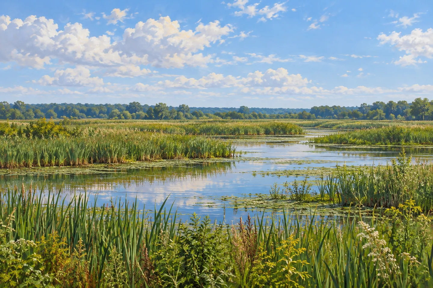
A small change in water level can be part of a large landscape story at Stanley J. Hamlin Marsh Wildlife Management Area. Mud Creek falls only about 2.4 feet as it passes through the marsh, while Mill Creek enters from the south beneath Bear Road. Across 1,686 acres in Clay, Onondaga County, water and gently rolling ground shape a place whose character is more specific than a broad impression of open wetland.
Approximately 88 percent of the WMA is wetland. The property stretches about four miles in length, varying from a quarter mile to a mile in width. Those figures describe its scale, not a trail distance or a prepared circuit. Use them to place a view in context while choosing an actual public approach from the current map, rather than expecting to walk the entire marsh perimeter.
The area has carried several names, including Clay Marsh, Little Cicero Swamp and Peat Swamp. In 1994 it was renamed for Stanley J. Hamlin, a local conservationist instrumental in state acquisition. That history helps distinguish it from nearby Cicero Swamp WMA, a separate destination. A shared older place name should not turn two different public properties into the same outing or an assumed connecting route.
The New York State Department of Environmental Conservation (DEC) describes a marsh that has become wetter since the 1940s, relating that change partly to runoff from surrounding development and partly to downstream dams. Keep that explanation at the scale of the agency's account, rather than assuming the water level will match a particular historical photograph. The relationship between water and its surroundings is part of what makes the landscape worth considering.
For a defined observation point, DEC identifies a wheelchair-accessible viewing platform from the Henry Clay Boulevard parking area. Assess that specific approach and current conditions against your needs; it does not describe access throughout the whole wetland. A platform view can be enough to look at the relation between water, vegetation and the surrounding ground, without entering the marsh to find another angle.
The habitat provides breeding, nesting, resting and feeding opportunities for nearly 200 bird species in DEC's description. The number concerns habitat use across species and seasons, not birds promised during one visit. Use the agency's bird and vertebrate checklists for actual observations, and give wildlife room. A scene without a bird in the frame can still show the character of the wetland.
Approach references include Henry Clay Boulevard, Old Wetzel Road, Bear Road and Davis Road. Choose the correct point for the route intended, and remain on designated trails. The railway is private land outside the WMA, so it must not be used as a shortcut. Match the entry to the map before traveling rather than treating nearby roads and tracks as interchangeable ways into the habitat.
Follow posted conditions, Leave No Trace guidance and DEC tick precautions. For photographs, a layered composition from an appropriate viewpoint can show water and marsh vegetation without disturbing either. Hamlin Marsh brings low-gradient streams, a particular conservation history and a defined viewing opportunity into the same visit, with the access actually provided keeping that experience grounded.
Fun facts
- Hamlin Marsh WMA covers 1,686 acres in Clay, Onondaga County, with about 88 percent wetland.
- Mud Creek drops about 2.4 feet through the marsh; Mill Creek enters from the south.
- The WMA was renamed for Stanley J. Hamlin in 1994.
- DEC identifies a wheelchair-accessible viewing platform from Henry Clay Boulevard parking.
- The railway is private land outside the WMA.
Before you go
- Use the current WMA map to choose the correct approach.
- Assess the specific Henry Clay viewing-platform access rather than generalizing across the wetland.
- Stay on designated trails and do not use the private railway as a shortcut.
- Treat bird-species totals as habitat context rather than a sightings checklist.
- Follow Leave No Trace guidance and DEC tick precautions.
Capture
- Use a layered marsh composition from the established viewing platform.
- Let vegetation and open water be the subject without approaching wildlife.
- Work with actual conditions rather than promising a fixed water level or seasonal appearance.
 Cameron Mills State Forest
 Cameron State Forest
 Huckleberry Ridge State Forest
Social
Hamlin Marsh WMA covers 1,686 acres, about 88 percent of them wetland. #Cre8Travel
Mud Creek drops only about 2.4 feet through Hamlin Marsh, giving water a particular landscape role. #Cre8Travel
The marsh was renamed for conservationist Stanley J. Hamlin in 1994. #Cre8Travel
A wheelchair-accessible viewing platform is a specific feature from the Henry Clay Boulevard parking area. #Cre8Travel
Nearly 200 bird species use Hamlin Marsh habitat across seasons, without a guarantee of sightings during one visit. #Cre8Travel
Older names link Hamlin Marsh with local history, but nearby Cicero Swamp is a separate WMA. #Cre8Travel
The railway is private property outside Hamlin Marsh. Use only the appropriate public route. #Cre8Travel
At Hamlin Marsh, what would draw your attention first: water, vegetation layers or birds actually present? #Cre8Travel
Hashtags