 Cre8Travel
CRE8TRAVEL · NEW YORK PLACES
Spicer Creek Wildlife Management Area
Spicer Creek WMA: A Short Route beside the Niagara River
Discover
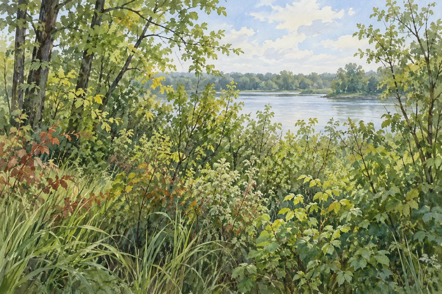
Spicer Creek Wildlife Management Area gives a short walking route a particular setting beside the Niagara River. The 34-acre property lies along East River Road in Grand Island, Erie County. Nearly 26 acres are wetland, with about eight acres of brushland and woodland. That balance makes wetland conservation central to the visit, while a defined approach helps keep recreation within the area's wildlife purpose.
The state acquired Spicer Creek in 2004. Its property rights include part of the Niagara riverbed along 1,600 feet of shoreline, adding a less obvious dimension to the mapped land parcel. Those rights help explain the conservation setting; they do not establish a public route along every part of the water's edge. For a walk, follow the designated trail and current map rather than interpreting a shoreline figure as a promenade length.
From the East River Road parking area, DEC identifies a trail to two viewing platforms. The route to the Niagara River viewing area is 0.4 mile one way, with a firm compacted-stone surface, a minimum width of three feet and a maximum slope of 10 percent. These are useful details for deciding whether an outing fits your needs. Check present conditions and operator guidance, particularly if surface condition, grade or mobility equipment will shape your route choice.
The facilities have their own history. In 2009, an accessible trail and a combined observation deck and hunting blind were developed with partial support from the Oakawanda Wildlife Foundation. A second blind followed in 2015. The viewing structures therefore belong to a shared wildlife-recreation setting rather than an exclusively photographic attraction. Consult current seasonal arrangements and respect other lawful uses when planning a stop.
DEC describes management objectives that include habitat for resident and migratory species, compatible wildlife-related recreation and protection of wetland habitat and the Niagara River corridor. Those aims give context to the landscape without proving a particular species will appear. Bird and vertebrate checklists are available as observation aids. Use them to sharpen attention to what is present, rather than setting a target list that the wetland must produce on demand.
For photography, the river and vegetation can supply the subject even when wildlife is out of view. From an appropriate viewing location, compare the texture of water with the forms of wetland and woodland cover. A wider image and a smaller detail can tell the same landscape story at different scales. Keep the scene as you find it, staying on designated routes and leaving vegetation undisturbed.
DEC's approach from Buffalo uses Route 190 onto Grand Island and East River Road, with parking just beyond Whitehaven Road. Confirm that location and current access before departure. The WMA has activity-specific rules, so check current guidance for the purpose of your visit instead of assuming that every use is unrestricted throughout the year. Follow Leave No Trace and the agency's outdoor-safety advice.
Beaver Island and Buckhorn Island state parks are listed among nearby public-land options. Each needs its own route and access plan. At Spicer Creek, the value of a visit can remain modest and focused: a short approach, attention to river and wetland, and an understanding of how a small parcel serves conservation and carefully arranged public use.
Fun facts
- Spicer Creek WMA covers 34 acres in Grand Island, Erie County.
- Nearly 26 acres are wetland, with about eight acres of brushland and woodland.
- The state acquired the property in 2004.
- The trail to the river viewing area is 0.4 mile one way.
- Observation/hunting facilities were developed in 2009 and 2015.
Before you go
- Follow the designated trail and current map rather than treating the shoreline length as a walking route.
- Review the trail’s stated width, surface and maximum slope against your needs and present conditions.
- Check current seasonal arrangements for viewing structures shared with other wildlife-recreation uses.
- Confirm the East River Road parking approach near Whitehaven Road before departure.
- Use wildlife checklists as observation aids without expecting particular sightings.
Capture
- From an appropriate viewing location, compare river-water texture with the surrounding vegetation.
- Pair a wider wetland-and-river frame with a smaller woodland or plant detail.
- If wildlife appears, observe from a respectful distance and avoid changing the scene to obtain a photograph.
 Dill Brook Community Forest
 Deer River State Forest
 Trout River State Forest
Social
Spicer Creek WMA covers 34 acres on Grand Island in Erie County, with nearly 26 acres of wetland and about eight acres of brushland and woodland. #Cre8Travel
The state acquired Spicer Creek in 2004. Wetland conservation and compatible wildlife-related recreation guide its public-land role. #Cre8Travel
Spicer Creek’s property rights include riverbed along 1,600 feet of Niagara shoreline. That does not make the whole shoreline a public walking route. #Cre8Travel
The Spicer Creek trail to the river viewing area is 0.4 mile one way, with compacted-stone tread at least three feet wide and maximum slope 10 percent. #Cre8Travel
Review Spicer Creek’s current route conditions against your needs. Specific surface and grade information is more useful than a blanket accessibility promise. #Cre8Travel
Spicer Creek’s observation/hunting facilities have chapters in 2009 and 2015. Check current seasonal arrangements and respect other lawful users. #Cre8Travel
Bird and vertebrate checklists can guide attention at Spicer Creek. A wildlife list is not a guarantee of what will appear during one visit. #Cre8Travel
At Spicer Creek, try framing the relationship between river water and vegetation. A small landscape can reward patient observation. #Cre8Travel
Hashtags