 Cre8Travel
CRE8TRAVEL · NEW YORK PLACES
Deer River State Forest
Deer River State Forest: Water, Woodland and a Rustic Camp
Discover
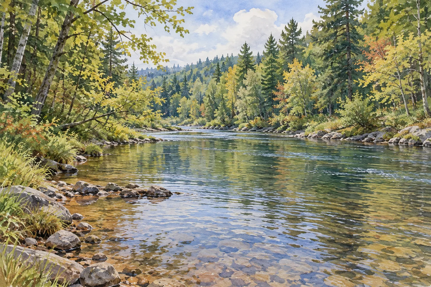
Deer River State Forest has water at the center of its character. The 12,273-acre property extends through Dickinson, Brandon and Malone in Franklin County, with the Deer River linking wetlands and tributaries through a landscape of rapids, waterfalls, open flat water and broad marshes. Those different water forms give the forest variety, but they also make choosing a specific access point more useful than arriving with a general intention to see the river.
The Beaneville Trail offers one defined walking option. It begins at Webster Mills Public Forest Access Road and follows the Deer River for 0.6 mile. DEC identifies the Webster Mill Road angler parking area as the trailhead reference. Use the current map to locate the route and plan a turnaround, without assuming that every waterfall or marsh mentioned in the wider forest description lies along this short trail.
Other recreation follows several miles of unpaved roads and unmarked routes. The forest has limited developed amenities, so any extension beyond the named trail calls for navigation and an approach suited to your experience. Read the boundary and road information before setting out. A large acreage offers scope for choosing a visit, but it does not make every part of the property a prepared route.
Camping has a particularly clear description here. DEC identifies nine designated primitive sites: eight off Conservation Public Forest Access Road and one off Avery Lot Public Forest Access Road. Sites are generally cleared spaces with a stone fire ring, with many offering vehicle access and parking. Toilets, running water and electricity are not available. Plan for that level of provision rather than treating a listed site as a serviced campground pitch.
Dispersed camping is also allowed under 150-foot setbacks from roads, trails and water. Stays beyond three nights or groups of ten or more require a Forest Ranger permit. Check current rules and the map to distinguish designated sites from dispersed locations. A site being shown on a map does not guarantee space or suitable road access on a particular date, so review conditions before an overnight trip.
For anglers, DEC points to its interactive fishing-rights map for the Deer River. Other named access references include Mill/Mandish Road, Conservation Road and Iron Bridge. Check the current fishing rules and actual public access before choosing a place to stop. A water feature's appearance in a forest description is not evidence of a fish species, a permitted catch or continuous public access along both banks.
Photography can focus on the changing relationship between water and vegetation from appropriate access. A wider view of river and woodland may pair well with a closer water-texture study. No particular bird, amphibian or glacial boulder needs to be promised to give the landscape interest. Let the scene you encounter guide the image, keeping natural features undisturbed.
Snowmobile routes connect with the state network, while other seasonal activities have different route provisions. Consult activity-specific information rather than assuming every unmarked corridor serves each use. Follow Leave No Trace and DEC outdoor-safety guidance. Malone is identified for supplies and lodging; nearby public-land options include Trout River, Titusville and St. Regis River state forests. For this visit, one manageable river section or campsite plan gives Deer River's larger landscape a clear focus.
Fun facts
- The forest covers 12,273 acres across Dickinson, Brandon and Malone.
- The 0.6-mile Beaneville Trail follows the Deer River from Webster Mills PFAR.
- DEC identifies nine designated primitive campsites.
- Eight sites are off Conservation PFAR and one is off Avery Lot PFAR.
- Designated sites have no toilets, running water or electricity.
Before you go
- Use the current map to choose a specific river access point or trail.
- Do not assume the Beaneville Trail passes every water feature mentioned in the forest description.
- Plan an overnight visit around primitive facilities without water, toilets or electricity.
- Check current designated-site and dispersed-camping guidance, road conditions and permit requirements.
- Consult DEC fishing-rights information and current rules before selecting an angling location.
Capture
- Frame river water and surrounding vegetation together from appropriate public access.
- Pair a wider river-and-woodland image with a closer water-texture composition.
- Let actual features shape the image without relying on unverified species or geological formations.
 Spicer Creek Wildlife Management Area
 Trout River State Forest
 Rockwood State Forest
Social
Deer River State Forest covers 12,273 acres in Franklin County, with a landscape organized around its river, tributaries and wetlands. #Cre8Travel
The 0.6-mile Beaneville Trail follows the Deer River from Webster Mills PFAR. Use the current map for the actual trailhead and return plan. #Cre8Travel
Rapids, waterfalls, flat water and marshes feature in the wider Deer River forest description. A short trail does not necessarily reach them all. #Cre8Travel
DEC identifies nine primitive sites at Deer River: eight off Conservation PFAR and one off Avery Lot PFAR. Check current access and conditions. #Cre8Travel
Deer River’s designated sites have no toilets, running water or electricity. Plan for primitive provision before an overnight visit. #Cre8Travel
Use DEC’s fishing-rights map for Deer River access and current regulations. A scenic riverbank is not automatically a public fishing location. #Cre8Travel
At Deer River, compare a wider water-and-woodland scene with a close study of surface texture. The landscape can tell the story without a wildlife promise. #Cre8Travel
One focused trail section or camp plan can make Deer River’s large woodland manageable. Which water feature would guide your attention? #Cre8Travel
Hashtags