 Cre8Travel
CRE8TRAVEL · NEW YORK PLACES
Sonyea State Forest
Sonyea State Forest: A Closer Look
Discover
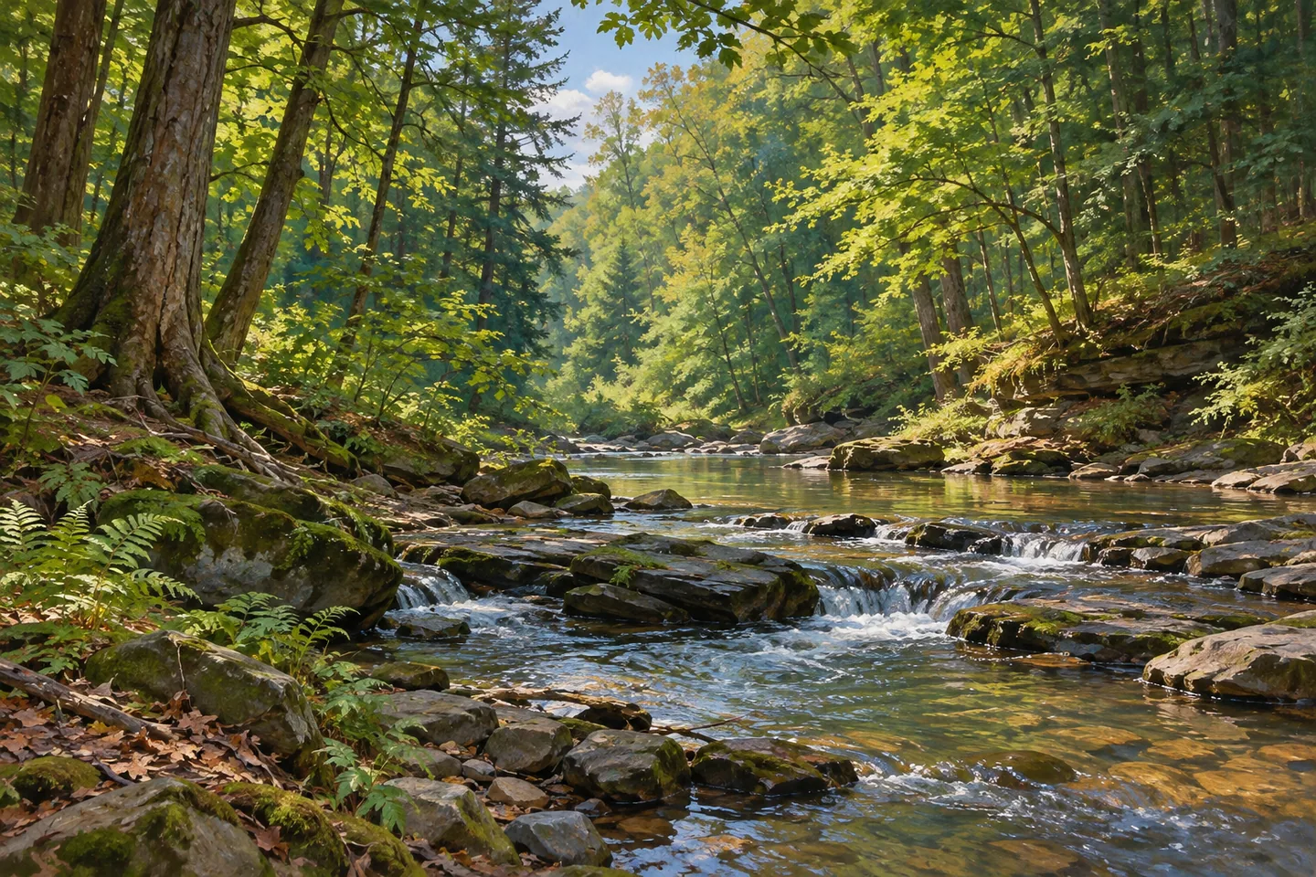
A former transport corridor and a changing creek share the story at Sonyea State Forest. The 922-acre property in Livingston County includes the western Keshequa Creek Gorge and, in its eastern part, headwaters of Two Mile Creek. It is a lightly developed forest across Groveland, West Sparta and Mount Morris, where the relationship between water and human routes matters as much as the woodland setting itself.
The Genesee Valley Greenway passes through the forest, connected with the remains of the Genesee Canal and a branch of the Pennsylvania Railroad. That history gives the landscape another way to be read: routes once made for transport now help tell a public-land story. It does not mean intact railway tracks or a complete canal structure await at a convenient viewpoint. The line of a former grade can be meaningful without reconstructing a finished historic scene.
Water has changed the practical route. Large sections of the old canal and railroad alignment beside Keshequa Creek have washed away. The official Greenway path through the forest was consequently moved onto town roads and the Shaker public forest access road at the top of the hill. Use the current official alignment and park detour guidance when planning a walk, rather than following an older map line down the creek bank.
The difference between the former grade and the current route is part of Sonyea's character. It shows why a historic corridor cannot always keep the same modern purpose in the same location. An observation-focused visit can consider the creek's place in the wider landscape without making access to a waterfall, a surviving structure or an old bank-side section the condition for a worthwhile outing. Let the route actually provided guide what you see.
The New York State Department of Environmental Conservation (DEC) describes limited development here. Union Corners Road is the public approach named in its visitor information. Consult the property map before leaving the road and pay attention to boundaries: neighboring land operates under different regulations. Remaining within the state forest is a basic part of the outing, not something that can be decided from the appearance of woodland alone.
Management is addressed through the Livingston Unit Management Plan, which places the forest within a wider public-land framework. At the local scale, the useful contrasts are already specific: headwaters to the east, gorge to the west, a transport history and a route changed by erosion. For a photograph, work with woodland texture or an appropriate view from the actual route. No descent or presumed access to a historic remnant is needed to illustrate those themes.
Check the Greenway's present detour information and posted conditions before setting out, follow Leave No Trace guidance, and carry out anything brought into the forest. Keep the outing on the current official route rather than treating an old transport line as a continuous path. Sonyea offers a place to consider how public access and a water-shaped landscape adapt to one another, with the practical route doing as much to explain the forest as the history behind its former corridor.
Fun facts
- Sonyea State Forest covers 922 acres across three Livingston County towns.
- Keshequa Creek Gorge is along the western boundary; Two Mile Creek headwaters are in the east.
- The Greenway is associated with a former canal and Pennsylvania Railroad branch corridor.
- Washouts caused the official route to move onto town and Shaker forest access roads at the hilltop.
- Union Corners Road is the public approach described by DEC.
Before you go
- Use the present official Greenway alignment and current park detour guidance.
- Do not follow a historic creekside grade as if it were a continuous modern route.
- Remain within the state forest, respecting neighboring boundaries and different regulations.
- Check the Union Corners Road approach and posted conditions.
- Carry out litter and follow Leave No Trace guidance.
Capture
- Study woodland texture from the current official route rather than descending to an old grade for a photograph.
- Use a water-and-landscape view only where actually available from an appropriate position.
- Let the corridor's present landscape be the subject without staging railways, canal structures or ruins.
 Tug Hill State Forest
 Brookfield Railroad State Forest
 Charles E. Baker State Forest
Social
Sonyea State Forest spans 922 acres in Livingston County, with limited development and a changing route history. #Cre8Travel
Keshequa Creek Gorge lies to Sonyea's west; Two Mile Creek headwaters are in the eastern part. #Cre8Travel
The Genesee Valley Greenway at Sonyea recalls a former canal and railway corridor. #Cre8Travel
Washouts changed Sonyea's Greenway route. Plan around the current official road alignment and park detour guidance. #Cre8Travel
A historic line on a map is not proof of a continuous walking route today. Check Sonyea's actual access. #Cre8Travel
Union Corners Road is the DEC-listed approach to Sonyea State Forest. Respect the public-land boundaries. #Cre8Travel
At Sonyea, a considered woodland composition can tell the present story without a descent toward historic remnants. #Cre8Travel
How does a route change when water changes the landscape? Sonyea offers a place to consider that question. #Cre8Travel
Hashtags