 Cre8Travel
CRE8TRAVEL · NEW YORK PLACES
Charles E. Baker State Forest
Charles E. Baker State Forest: A Closer Look
Discover
Charles E. Baker State Forest is the core of a much larger walking and riding landscape. Its 9,400 acres in Brookfield and Hamilton, Madison County, combine with Brookfield Railroad and Beaver Creek State Forests to contain 100 miles of connected trails. That broad network is a regional picture, not mileage belonging to Baker alone. Begin with the part you intend to explore, then let the larger system provide context rather than pressure to cover distance.
The forest honors the district forester who oversaw its establishment. Reforestation, watershed protection, timber production and recreation were among the purposes behind the state's purchase. Those aims remain useful ways to think about the place. This is a working state forest, whose trees and routes belong to a history of public-land management rather than a claim of untouched wilderness. Its name keeps the person involved in that establishment within the story.
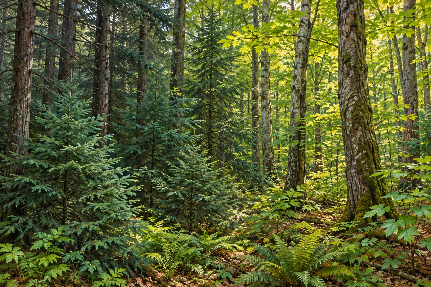
Plantations of red, white and Scotch pine and Norway spruce stand alongside natural woodland. The latter includes American beech, sugar maple, red maple, black cherry, white ash, basswood and eastern hemlock. Looking at the contrast between planted stands and natural forest can give an ordinary walk a particular focus. Consider spacing, tree forms and the way different foliage changes a composition, without expecting every species to be identifiable from a single stretch of trail.
The timber history also connects the woods with everyday objects. Forest products harvested here have supplied paper, construction lumber, cabin logs and fine furniture. That range makes an interesting counterpoint to looking at trees as scenery alone. A stand can be a place to walk, part of habitat, and a resource managed for human use. Those overlapping roles are more informative than a general claim that everything in the forest is in perfect balance.
The New York State Department of Environmental Conservation (DEC) lists deer, turkey, ruffed grouse and migratory songbirds among the wildlife present. Their association with the forest adds context without making an encounter part of a visitor guarantee. Enjoy the woodland setting whether or not an animal appears. A photograph might focus on the contrast between planted conifers and mixed forest instead of relying on a bird to arrive in the frame.
Topography ranges from mild to moderate slopes with some steep areas. Select a route from the Brookfield system and property maps that matches your plans, and pay attention to trail designations on this shared network. The Brookfield Auto Tour Guide is another planning resource, though it does not establish that every forest road or facility is available in every season. Some visitor facilities and equestrian provisions have seasonal arrangements, making present conditions worth checking.
For the approach, DEC directs visitors through Larkin Road and Moscow Road toward the assembly-area side of the forest. Match that information to your own chosen route rather than treating one access point as the start of the entire network. Follow posted rules and Leave No Trace guidance. Charles E. Baker offers a landscape where trail use, forestry history and a varied tree mixture can all inform the same outing, at whatever distance the actual route supports.
Fun facts
- Charles E. Baker State Forest covers 9,400 acres in Brookfield and Hamilton, Madison County.
- The 100-mile connected trail figure is shared across Baker, Brookfield Railroad and Beaver Creek state forests.
- The forest is named for the district forester who oversaw its establishment.
- Plantations of pine and Norway spruce mix with natural woodland including beech, maples, black cherry and hemlock.
- Forest products have supplied paper, construction lumber, cabin logs and fine furniture.
Before you go
- Use both the property and Brookfield system maps for route planning.
- Do not assign all 100 system miles to Charles E. Baker alone.
- Choose for actual terrain, which includes some steep areas.
- Check shared-route designations and current seasonal provisions.
- Follow posted rules and Leave No Trace guidance.
Capture
- Compare planted conifer patterns with the mixture of natural woodland visible along your route.
- Study trunk and foliage textures rather than expecting an animal in the frame.
- A close composition can connect tree detail with the forest's working history without staging a harvest.
 Brookfield Railroad State Forest
 DeRuyter State Forest
 Earlville State Forest
Social
Charles E. Baker State Forest is the 9,400-acre core of the Brookfield Trail System. #Cre8Travel
The system's 100 connected trail miles span Baker, Brookfield Railroad and Beaver Creek state forests together. #Cre8Travel
A district forester who oversaw its establishment gives Charles E. Baker State Forest its name. #Cre8Travel
Pine and spruce plantations meet natural beech, maple, cherry and hemlock woodland at Charles E. Baker. #Cre8Travel
Paper, lumber, cabin logs and fine furniture are part of Charles E. Baker's forest-product story. #Cre8Travel
DEC lists deer, turkey, ruffed grouse and migratory songbirds here; a visit need not depend on a sighting. #Cre8Travel
Shared routes and some steep terrain make map and designation checks part of a Charles E. Baker visit. #Cre8Travel
At Charles E. Baker, would you focus on a section of the trail system or the trees' working history? #Cre8Travel
Hashtags