 Cre8Travel
CRE8TRAVEL · NEW YORK PLACES
Sargent Ponds Wild Forest
Sargent Ponds Wild Forest: Wooded Hills and Central Adirondack Waters
Discover
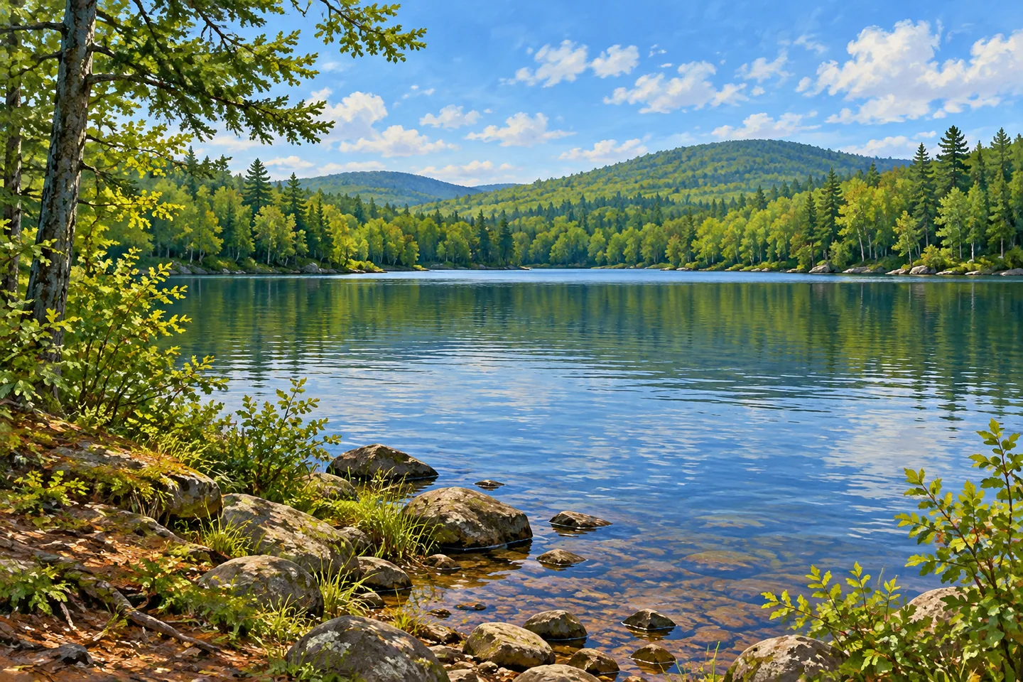
Sargent Ponds Wild Forest brings together gently rolling wooded hills, interior waters and several different kinds of public access. Its 43,460 acres occupy northern Hamilton County in the central Adirondacks, largely east of Raquette Lake, north of Route 28 and west of Route 30. The forest is visible from major travel corridors, but its identity extends well beyond a roadside view. A carefully chosen trail can introduce one part of a broad landscape that includes ponds, lake margins and higher wooded ground.
DEC describes two main concentrations of trails: the Lake Eaton/Owl's Head area and the Sargent Ponds/Castle Rock area. This division is a useful starting point for planning. The names refer to different portions of the property, rather than stops along one continuous visitor circuit. Choose an approach for a particular outing and let that local setting supply the detail, keeping the wider wild forest as context rather than trying to collect all its landmarks in a day.
In the southern trail grouping, Castle Rock rises above the northern shore of Blue Mountain Lake. The operator describes a 200 foot rock outcrop, with a natural overhanging rock shelter and small cave to its south. Its setting gives a visit a relationship between stone, wooded slope and lake, while views from an appropriate established position place Blue Mountain and the water together. This Adirondack landform belongs to the Sargent Ponds landscape, with its own mapped access and surroundings.
The same general trail area connects toward Upper Sargent Pond through Helms Pond Trail. Elsewhere, a 3.1 mile developed trail leads to the Owl's Head Mountain fire tower. Those two examples reveal the variety within the unit: a pond-oriented route and a higher destination with a tower involve different approaches. Their individual distances and connections need to be checked on the current official map, rather than assembled into a simplified loop across the forest. A scene of woodland beside water can be as characteristic as a distant view.
Conservation easements add another layer to the map. At Bluff Point, a 34 acre easement permits public use of existing trails toward Castle Rock and Sargent Ponds. A separate 20 foot-wide canoe-carry easement allows passage between the south shore of Forked Lake and the north shore of Raquette Lake Outlet. These arrangements preserve particular passage rights across land; they do not make every nearby parcel unrestricted state forest. The Togus and Eagle Nest easements described on the same DEC page provide no public recreation access.
Surrounding campgrounds and launches create further choices, but they remain separate facilities with their own arrangements. DEC lists nearby places including Lake Eaton, Forked Lake and Golden Beach campgrounds. Their proximity can help with planning an appropriate stay without implying that a campground booking includes every forest activity or that every pond has vehicle access. Within the wild forest, several trailheads are limited to a sign and a small pull-off, so a broad road network should not be mistaken for developed visitor infrastructure everywhere.
Use current notices, maps and posted boundaries to select the actual route. Historical winter-route descriptions should not be treated as present permission, especially where private access has been withdrawn. For a considered visit, focus on the relationship between water, wooded hills and the specific passage available. Sargent Ponds Wild Forest gains its interest from those linked but distinct landscapes, with a pond shore, a wooded ascent or a rock formation each offering one grounded way into the larger Adirondack setting.
Fun facts
- Sargent Ponds Wild Forest covers 43,460 acres in Hamilton County.
- Its trails concentrate in two main landscape areas.
- The Adirondack Castle Rock is a 200 foot outcrop above Blue Mountain Lake.
- Bluff Point’s 34 acre easement permits use of specified existing trails.
Before you go
- Select one trail area using the current map and access notices.
- The Togus and Eagle Nest easements do not permit public recreation.
- Check the exact trailhead because many approaches have only small pull-offs.
Capture
- Frame wooded hills and a water view available from appropriate public access.
- Use ordinary woodland detail without reconstructing exact landmark geology.
- Stay on the permitted route rather than approaching a rock edge for a dramatic image.
 Rusk Mountain Wild Forest
 Humes Preserve
 Henry Morgenthau Preserve
Social
Sargent Ponds Wild Forest spans 43,460 acres of central Adirondack wooded hills and waters. #Cre8Travel
Lake Eaton/Owl’s Head and Sargent Ponds/Castle Rock form distinct trail concentrations. #Cre8Travel
Castle Rock’s Adirondack setting links a rock outcrop with Blue Mountain Lake and surrounding woodland. #Cre8Travel
Pond routes and higher tower destinations offer different ways to encounter the wild forest. #Cre8Travel
Bluff Point’s easement provides specific trail rights, rather than unrestricted use of surrounding land. #Cre8Travel
Togus and Eagle Nest easements provide no public recreation access. #Cre8Travel
Nearby campgrounds remain separate facilities with their own access arrangements. #Cre8Travel
Choose an actual mapped outing and let its water, woodland or rock setting tell part of the larger story. #Cre8Travel
Hashtags