 Cre8Travel
CRE8TRAVEL · NEW YORK PLACES
Rusk Mountain Wild Forest
Rusk Mountain Wild Forest: A Catskill Ridge beyond One Name
Discover
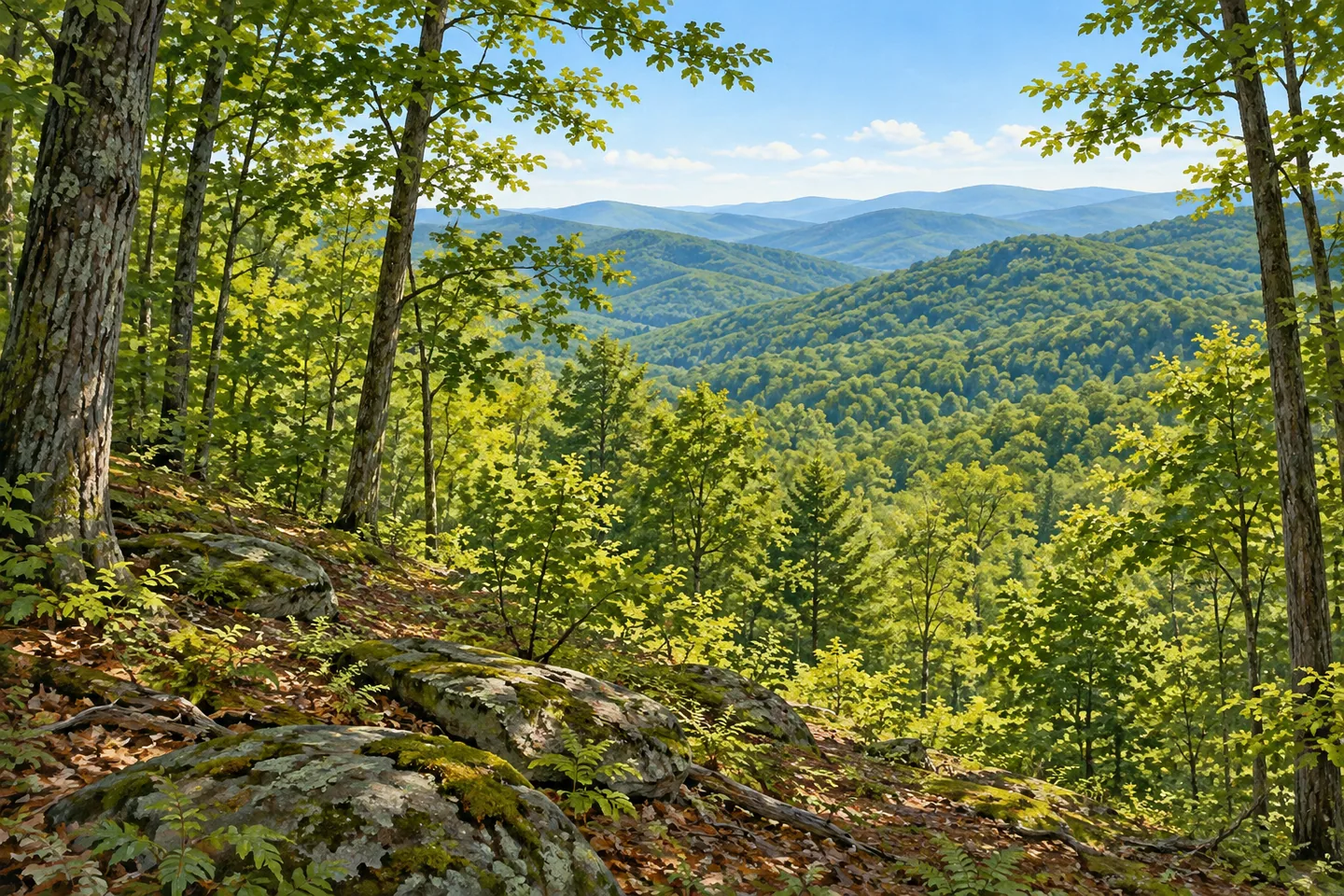
Rusk Mountain Wild Forest follows a ridge across several named Catskill mountains. The 3,900 acre public unit extends west from Hunter Mountain through land including Rusk, Evergreen, Pine Island and Packsaddle mountains. In Greene County's towns of Lexington, Hunter and Jewett, that arrangement gives the forest a geographical story broader than the single mountain in its name. A visit begins by choosing a documented route within that larger ridge landscape, rather than assuming that the name describes one prepared summit walk.
The management boundary has its own history. Rusk Mountain Wild Forest was reclassified in 2008 after previously forming part of Hunter Mountain Wild Forest. DEC's destination information identifies the 1995 Hunter Mountain Wild Forest management plan as its planning framework. The older name therefore remains relevant to understanding the public land, while the present designation describes the unit being visited. These are stages in management history, rather than evidence that the state forest and the nearby ski resort are the same destination.
Spruceton Trail provides a clearly described approach to the ridge's eastern end. Marked blue, it extends 3.4 miles from the Spruceton Road parking area to Hunter Mountain's summit. The route is also maintained as a horse trail, reflecting more than one kind of permitted recreation on the same public corridor. Its distance describes the ascent route, with the return and the demands of mountain terrain still to consider separately. Use the current DEC map and conditions to decide which section fits the outing.
The trail passes the John Robb lean-to area before reaching a junction with Colonel's Chair Trail. That yellow-marked connector continues 1.7 miles toward the top of Hunter Mountain Ski Area. The junction illustrates how a public forest trail can connect with an independently operated destination. Its existence does not establish admission, operating hours or unrestricted recreation on resort property. For a visit focused on the forest, the map helps keep the chosen public-land route distinct from any separately arranged resort experience.
Hunter Mountain's summit contains a fire tower and observer's cabin described in DEC's account. Those structures belong to the eastern end of the unit's wider ridge setting; they do not turn every mountain named within the forest into another tower destination. A woodland-focused outing can consider the transition toward higher ground without making a tower climb its essential purpose. Where a suitable established position offers a view, ordinary forest foreground can help show the relationship between the ridge and the country around it.
Watercourses also help orient the area. Schoharie Creek lies to the north and West Kill to the south, with separately mapped public fishing rights in the surrounding creek corridors. These references place the forest between recognizable valleys without implying that every bank forms part of the same public unit. The combination of ridge names, valley waters and a small number of documented trails is a useful way to read the landscape at more than one scale.
Plan from the Spruceton Road parking reference and current official backcountry information. Seasonal conditions, mountain travel and any proposed overnight stay require their own preparation; this account does not turn an old facility notice into proof of present availability. Rusk Mountain Wild Forest offers a connected ridge landscape with a particular public-management history. Let the chosen route reveal part of that larger structure, with the forest itself retaining an identity beyond its most familiar neighboring mountain or resort.
Fun facts
- The wild forest covers 3,900 acres in Greene County.
- It includes a ridge connecting Hunter, Rusk, Evergreen, Pine Island and Packsaddle mountains.
- The unit was reclassified in 2008.
- The blue-marked Spruceton Trail extends 3.4 miles from its parking area to Hunter Mountain’s summit.
Before you go
- Choose a documented route from the current DEC map.
- Treat Spruceton’s 3.4 miles as an ascent-route distance with a separate return.
- Resort access and public forest access have separate arrangements.
Capture
- Compose ordinary woodland and ridge relationships from an established position.
- Use forest foreground in a view actually available on the chosen outing.
- Avoid presenting a conceptual image as an exact tower or summit photograph.
 Pigeon Lake Wilderness
 Sargent Ponds Wild Forest
 Humes Preserve
Social
Rusk Mountain Wild Forest follows a 3,900 acre Catskill ridge landscape. #Cre8Travel
Hunter, Rusk, Evergreen, Pine Island and Packsaddle mountains help describe its geographical extent. #Cre8Travel
The unit’s 2008 reclassification is part of its public-land management story. #Cre8Travel
The blue-marked Spruceton Trail is a documented approach toward Hunter Mountain. #Cre8Travel
Spruceton is maintained as a horse trail as well as providing hiking access. #Cre8Travel
Colonel’s Chair Trail links toward a separately operated ski area; check distinct access arrangements. #Cre8Travel
Schoharie Creek and West Kill help place the ridge between surrounding valleys. #Cre8Travel
Plan an actual forest route rather than inferring a summit trail from the unit’s name. #Cre8Travel
Hashtags