 Cre8Travel
CRE8TRAVEL · NEW YORK PLACES
Sand Bay State Forest
Sand Bay State Forest: A Closer Look
Discover
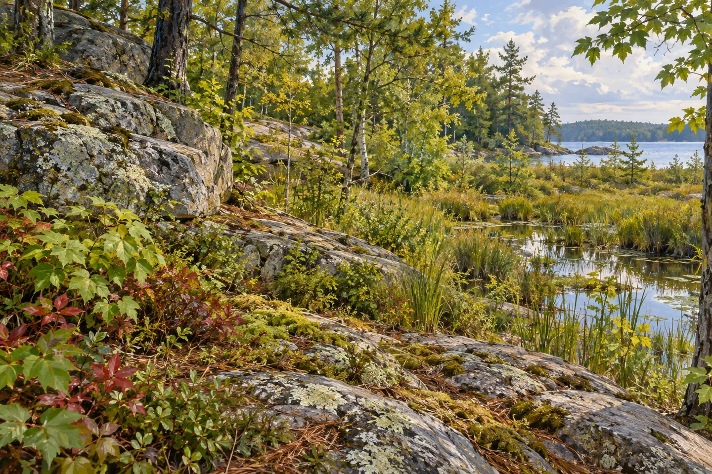
Sand Bay State Forest holds a contrast between its name and much of its terrain. The sandy shore of Lake Bonaparte forms part of its southern boundary, but this 326-acre property in Diana, Lewis County, also includes steep rocky ridges and a 90-acre wetland. Think of it as a meeting of different landscapes, rather than assuming the name describes an equipped beach or an uninterrupted stretch of shoreline walking.
Granite lies beneath much of the forest. In places it reaches the surface as bare outcrops; elsewhere it is covered by deeper, richer soil. Those differences give a visit a useful thread to follow. From whatever appropriate route you choose, compare the relationship between exposed rock and wooded ground. A close view of stone against vegetation can be as interesting as a wider scene, especially in a property where terrain is a major part of its character.
The wetland occupies another part of the picture. At 90 acres within a 326-acre forest, it is a substantial landscape element rather than a minor feature to pass on the way to somewhere else. That acreage says something about the composition of the property, not how much of the wetland can be approached or viewed on foot. Give attention to water and vegetation where they are actually visible without making an outing depend on reaching a particular marsh edge.
The state acquired Sand Bay in 1964. Today, the New York State Department of Environmental Conservation (DEC) manages it within the Westward Waters Unit Management Plan. Difficult terrain limits timber work, which has been confined to stands near North Shore Road. That detail links the landform to the working-forest story: management is shaped by the ground available, rather than taking an identical form everywhere across a property.
Woodland hiking is among the uses described by DEC, but the visitor information does not lay out a named walking circuit. Choose your approach with the map and present conditions in mind. The steep ridges are part of the landscape description, not an invitation to climb an outcrop for a better photograph. There is no need to make a small state forest sound more developed, or more easily traversed, than the access information establishes.
The lake side has a shallow-draft boat launch and parking. For an observation-focused visit, that is a particular mapped access reference rather than proof of a waterfront promenade or swimming facilities. DEC's approach from Harrisville uses North Bonaparte Road. Keep that approach name separate from the North Shore Road reference in the timber-management description, and match the location you intend to visit before setting out. Camping opportunities are not available in this state forest.
Follow the site's posted rules and Leave No Trace guidance, respecting boundaries and the access actually provided. Sand Bay's character comes from the combination of lake shoreline, granite, steep ground and wetland within a modest acreage. A visit can give one of those elements sustained attention instead of trying to make them all into a connected itinerary. Let the meeting of rock, woods and water provide the story, without relying on an invented trail, overlook or wildlife encounter.
Fun facts
- Sand Bay State Forest covers 326 acres in Diana, Lewis County.
- Part of the southern boundary is the sandy shoreline of Lake Bonaparte.
- The terrain includes granite outcrops, steep rocky ridges and a 90-acre wetland.
- The state acquired the property in 1964.
- DEC lists a shallow-draft boat launch and parking; camping opportunities are not available.
Before you go
- Use the property map and actual access conditions rather than expecting a named walking circuit.
- Keep North Bonaparte Road approach information separate from North Shore Road management references.
- Do not treat shoreline naming as evidence of swimming facilities or a promenade.
- Plan a day visit without camping in this forest.
- Follow site-specific rules and Leave No Trace guidance.
Capture
- Study exposed granite against woodland from a position you can appropriately reach.
- If a wetland view is available, contrast vegetation and water without entering sensitive ground.
- Use a lake-and-woodland composition at a lawful access point without implying a developed beach.
 Onjebonge State Forest
 Sears Pond State Forest
 Tug Hill State Forest
Social
Sand Bay State Forest combines lake shoreline, rocky ridges and wetland across 326 acres in Diana. #Cre8Travel
A sandy section of Lake Bonaparte's shore gives Sand Bay State Forest its name. #Cre8Travel
Granite outcrops and deeper-soil areas bring contrasting textures to Sand Bay's woodland story. #Cre8Travel
Sand Bay includes a 90-acre wetland, a substantial part of the property's landscape mix. #Cre8Travel
The state acquired Sand Bay State Forest in 1964. Its terrain has limited timber-management work. #Cre8Travel
DEC lists a shallow-draft launch and parking at Sand Bay, rather than a developed waterfront walking circuit. #Cre8Travel
Camping opportunities are not available at Sand Bay State Forest. Plan the visit around actual public access. #Cre8Travel
At Sand Bay, which contrast catches your interest: granite and trees, or lake shoreline and wetland? #Cre8Travel
Hashtags