 Cre8Travel
CRE8TRAVEL · NEW YORK PLACES
Onjebonge State Forest
Onjebonge State Forest: A Closer Look
Discover
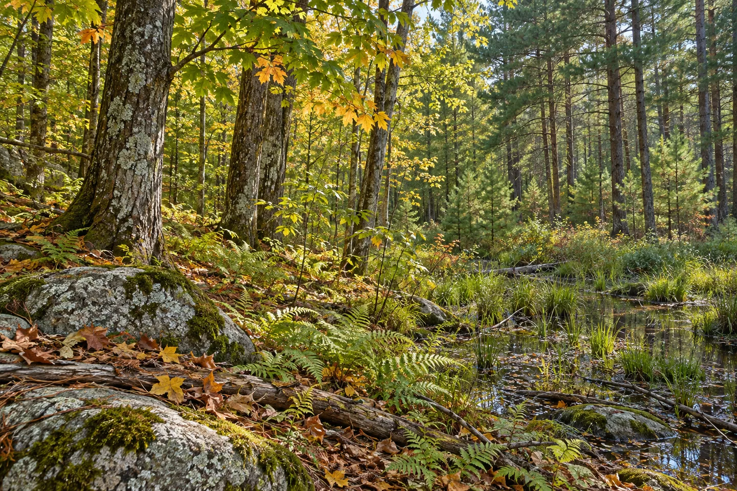
Soil helps explain why Onjebonge State Forest changes character from one area to another. Across 1,835 acres in Diana, Lewis County, granite-based ground ranges from shallow and poor to deep and rich. The woodland mixture reflects those differences. Natural hard maple and white ash grow on better ground, alongside planted red and white pine, while rough white pine, red maple, aspen and gray birch belong to the poorer-soil picture.
The forest is named for a nearby pond, but the Indian River is the main boundary reference for a visit. It forms the western edge of the property. Keep the forest boundary in mind, because adjoining land has different access requirements. A view across water does not make the opposite bank part of the same public outing. Use the map to understand where the state forest ends as well as where an approach begins.
There are no official trails. Instead, walking is allowed on a 4.47-mile network of public forest access roads, including Onjebonje, Lime Quarry, Lime Quarry Extension and Alice Coffey. That road-based arrangement gives the outing a different character from a signed footpath circuit. Choose the relevant section and return from the map rather than expecting a single loop joining every feature. Terrain in the forest ranges from moderate to steep, so mileage alone is an incomplete description.
For a particular waterside destination, Lime Quarry Road provides access to a fishing and viewing platform by the Indian River. The New York State Department of Environmental Conservation (DEC) identifies the platform as wheelchair accessible from the Lime Quarry public forest access road parking area. That is a specific provision worth noting; the wider woodland and access-road network should be assessed separately. Match the feature to the approach that suits your needs before visiting.
Wetlands periodically flooded by beavers add another element to the landscape. They belong to a property whose character is shaped by differences in terrain, soil and water, rather than one uniform type of forest. If a wetland is visible from the route, consider its contrast with the surrounding woods. There is no need to find a visible animal or a beaver lodge for the water-and-woodland relationship to be worth noticing.
Timber management is part of Onjebonge's story. Controlled harvests on the better stands are carried out by private contractors under DEC forestry direction. The poorer ground supports a different mixture, including occasional black ash, a species associated with basket making. Together, those details offer an invitation to look beyond a general impression of trees: different species, different soils and different human uses can all belong to one state forest. Management follows the Westward Waters Unit Management Plan.
Lime Quarry Extension, the Indian River pier and Alice Coffey Road have separate parking references on DEC's map. Pick the approach for your chosen route, follow posted conditions and Leave No Trace guidance, and remain within public boundaries. An outing here can focus on a river view, a road walk or the contrast between woodland stands. Let the actual access arrangement connect those interests, rather than assuming that the forest's acreage comes with an extensive trail system.
Fun facts
- Onjebonge State Forest covers 1,835 acres in Diana, Lewis County.
- The Indian River forms the western boundary.
- There are no official trails; walking is allowed on 4.47 miles of public forest access roads.
- The Lime Quarry fishing and viewing platform is identified as wheelchair accessible from its parking area.
- Granite-based soils vary from shallow and poor to deep and rich.
Before you go
- Choose a section of the public forest access roads using the DEC map.
- Remain within the state-forest boundary beside the Indian River.
- Assess the Lime Quarry platform approach separately from the wider forest terrain.
- Match your route to the appropriate parking location.
- Follow posted conditions and Leave No Trace guidance.
Capture
- From the Lime Quarry viewing platform, consider the relationship between the river and its wooded bank without assuming access to the opposite side.
- Where visible from the route, compare natural hardwood textures with planted conifer forms.
- Let a wetland-and-woodland contrast be the subject without seeking a close animal encounter.
 Mohawk Springs State Forest
 Sand Bay State Forest
 Sears Pond State Forest
Social
Onjebonge State Forest spans 1,835 acres in Diana, Lewis County, with varied granite-based soils. #Cre8Travel
Onjebonge has no official trails; walkers use a 4.47-mile public forest access-road network. #Cre8Travel
The Indian River forms Onjebonge State Forest's western boundary. Plan to remain within public forest land. #Cre8Travel
The Lime Quarry fishing and viewing platform is a specific wheelchair-accessible feature, distinct from the wider forest terrain. #Cre8Travel
Better soils at Onjebonge support hard maple and white ash, alongside planted red and white pine. #Cre8Travel
Poorer ground at Onjebonge carries a different woodland mix, including aspen, gray birch and rough white pine. #Cre8Travel
Periodic beaver flooding is part of Onjebonge's wetland story. Habitat can be worth observing without an animal in view. #Cre8Travel
At Onjebonge, would you choose a river view or a closer look at the contrasting woodland stands? #Cre8Travel
Hashtags