 Cre8Travel
CRE8TRAVEL · NEW YORK PLACES
Pigeon Lake Wilderness
Pigeon Lake Wilderness: A Landscape of Forests and Interior Ponds
Discover
Pigeon Lake Wilderness is a place of many waters, rather than a single lake with a trail around it. Its 50,100 acres extend through Webb in Herkimer County and Inlet and Long Lake in Hamilton County. Within the Adirondack Forest Preserve, wooded ridges enclose 71 interior lakes and ponds. That repeated meeting of water and forest gives the wilderness its defining image: separate small destinations within a much larger protected landscape, with the chosen route determining which one a visitor encounters.
Four larger waters help place the unit on the regional map: Big Moose Lake, Stillwater Reservoir, Raquette Lake and the Fulton Chain of Lakes surround the area. Inside it, Shallow Lake is the largest waterbody at 268 acres. Keeping those scales distinct makes the landscape easier to understand. The surrounding lakes are geographical references, while the interior waters give a walk its more immediate destination. Neither the number of ponds nor the wilderness acreage implies that they can all be joined by a convenient circuit.
Approximately 32 miles of hiking trails cross the unit. Their arrangement creates choices between a pond-centered outing, connections through the interior and a climb toward higher ground. West Mountain is the wilderness's highest point. DEC describes a 5 mile one-way approach to its top from Uncas Road, part of the much longer Constable Pond–West Mountain Trail. Distance here has a particular meaning: a through-trail, a summit approach and the return to a parked vehicle are separate considerations.
The blue-marked Constable Pond–West Mountain Trail extends 12 miles between its western and eastern road approaches. From the western end, connecting trails lead toward Mays Pond and Chub Lake, among other destinations. Those junctions reveal a network built around individual waters and routes through wooded ground. They provide useful orientation on the official map, without requiring a visitor to turn every named branch into part of the same day's plan. Choosing one destination can give the surrounding forest enough time to become part of the experience.
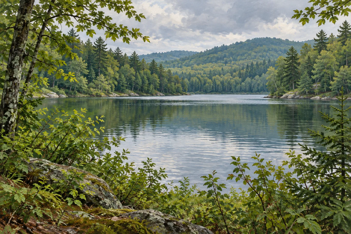
Other trail descriptions emphasize the pond landscape more directly. The Windfall Pond route begins from Big Moose Road and connects with several interior pond trails. The repeated names on the map convey something of the unit's geography even before the walk begins: waterbodies are separated by ridges and forest, with trails providing selected connections. A photograph from an appropriate existing route can concentrate on that relationship, using the tree-lined shore and the wooded rise behind it rather than depending on an animal or a dramatic panorama.
Access to the water varies. DEC lists a Town of Webb hand launch at Big Moose Lake and a launch within Brown Tract Pond Campground, where a day-use fee applies. Many interior waters, including Shallow Lake and Constable Pond, lack established boat launches and require carrying a boat to reach them. The distinction matters even for an observation-focused visit, because a lake shown on a map does not imply a road, developed shore or visitor facility beside it.
Check the current regional backcountry notices before selecting an approach. The retained DEC destination information reports the Andy's Creek bridge out, so do not plan an outing around an assumed crossing there. Choose a verified route appropriate to the actual distance and conditions, remaining on the access provided. Pigeon Lake Wilderness rewards a clear, limited plan: one waterbody, its wooded setting and the trail that reaches it can express the character of a far larger landscape of lakes and ridges.
Fun facts
- The wilderness covers 50,100 acres across Herkimer and Hamilton counties.
- There are 71 interior lakes and ponds.
- Shallow Lake is the largest interior waterbody at 268 acres.
- The trail network totals approximately 32 miles.
Before you go
- Use the current map to choose a destination and return.
- A 5 mile one-way West Mountain approach is not a 5 mile round trip.
- Check current notices; retained DEC information reports the Andy’s Creek bridge out.
Capture
- Use a documented pond shore and wooded ridge as the composition where appropriate access exists.
- Keep the scale modest rather than inventing an alpine lake panorama.
- Photograph woodland details from the chosen route without entering wetland vegetation.
 McKenzie Mountain Wilderness
 Rusk Mountain Wild Forest
 Sargent Ponds Wild Forest
Social
Pigeon Lake Wilderness contains 71 interior lakes and ponds within 50,100 acres. #Cre8Travel
Wooded ridges and separate interior waters define the landscape’s visual character. #Cre8Travel
Shallow Lake is the largest interior waterbody at 268 acres. #Cre8Travel
The approximately 32 mile trail network offers separate choices, rather than one wilderness loop. #Cre8Travel
West Mountain is the unit’s highest point, reached by a substantial one-way approach from Uncas Road. #Cre8Travel
Many interior waters have no established boat launch and require carrying access. #Cre8Travel
Check current DEC notices before planning any route near the reported missing Andy’s Creek bridge. #Cre8Travel
A single pond and its forested setting can reveal the character of a much larger wilderness. #Cre8Travel
Hashtags