 Cre8Travel
CRE8TRAVEL · NEW YORK PLACES
Popple Pond State Forest
Popple Pond State Forest: A Closer Look
Discover
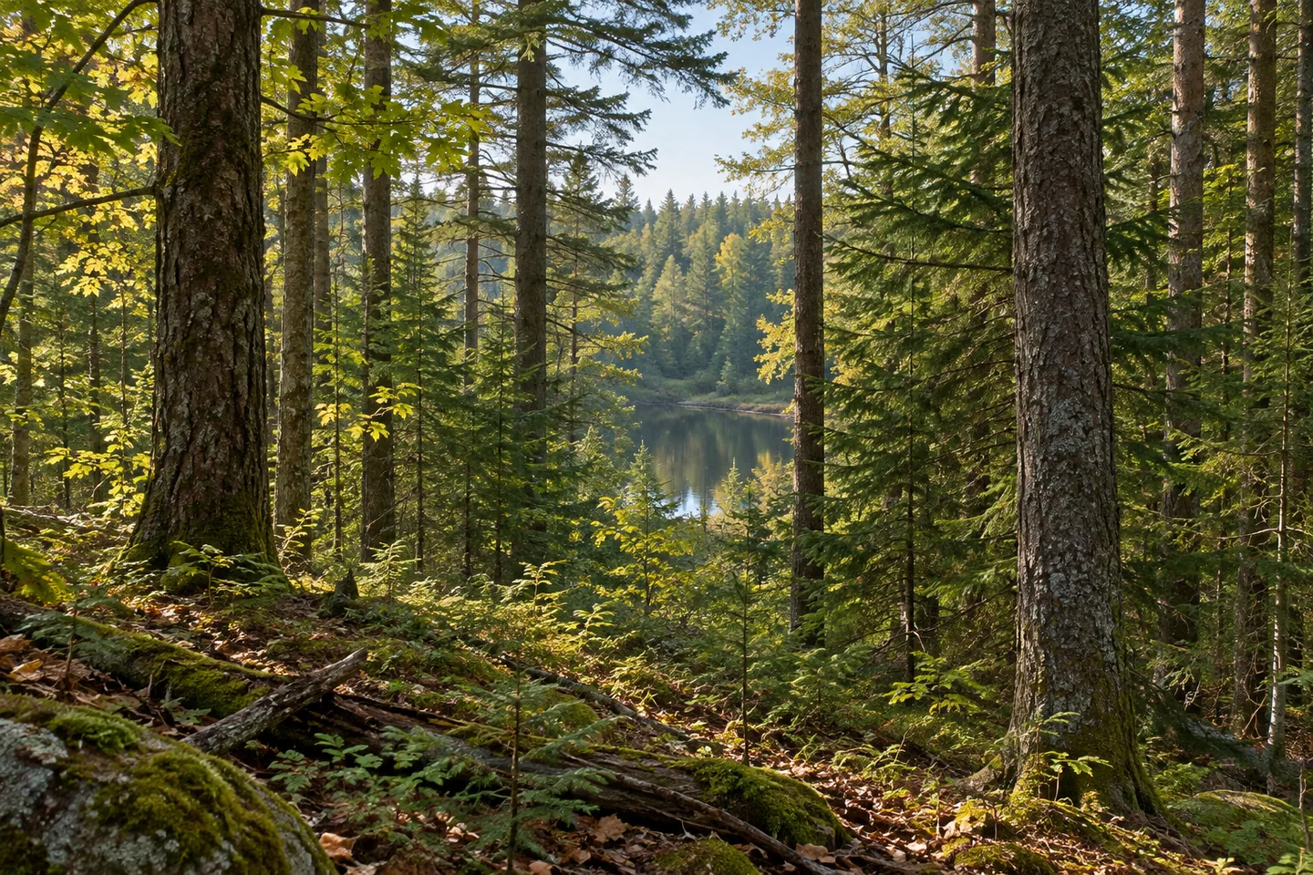
Popple Pond State Forest has more than one kind of water in its story. The namesake pond occupies about eight acres in the northeastern part, while Cropsey Creek, the North Branch of Cummings Creek and Long Lake Outlet cross different sections of the wider forest. Those features sit within 2,461 acres in Boonville and Forestport, Oneida County, with natural woodland and plantations adding another layer to the setting.
Most land was acquired in the 1930s and 1940s. Two further pieces were added in 1979, followed by a final acquisition in 1985. The New York State Department of Environmental Conservation (DEC) manages the property for timber, watershed, habitat and recreation purposes. A present map boundary therefore contains land assembled over decades, with a story broader than one pond or one access road.
Natural woodland includes hardwood, hardwood-hemlock and hardwood-spruce-fir mixtures. Red maple, black cherry, sugar maple, beech, hemlock and balsam fir are among the principal trees in DEC's account. Plantations established in the late 1930s and early 1940s contain several pine species and spruce. Where the route permits a suitable view, compare forms and textures without expecting every named tree beside the same stretch of road.
There are no maintained hiking trails. Approximately 9.44 miles of unpaved access roads and designated recreational routes may be walked, with the map and present conditions determining the appropriate outing. That combined mileage is not a single loop linking all the waters. Choose a route and return at a scale that fits the actual access rather than making every feature part of one itinerary.
Water access is limited. There is no boat launch, and DEC notes that reaching Popple Pond can be difficult because of primitive infrastructure. The streams also have access constraints. An observation-focused visit should respect those limits, not turn the pond's small size into an assurance of a simple shoreline walk. A woodland scene may be the subject available from the route even when water is nearby on the map.
Parking requires attention too, with no maintained parking lots listed. Pines and Hawkinsville roads provide approach references, and Fire Lane Road crosses a substantial portion of the property. Match the chosen location to the route you intend before setting out. A pull-off or trailhead reference should not be presented as a developed visitor lot with facilities that the source does not describe.
Winter plowing differs among roads. Pines and Hawkinsville are plowed through, while Fire Lane and North Long Lake Outlet roads are not. Check the specific approach rather than treating one plowed road as evidence of access throughout the forest. Those details are part of a grounded decision about whether a visit fits the conditions, not an obstacle to be edited out of the description.
Management follows the Adirondack Foothills planning framework. Follow posted conditions and Leave No Trace guidance, leaving vegetation undisturbed. Popple Pond's interest lies in the combination of several waterways, planted and natural forest, and a public property assembled over time. Let the actual road-based outing determine which of those layers comes into view, without adding a maintained pond circuit or a promised animal encounter.
Fun facts
- Popple Pond State Forest covers 2,461 acres in Boonville and Forestport, Oneida County.
- The namesake pond is about eight acres in the northeastern forest.
- There are no maintained hiking trails; about 9.44 miles of roads and designated routes may be walked.
- No boat launch or maintained parking lots are listed, and water access can be difficult.
- Pines and Hawkinsville roads are plowed through, unlike Fire Lane and North Long Lake Outlet roads.
Before you go
- Plan around actual road-based access rather than a maintained pond circuit.
- Keep limited pond and stream access central to the choice of outing.
- Resolve parking before visiting because no maintained lots are listed.
- Check winter conditions for the specific access road.
- Follow posted rules and Leave No Trace guidance.
Capture
- Compare natural woodland and planted conifer forms visible from the chosen route.
- Use a water view only where appropriate actual access provides one.
- Tree and ground texture can be a subject without a close approach to the pond.
 Point Rock State Forest
 Rome Wildlife Management Area
 Swancott Hill State Forest
Social
Popple Pond State Forest spans 2,461 acres in Boonville and Forestport, Oneida County. #Cre8Travel
Popple Pond itself is about eight acres in the forest's northeast, distinct from the larger property. #Cre8Travel
Cropsey Creek, Cummings Creek's North Branch and Long Lake Outlet cross different parts of the forest. #Cre8Travel
There are no maintained hiking trails, though roads and designated routes may be used for walking. #Cre8Travel
Popple Pond has no boat launch and can be difficult to reach because of limited infrastructure. #Cre8Travel
No maintained parking lots are listed at Popple Pond State Forest. Plan the actual approach. #Cre8Travel
Winter plowing differs among Pines, Hawkinsville, Fire Lane and North Long Lake Outlet roads. #Cre8Travel
At Popple Pond, let the route determine the view rather than assuming a developed shoreline walk. #Cre8Travel
Hashtags