 Cre8Travel
CRE8TRAVEL · NEW YORK PLACES
Point Rock State Forest
Point Rock State Forest: A Closer Look
Discover
Point Rock State Forest sits along the eastern edge of the Tug Hill Plateau, with planted and natural woodland sharing 1,202 acres. Its location in Ava and Lee, Oneida County, provides the first useful distinction for a visit. The name identifies a particular public forest, not a guaranteed rock overlook or a summit walk. Begin with its mapped access and the tree mixture that actually defines the property.
Most land was purchased in the 1930s and 1940s, with one later parcel acquired in the 1990s. Plantation work was largely carried out in the 1940s. Those dates give a road-based outing a historical thread: a modern forest boundary can encompass acquisitions from different periods, while the trees planted on the ground have their own timeline. Neither story needs a reconstructed historical scene to make it interesting.
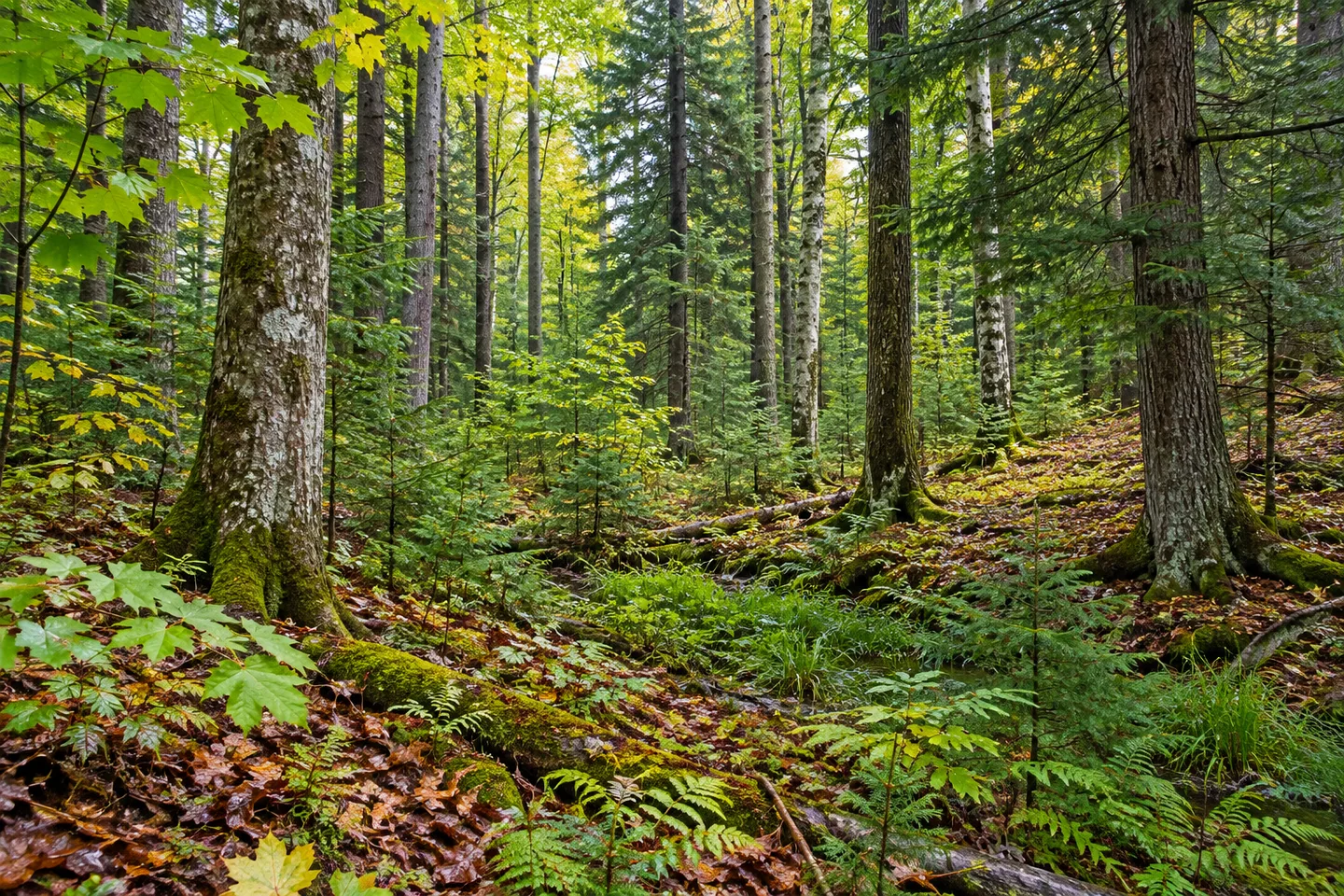
The New York State Department of Environmental Conservation (DEC) describes natural hardwood and hardwood-hemlock stands alongside plantations and wetlands. Red maple, black cherry, sugar maple, hemlock and red spruce are principal trees in the natural stands. Plantation areas include red, white and Scotch pines with spruce. Where visible from an appropriate route, compare the forms and textures rather than expecting each species beside a particular access point.
There are no formal hiking trails. Access roads and a designated recreational route provide opportunities for walking instead. Choose the section and return from the property map and present conditions, without converting a winter-route distance into an assumed hiking loop. The state forest's modest acreage does not mean every part shares the same visiting conditions or can be joined conveniently from one approach.
Tuffy Road is the main access reference from Route 26. Two roads lead south into the property: Camp Kingsley Road and Brown's Rock Road. Match the chosen approach to the actual mapped route, rather than assuming that a road name establishes a particular rock feature or viewpoint. The forest access-road parking area off Tuffy Road is a separate planning reference, not evidence of a full visitor-facility complex.
Winter road arrangements make that distinction especially useful. Tuffy Road is plowed, but the two forest access roads running south from it are not. Check the approach before a visit rather than treating a plowed main road as proof of a plowed drive to every starting point. The same map can support different practical plans depending on the condition of the route and the season.
DEC records deer, ruffed grouse, porcupines, chipmunks, squirrels and birds among wildlife associated with the forest. Those references describe its setting rather than a schedule of sightings. A quiet outing can still focus on changes between woodland and wet ground where they are visible. Tree forms and vegetation texture provide subjects without an animal being needed in the frame.
The Oneida Hills Unit Management Plan provides the framework for these lands. Follow posted conditions and Leave No Trace guidance, leaving vegetation undisturbed. Point Rock's particular interest can be the relationship between a plateau-edge setting, acquisition history and different forest types, with the road-based approach kept honestly in view. Let the route you choose determine the detail, rather than adding an invented viewpoint to complete the story.
Fun facts
- Point Rock State Forest covers 1,202 acres on the eastern edge of the Tug Hill Plateau.
- Most acquisition was in the 1930s and 1940s, with a later parcel in the 1990s.
- Most plantations were established in the 1940s.
- There are no formal hiking trails; access roads and designated routes provide walking opportunities.
- Tuffy Road is plowed in winter, but the two southbound forest access roads are not.
Before you go
- Choose the route from the current property map rather than inferring a rock overlook from the name.
- Distinguish Tuffy Road from the southbound Camp Kingsley and Brown's Rock access roads.
- Check winter approach conditions for the actual starting point.
- Treat wildlife lists as habitat context, not guaranteed encounters.
- Follow posted conditions and Leave No Trace guidance.
Capture
- Compare natural hardwood-hemlock textures with planted conifer forms where visible from the route.
- Use woodland detail instead of an assumed plateau-edge panorama.
- A wetland view can be a subject where actually available without leaving an appropriate route.
 Penn Mountain State Forest
 Popple Pond State Forest
 Rome Wildlife Management Area
Social
Point Rock State Forest spans 1,202 acres along the eastern edge of the Tug Hill Plateau. #Cre8Travel
Point Rock's main acquisitions occurred in the 1930s and 1940s, with a later addition in the 1990s. #Cre8Travel
Pine and spruce plantations from the 1940s mix with natural hardwood-hemlock woodland. #Cre8Travel
Point Rock has no formal hiking trails; road-based access helps shape a visit. #Cre8Travel
Tuffy Road is plowed in winter, but the forest access roads south from it are unplowed. #Cre8Travel
Camp Kingsley and Brown's Rock roads are map references, not promises of named viewpoints. #Cre8Travel
A wildlife list need not become a sightings checklist at Point Rock. Woodland texture has its own interest. #Cre8Travel
At Point Rock, would you focus on plateau-edge location or the different woodland stands? #Cre8Travel
Hashtags