 Cre8Travel
CRE8TRAVEL · NEW YORK PLACES
Penn Mountain State Forest
Penn Mountain State Forest: A Closer Look
Discover
The name Penn Mountain carries a trace of the Welsh settlement that once grew around this part of Oneida County. Settlers called the area Penymynydd, meaning on top of the mountain, and the present name developed from that earlier one. Today, Penn Mountain State Forest covers 3,725 acres in Steuben, with woodland, old farm lanes and managed open ground offering different ways to consider its changing land use.
The settlement dwindled amid harsh winters and thin, unproductive soils. A surviving cemetery on Penn Mountain Road is private land surrounded by the state forest, so its historical importance does not make it part of public recreational access. The wider settlement story can inform the visit without an excursion onto that enclave. Remain within public boundaries and leave historical traces undisturbed.
Most state acquisition took place in the 1940s and 1950s, with additional land added in the 1980s and 1990s. Plantation history extends from the 1930s through the 1950s on former cropland and pasture. Keep those histories distinct: acquisition records and tree-planting dates do not describe exactly the same sequence, and the forest's current outline contains land with more than one earlier chapter.
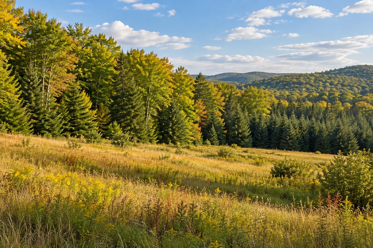
Natural woodland includes northern hardwoods, pioneer hardwoods and hardwood-hemlock mixtures. Hard maple, black cherry, white ash, beech, aspen and hemlock are among the principal trees described by the New York State Department of Environmental Conservation (DEC). Plantations add several pines, spruce and larch species. Looking at the contrast between those stands can give a walk a theme without making the identification of every tree its purpose.
At the south end of Penn Mountain Road, DEC describes roughly 40 acres managed by mowing to support songbird habitat and preserve views south and west. That area is not the size of the whole forest, nor a promise that a particular species or distant feature will be visible. It is a specific example of open-ground management within a mostly wooded public property.
There are no formal hiking trails. Approximately 4.75 miles of unmarked old farm lanes and forest access routes provide walking opportunities. Use the current map to select an approach and return rather than imagining a signed summit circuit. A former lane can also be a useful historical prompt, connecting today's woodland with the land that was once worked around the earlier settlement.
Duck Pond is another named feature, with parking a short distance away in DEC's description. The Starr Hill Vista north and south unpaved parking references belong on the map as separate planning points. Match the chosen location to the visit you intend instead of assuming a path links the pond, all parking areas and the open vistas into one prepared outing.
The Oneida Hills Unit Management Plan supplies the management framework. Follow posted conditions and Leave No Trace guidance, and keep private boundaries central to planning. For photographs, use the actual woodland or open-ground view available from an appropriate position. Penn Mountain's particular story is the meeting of a Welsh place name, former agricultural ground, planted trees and maintained open habitat, at the scale of the route you choose.
Fun facts
- Penn Mountain State Forest covers 3,725 acres in Steuben, Oneida County.
- Its name derives from the Welsh Penymynydd, meaning on top of the mountain.
- A surviving settlement cemetery on Penn Mountain Road is private land.
- There are no formal hiking trails; about 4.75 miles of unmarked lanes and access routes provide walking opportunities.
- DEC describes roughly 40 acres mowed near the south end of Penn Mountain Road for habitat and views.
Before you go
- Stay on public land and do not enter the private cemetery enclave.
- Choose a mapped route and return rather than expecting a signed summit circuit.
- Keep the 40-acre mowing area distinct from the full forest acreage.
- Match Duck Pond and Starr Hill Vista parking references to your own plan.
- Follow posted conditions and Leave No Trace guidance.
Capture
- Compare natural woodland with planted tree forms visible from your appropriate route.
- Where a public open-ground view is available, compose it without promising a particular distant landmark.
- Use woodland and old-lane textures rather than entering private land for historical photographs.
 Oriskany Flats Wildlife Management Area
 Point Rock State Forest
 Popple Pond State Forest
Social
Penn Mountain State Forest covers 3,725 acres in Steuben, Oneida County. #Cre8Travel
The Welsh name Penymynydd, meaning on top of the mountain, lies behind Penn Mountain's name. #Cre8Travel
The surviving settlement cemetery is private property within the surrounding state forest. Respect that boundary. #Cre8Travel
Penn Mountain has no formal hiking trails; old farm lanes and access routes provide walking opportunities. #Cre8Travel
About 4.75 miles of unmarked routes are described, rather than one signed summit circuit. #Cre8Travel
Roughly 40 acres near southern Penn Mountain Road are managed for songbird habitat and views. #Cre8Travel
Plantations and natural hardwood-hemlock woodland add different land-use layers to Penn Mountain. #Cre8Travel
At Penn Mountain, would the place-name history or the contrast between open ground and woods hold your attention? #Cre8Travel
Hashtags