 Cre8Travel
CRE8TRAVEL · NEW YORK PLACES
McKenzie Mountain Wilderness
McKenzie Mountain Wilderness: Ridges, Ponds and Adirondack Space
Discover
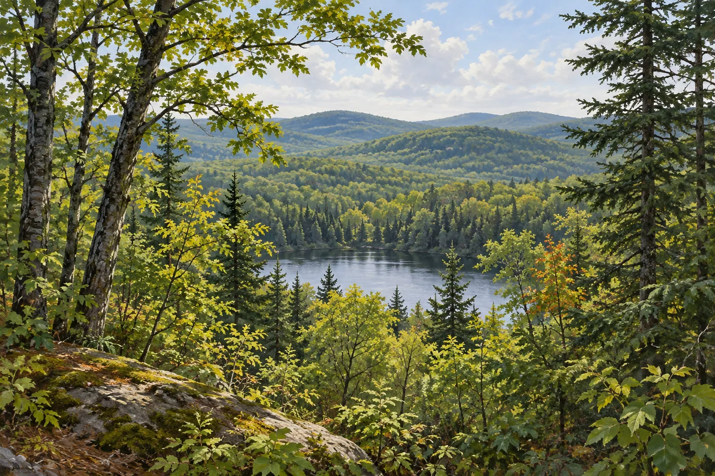
McKenzie Mountain gives its name and backbone to a much larger Adirondack landscape. The 37,616 acre McKenzie Mountain Wilderness lies in North Elba and St. Armand in Essex County, with a limited number of well-known hiking routes set against extensive ground without trails. Its character comes from that contrast. A familiar summit or pond approach offers one encounter with the wilderness, while the protected unit extends far beyond the section visible during an individual outing.
Water helps describe its edges. Lake Placid, McKenzie Pond, Moose Pond, Franklin Falls Pond and the Saranac River border the wilderness, while smaller interior ponds range from 2 to 15 acres. Those different scales give the setting depth: large waters establish the surrounding geography, and small ponds belong within the forest itself. A lake appearing beside the wilderness on a map should still be understood through its actual shoreline ownership and access, rather than treated as water contained entirely inside the protected unit.
The namesake mountain rises to 3,861 feet. Nearby Haystack Mountain and Baker Mountain provide other distinct destinations within the wilderness, with different elevations and approaches. Together, these three peaks account for half of the Saranac Lake 6 ers hiking group. They are separate walks with individual route demands, rather than a ready-made circuit to complete in one outing. Looking at their positions on the official map is a useful way to understand how a small trail system reaches different parts of the same large landscape.
Baker Mountain illustrates how a short route can involve substantial climbing. DEC describes a 0.9 mile ascent gaining nearly 900 feet from its trailhead in the Village of Saranac Lake. Overlooks near the summit face east, south and west. The distance and elevation change belong together when considering that approach. Its village starting point does not turn the climb into a level town stroll, and its views describe one perspective on the surrounding Adirondacks rather than the whole wilderness experience.
Moose Pond offers another emphasis. Its trail follows an old woods road for 1.3 miles to the shore, with views toward Whiteface, Moose and McKenzie mountains described by DEC. Here the relationship between water and wooded ridges provides the focus. A pond-side scene can make the surrounding landforms easier to read, while the old road gives the approach a different physical character from a summit climb. Choose the actual access and return from the current map rather than combining pond and mountain routes by assumption.
The wider network also connects this area with neighboring public lands. The Whiteface Landing approach begins at Connery Pond in the adjacent Saranac Lake Wild Forest, and parts of Connery Pond's shoreline and access involve private property. Six miles of the Jack Rabbit Trail pass through McKenzie Mountain Wilderness between Lake Placid and Saranac Lake. These connections show why a useful route description can extend beyond a single management boundary, while permission and posted access still apply at each section.
Plan a visit around one clearly chosen destination, using DEC's current backcountry notices and the appropriate trailhead information. The majority of this wilderness has no trails and is not readily accessible. Its scale is part of what the designation protects, rather than an invitation to improvise a connection between mapped features. From a suitable marked route, woodland foreground, a pond margin or a mountain view can each express something specific about this landscape, with enough space beyond the outing to retain the larger wilderness story.
Fun facts
- McKenzie Mountain Wilderness protects 37,616 acres in Essex County.
- The namesake mountain rises to 3,861 feet.
- Baker Mountain’s listed 0.9 mile ascent gains nearly 900 feet.
- The Moose Pond Trail follows an old woods road for 1.3 miles to the shore.
Before you go
- Choose one mapped route and return appropriate to the elevation gain.
- Use current DEC backcountry notices for conditions and closures.
- Respect private property and marked access around Connery Pond and connected approaches.
Capture
- Use woodland foreground to frame a view available from the chosen trail.
- Compose water and forested ridges from appropriate Moose Pond access.
- Avoid relying on a particular distant summit being visible in changing weather.
 PortSide New York
 Pigeon Lake Wilderness
 Rusk Mountain Wild Forest
Social
McKenzie Mountain Wilderness extends across 37,616 acres of the Adirondack Forest Preserve. #Cre8Travel
The namesake ridge is one part of a landscape where most ground has no trails. #Cre8Travel
Large bordering waters and smaller interior ponds give this wilderness several different scales. #Cre8Travel
McKenzie, Haystack and Baker mountains are distinct destinations within the wilderness. #Cre8Travel
Baker Mountain combines a short listed route with nearly 900 feet of ascent. #Cre8Travel
The 1.3 mile Moose Pond approach follows an old woods road toward a waterside view. #Cre8Travel
Connected trails can cross neighboring public units and private access areas; boundaries remain relevant. #Cre8Travel
Choose a specific outing and let its actual woodland, pond or ridge view reveal part of the larger landscape. #Cre8Travel
Hashtags