 Cre8Travel
CRE8TRAVEL · NEW YORK PLACES
Oriskany Flats Wildlife Management Area
Oriskany Flats Wildlife Management Area: A Closer Look
Discover
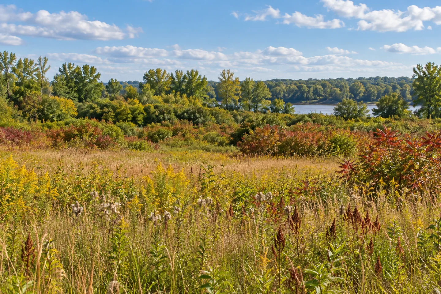
Old fields show more than one stage of change at Oriskany Flats Wildlife Management Area. Across its 806 acres of Mohawk River floodplain, more than half the ground is former agricultural land in different stages of succession. Goldenrod, milkweed and grasses characterize earlier stages; blackberries, sumac and other perennials appear in later ones. That contrast provides a close-up subject for a visit without needing a long walk or a rare wildlife encounter.
The property lies within the City of Rome and the towns of Marcy and Whitestown in Oneida County. The New York State Department of Environmental Conservation (DEC) manages it for wildlife, habitat and wildlife-dependent recreation, while protecting the floodplain's natural character. The river gives the landscape a wider context, but the changing vegetation within the fields is already specific enough to hold attention at the scale of a single view.
About 15 percent of the WMA is wetland, including shrub swamp, wooded wetland and marsh. A forested corridor follows the Mohawk River, while brushlands contain species such as buckthorn, thorn apple, elm and ash. These different kinds of cover help explain why the property should not be imagined as one uniform open field. From a designated route, compare vegetation layers and the transition between more open and more wooded ground.
DEC asks walkers to remain on designated trails to protect plant communities. That guidance can also shape photography: work with the view available from the route rather than entering a patch of vegetation for a closer angle. Goldenrod, milkweed, grasses and shrubs provide subjects on their own terms. Their mention in a habitat description is not a guarantee of flowers, fruit or a particular seasonal color during every visit.
The river system supports largemouth and smallmouth bass, yellow perch and brown bullhead, while the WMA's wildlife account includes deer, beaver, gray squirrels and many birds. Mallards and wood ducks are among the waterfowl associated with the river. Treat those names as ecological context rather than an observation schedule. A habitat-focused outing can remain interesting without an animal appearing, and any actual wildlife should be given room rather than approached to complete a photograph.
River Street provides two principal parking references on the eastern edge, one paved and one gravel, serving land north and south of the Mohawk. A canoe launch is at the parking facility on the north side. Match the chosen facility to the part you intend to visit, rather than assuming a walking connection across the water. The nearby railway is another boundary reference, not a pedestrian route into the WMA.
The habitat plan identifies management goals for this floodplain setting. Follow posted conditions and Leave No Trace guidance, and include DEC's tick precautions in preparations. For photographs, a field-to-shrub or woodland-to-water composition can connect directly with the landscape's changing cover. Oriskany Flats offers a particular way to look at former farmland: different stages of vegetation sharing a river setting, with the designated route deciding which of those transitions can be observed without disturbing the plants.
Fun facts
- Oriskany Flats WMA covers 806 acres of Mohawk River floodplain in Oneida County.
- More than half the tract is former agricultural land in different stages of succession.
- About 15 percent of the WMA is wetland habitat.
- DEC asks walkers to stay on designated trails to protect plant communities.
- River Street has principal paved and gravel parking references serving lands north and south of the river.
Before you go
- Stay on designated trails and observe vegetation without entering it for photographs.
- Match the River Street parking facility to the correct side of the river.
- Do not treat the railway boundary as a walking route.
- Do not expect flowers, fruit or wildlife on a fixed schedule.
- Follow Leave No Trace guidance and DEC tick precautions.
Capture
- Compare early-stage field vegetation with shrubs and more wooded cover from a designated route.
- Frame the river corridor only where appropriate public access provides the view.
- A plant-focused composition can tell the succession story without relying on a wildlife encounter.
 Amy's Park
 Penn Mountain State Forest
 Point Rock State Forest
Social
Oriskany Flats WMA covers 806 acres of Mohawk River floodplain in Oneida County. #Cre8Travel
More than half of Oriskany Flats is former agricultural land at different stages of succession. #Cre8Travel
Goldenrod, milkweed and grasses feature in earlier field stages; blackberry and sumac appear later. #Cre8Travel
About 15 percent of Oriskany Flats is wetland, adding shrub swamp, wooded wetland and marsh to the picture. #Cre8Travel
Stay on designated trails at Oriskany Flats to protect its plant communities. #Cre8Travel
River Street has paved and gravel parking references; match the chosen point to the intended river side. #Cre8Travel
A habitat view can be worthwhile even when deer, birds or other wildlife remain out of sight. #Cre8Travel
At Oriskany Flats, which transition would draw your eye: field to shrub, or woodland to river? #Cre8Travel
Hashtags