 Cre8Travel
CRE8TRAVEL · NEW YORK PLACES
Otsquago State Forest
Otsquago State Forest: A Visitor Guide
Discover
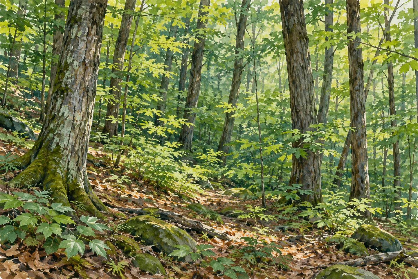
Otsquago State Forest takes its name from a creek with a much longer story than the boundaries of this 411-acre property. The forest lies in Stark, Herkimer County. For a visit, its defining features are practical ones: no marked foot trails, an approach along Wagner Hill Road and a setting managed for several public-land purposes rather than a developed recreation circuit.
DEC traces the name Otsquago to the Mohawk language and gives its meaning as “under a bridge.” The creek starts roughly at the Otsego–Herkimer county line and drops 1,100 feet over 17 miles. The agency describes waterpower from the creek driving mills in the villages along its course. Those details give the forest's name regional context; the full creek descent is not a trail distance or an elevation change that visitors necessarily experience inside this property.
The forest was created for reforestation, wildlife management, timber production, recreation and watershed protection. Keeping all five purposes in mind makes for a more accurate introduction than calling the land untouched. Public woodland can offer a place to walk while also being managed for timber and habitat. The name and acreage tell only part of the story; the map and present access information tell you how to approach it.
Wagner Hill Road runs through the center. DEC's directions approach east from Van Hornesville on Wiltse Hill Road, then turn north onto Wagner Hill Road; the state boundary is about half a mile northeast of that intersection. There are no official or maintained parking areas. The operator identifies roadside pull-off opportunities, including an unmaintained location, so check the situation before driving out and never treat a mapped pull-off as a reserved or improved space.
Once in the forest, there is no marked walking route to supply the day's itinerary. Choose a plan within your navigation skills, carry the current boundary map and allow time to retrace your route. Mountain biking, horseback riding, cross-country skiing and snowshoeing are permitted, but no maintained trails are provided for those activities. Permission alone does not establish a suitable surface, a route difficulty or a groomed winter network.
The wildlife list includes white-tailed deer, porcupines, grouse, coyotes, turkeys and songbirds. That gives a reason to observe quietly, without making any animal encounter a condition of a worthwhile visit. If an animal does appear, watch from a distance and avoid following it away from your planned route. A photograph of the woodland can be complete on its own, with no need to approach or stage wildlife.
Primitive camping is allowed under state-land rules. A dispersed site must be at least 150 feet from the nearest road, trail or water, and stays longer than three nights or groups of ten or more require a Forest Ranger permit. Work out the camping plan with the boundary map and current regulations before arriving. The absence of a marked foot trail should be part of that decision, especially when considering the return journey with overnight equipment.
DEC identifies Van Hornesville, Fort Plain, Little Falls, Herkimer and Richfield Springs for food, lodging and other supplies. Choose the services that fit your approach rather than expecting facilities inside the forest. Otsquago can be understood as a modest, undeveloped woodland visit, with its creek-derived name adding historical context. It need not promise creekside paths, ruins or sweeping views to make that setting interesting.
Fun facts
- Otsquago State Forest covers 411 acres in Stark, Herkimer County.
- DEC gives the creek name’s Mohawk meaning as “under a bridge.”
- Otsquago Creek drops 1,100 feet over 17 miles; this is regional creek information, not an in-forest route measurement.
- Wagner Hill Road crosses the forest, which has no marked foot trails or maintained parking areas.
Before you go
- Carry the current boundary map and choose a route within your navigation skills.
- Check roadside access before relying on the unmaintained pull-off.
- Do not assume the creek’s name establishes a marked creekside route.
- Plan primitive camping around current setback and permit rules.
Capture
- Compose a woodland scene from a safe location within the public boundary.
- Use a longer lens if wildlife appears, keeping your distance rather than following it.
 Huntersfield State Forest
 Cranberry Creek Wildlife Management Area
 Honeyville Wildlife Management Area
Social
Otsquago State Forest is a 411-acre property in Stark, Herkimer County. #Cre8Travel
Otsquago takes its name from a creek; DEC gives the name’s meaning as “under a bridge.” #Cre8Travel
The creek’s 1,100-foot drop over 17 miles is regional context, not a marked hike inside Otsquago State Forest. #Cre8Travel
Wagner Hill Road crosses Otsquago State Forest. DEC lists no official or maintained parking areas. #Cre8Travel
There are no marked foot trails at Otsquago. Bring a map and choose an outing within your navigation skills. #Cre8Travel
Otsquago is managed for reforestation, habitat, timber, recreation and watershed protection. #Cre8Travel
Deer, porcupines, grouse and songbirds appear on DEC’s Otsquago wildlife list; sightings are never guaranteed. #Cre8Travel
For an Otsquago overnight plan, check primitive-camping setbacks and permit requirements before arrival. #Cre8Travel
Hashtags