 Cre8Travel
CRE8TRAVEL · NEW YORK PLACES
Mohawk Springs State Forest
Mohawk Springs State Forest: A Closer Look
Discover
The Mohawk River story begins with small water sources here, not a broad riverfront scene. Mohawk Springs State Forest is named for cold springs that form the river's headwaters. Across 1,210 acres in the towns of Lewis and West Turin, Lewis County, two neighboring parcels hold a combination of water, planted forest and walking routes. It is a place to think about beginnings: of a watercourse, and of woods established on acquired land.
The water names help distinguish the parcels. The East Branch of the Mohawk River flows through the southern piece, while Olmstead Brook passes through the northern piece. Their different positions matter when choosing an approach. They are not two stops on a single promised streamside path, and the forest's name does not establish a developed spring-viewing area. Match the watercourse to the map rather than assuming one entrance reveals the whole headwaters story.
The New York State Department of Environmental Conservation (DEC) identifies 1.65 miles of trails that can be used for hiking. That figure describes the total available trail mileage, not a stated loop linking both parcels. Plan the route and return around the approach you choose. A modest trail distance can leave time for looking at forest structure, but it does not make every part of the property equally accessible or provide a path beside every stretch of water.
Access to the waterways can be restricted by limited infrastructure, an important qualification in DEC's description. Keep that limitation in mind if the purpose of your visit is a close water view. Route 26 parking and the Anna Road pull-off are separate references for orienting yourself on the map. Check present conditions and the actual access arrangement before setting out, rather than making a photograph depend on a viewpoint that has not been established.
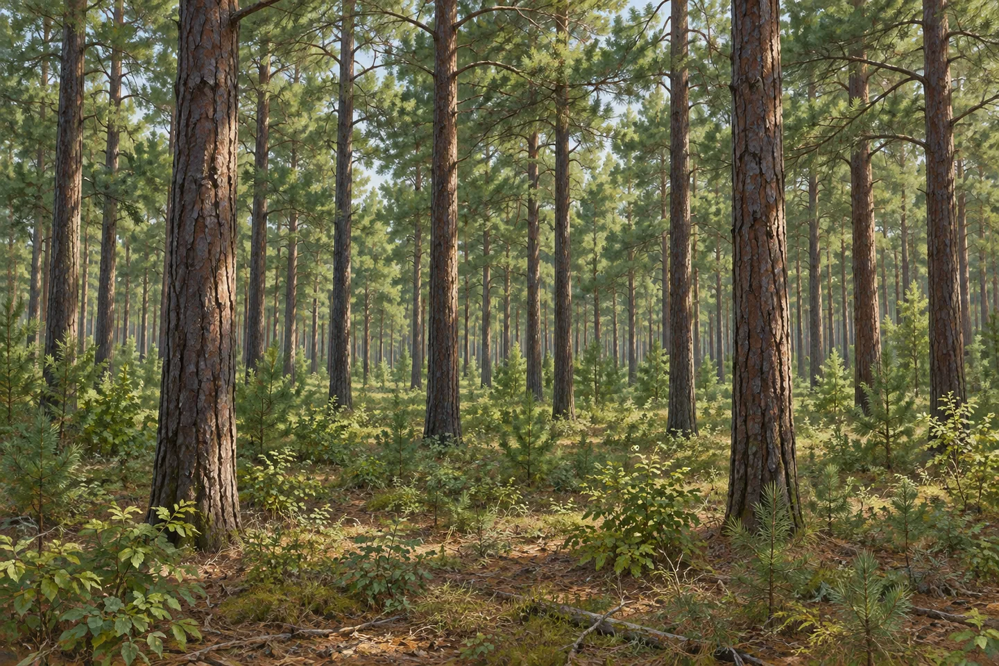
Pine plantations make up most of the forest. The state planted trees after acquiring land in the 1930s and again in the 1950s, giving the woods more than one period of planting history. Those dates invite a closer look at how a public forest develops over time. Where the route allows a view, tree spacing and the repetition of trunks can become subjects of observation without a claim that every stand looks identical.
Growing conditions are demanding. Deep winter snow and relatively shallow soils are part of the story DEC tells about these timber stands. Forestry work is part of their development, and the forest's broader purposes include reforestation, wildlife, timber, recreation and watershed protection. Think of these as overlapping reasons for management rather than a guarantee that all interests produce the same result. A working forest can be an interesting destination because those different purposes are present together.
The Tug Hill East Unit Management Plan supplies the wider framework. Follow posted conditions and Leave No Trace guidance, and keep the two-parcel layout and limited water access central to planning. For a photograph, the planted woodland may be as meaningful a subject as flowing water. Mohawk Springs offers a particular combination of headwaters and forestry history; let that grounded story guide a visit without expecting a spring pavilion, a continuous river walk or a view from every trail.
Fun facts
- Mohawk Springs State Forest covers 1,210 acres in Lewis and West Turin, Lewis County.
- Cold springs here form headwaters of the Mohawk River.
- The East Branch of the Mohawk River is in the southern parcel; Olmstead Brook is in the northern parcel.
- DEC lists 1.65 miles of trails that may be used for hiking.
- Most of the forest is pine plantation, with planting after acquisitions in the 1930s and again in the 1950s.
Before you go
- Choose an approach for the correct parcel rather than assuming one connected route.
- Account for limited infrastructure that may restrict access to the waterways.
- Use 1.65 miles as combined trail mileage, not a stated loop length.
- Distinguish Route 26 parking from the Anna Road pull-off on the DEC map.
- Check present conditions and follow Leave No Trace guidance.
Capture
- Where visible from your route, study the rhythm of trunks in the planted woodland.
- If a suitable water view is actually available, show the relationship between water and forest without implying a developed spring viewpoint.
- Use a close forest composition to interpret planting history without claiming an exact plantation layout.
 Hogsback State Forest
 Onjebonge State Forest
 Sand Bay State Forest
Social
Cold springs give Mohawk Springs State Forest its name and a connection to the Mohawk River's headwaters. #Cre8Travel
Mohawk Springs State Forest covers 1,210 acres in two neighboring parcels. #Cre8Travel
The East Branch of the Mohawk River is in the southern parcel; Olmstead Brook is in the northern one. #Cre8Travel
Mohawk Springs has 1.65 miles of hiking trails in total. That does not establish a loop linking both parcels. #Cre8Travel
Limited infrastructure can restrict water access at Mohawk Springs. Let actual access guide the visit. #Cre8Travel
Pine plantations trace planting after land acquisitions in the 1930s and again in the 1950s. #Cre8Travel
Deep winter snow and shallow soils are part of Mohawk Springs State Forest's growing conditions. #Cre8Travel
Would you focus on headwaters or planted-forest history at Mohawk Springs? Both belong to its story. #Cre8Travel
Hashtags