 Cre8Travel
CRE8TRAVEL · NEW YORK PLACES
Hogsback State Forest
Hogsback State Forest: A Closer Look
Discover
Hogsback State Forest takes its name from a landform rather than a former settlement or a prominent tree. A glacial esker forms the geological backbone of this 624-acre property in the Town of Diana, Lewis County. The name offers a starting point for looking at the terrain, while the forest's two named ponds and a notable stand of native white pine add their own reasons to pay attention.
Hardwoods dominate most of the forest cover. Around Fitzgerald Pond, however, a 52-acre stand of large native white pine provides a different woodland character. That is a specific part of the landscape, not a description of every tree across the property. It makes an interesting comparison to keep in mind: a forest can be broadly described one way while containing a distinct stand that changes the picture locally.
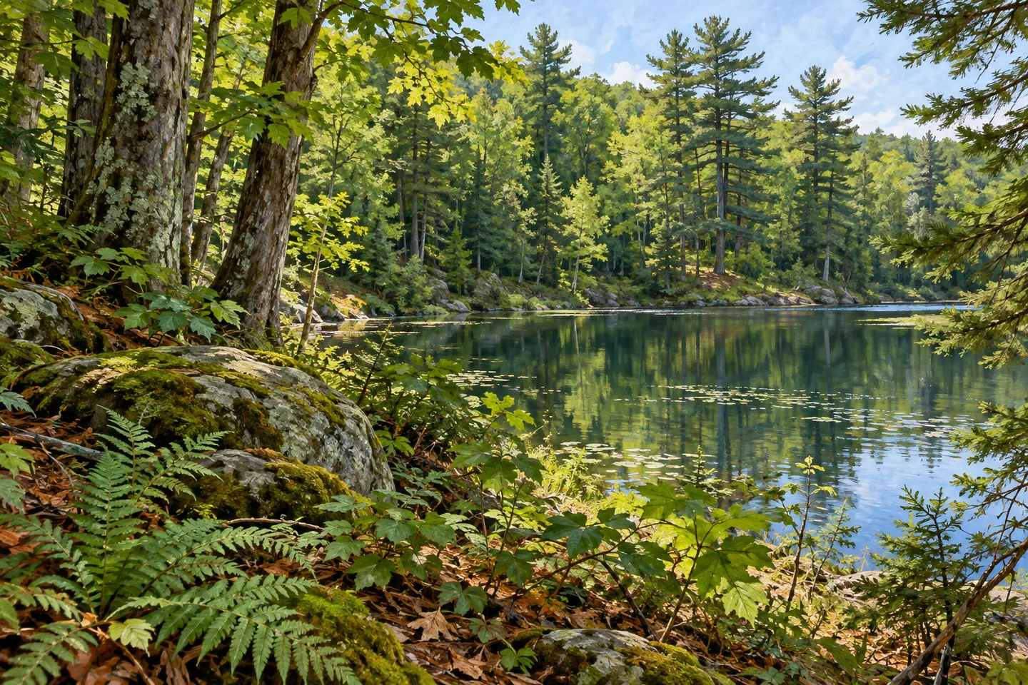
Fitzgerald Pond and the larger Hogsback Pond are both described as glacial in origin by the New York State Department of Environmental Conservation (DEC). Together with the esker, they give the forest a geological thread. Consider how water and wooded terrain relate in the scene you can actually observe. There is no need to turn the ponds into a promised shoreline circuit, or assume that a named landform has a signed viewpoint explaining it.
The Hogs Back Trail is the principal route to plan around. DEC lists it as 0.69 mile long and the only maintained access to the property. That is a modest, specific route, not an extensive maintained trail system. Use the property map to understand the approach and your return before setting out. The state forest's acreage does not establish that all of its features can be reached by a convenient walk from one entrance.
Parking is an important limitation: DEC lists no maintained parking areas on this unit. The trailhead location and a suitable place to leave a vehicle are separate planning questions. Check the approach and posted conditions before committing to a visit, rather than arriving with the expectation of a developed trailhead lot. The information is useful precisely because it describes a less developed arrangement, not because it makes the outing sound effortless.
DEC manages Hogsback within the Westward Waters Unit Management Plan. Its combination of woodland, glacial features and limited visitor infrastructure suits an approach based on careful observation rather than a long checklist of facilities. For photography, tree form and texture can be subjects in their own right. If a pond is visible from your appropriate position, use the relationship between water and forest; do not seek an angle by pushing into unmarked ground or assuming a waterside path.
Follow Leave No Trace guidance and the rules posted for the property. Check present trail and access conditions, and keep the limited parking provision central to the decision about whether this stop fits your plans. Hogsback's appeal does not need an invented wildlife encounter or a claim of a hidden viewpoint. A glacier-shaped backbone, two ponds and a contrasting stand of native pine give this small state forest a distinct story, with the practical limits of its approach kept in view.
Fun facts
- Hogsback State Forest covers 624 acres in Diana, Lewis County.
- The forest is named for a glacial esker that forms its geological backbone.
- A 52-acre stand of large native white pine surrounds Fitzgerald Pond.
- Fitzgerald Pond and the larger Hogsback Pond are glacial in origin.
- The 0.69-mile Hogs Back Trail is the only maintained access; no maintained parking areas are listed.
Before you go
- Plan around the 0.69-mile Hogs Back Trail rather than expecting an extensive maintained system.
- Resolve the parking approach before visiting; DEC lists no maintained parking areas.
- Check present route conditions and posted access before setting out.
- Do not infer a shoreline circuit from the two pond names.
- Follow Leave No Trace guidance and avoid unmarked shortcuts.
Capture
- Compare hardwood textures with pine forms where those subjects are visible from the route.
- If a pond view is available from an appropriate position, frame the water against the forest rather than assuming a designated overlook.
- A close woodland composition can suggest the forest's character without requiring a panoramic viewpoint.
 Grant Powell State Forest
 Mohawk Springs State Forest
 Onjebonge State Forest
Social
A glacial esker gives Hogsback State Forest its name and geological backbone. #Cre8Travel
Hogsback State Forest covers 624 acres in Diana, Lewis County. #Cre8Travel
Hardwoods dominate Hogsback, with a notable 52-acre native white pine stand around Fitzgerald Pond. #Cre8Travel
Fitzgerald Pond and the larger Hogsback Pond share a glacial-origin story in DEC's description. #Cre8Travel
The Hogs Back Trail is 0.69 mile long and the property's only maintained access. #Cre8Travel
DEC lists no maintained parking areas at Hogsback State Forest. Resolve the approach before visiting. #Cre8Travel
Two named ponds do not establish a shoreline loop. Use Hogsback's map and present access conditions. #Cre8Travel
At Hogsback, which would interest you most: the esker, glacial ponds or contrasting native pine stand? #Cre8Travel
Hashtags