 Cre8Travel
CRE8TRAVEL · NEW YORK PLACES
Lower Salmon River State Forest
Lower Salmon River State Forest: A Closer Look
Discover
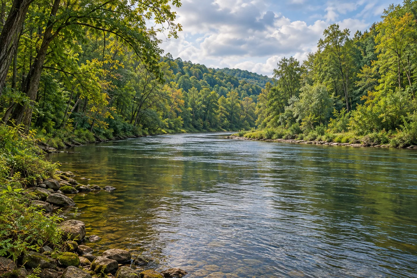
The Lower Salmon River State Forest was acquired with public access to a fishery at the center of its purpose. Approximately 1,700 acres beside the river came to the New York State Department of Environmental Conservation (DEC) through a settlement agreement with National Grid, formerly Niagara Mohawk. The land's story is therefore closely tied to the water, rather than to a broad trail network created for woodland walks alone.
The forest lies in Albion, Orwell and Richland in Oswego County. The Salmon River flows toward Lake Ontario, giving the local scene a connection with a much larger body of water. Its lower reaches are associated with seasonal salmon and trout movements. Think of the public forest as land beside a working river landscape, with actual access points determining how the water can be experienced during an outing.
Chinook, coho and Atlantic salmon, steelhead and brown trout are part of DEC's fishery description. Their presence in the river system does not mean fish will be visible from every bank or during every visit. A route can provide an interesting river view even when no animal enters the frame. Keep the focus on the water's setting rather than treating a seasonal wildlife event as a guaranteed performance.
Trails here are designed primarily for angler access, though they also provide river views. That arrangement matters when selecting a walking visit: the map should determine the access point and return rather than an assumption of one continuous riverside promenade. A short route to a particular section of water can have its own value, without being described as a prepared circuit linking the entire lower river.
The acquisition was intended to protect natural resources and secure public fishery access. Those are management purposes, not a reason to claim every part of the riverbank is open or easily reached. Match the forest boundary and the particular approach before setting out. Water visible across a property line is still a view, not permission to extend an outing beyond the land and access actually provided.
Route 13 east of Pulaski supplies the general road approach, with multiple parking and entry points shown on DEC's forest and river maps. Choose the correct point for the intended section rather than treating all references as interchangeable entrances. The state forest is distinct from other Salmon River properties, so a similar destination name should not be used to borrow facilities, waterfall access or camping arrangements from elsewhere.
Camping is prohibited here, including camping in vehicles. Plan the outing around the permitted public use and the actual return, not an overnight stay beside the river. Follow current posted conditions and Leave No Trace guidance, leaving banks and vegetation undisturbed. A photograph can use the relationship between flowing water and the surrounding land from an appropriate position, without entering the river or seeking a dramatic crossing.
The Lower Salmon River management framework provides the wider context. This forest's particular character is the relationship between an acquisition, a tributary fishery and public access designed around it. Let those actual features shape the visit, at the scale of the route selected, rather than enlarging the description into an unrestricted river walk or a wildlife encounter promised for a particular season.
Fun facts
- Lower Salmon River State Forest comprises approximately 1,700 acres beside the river in Oswego County.
- The acquisition resulted from a settlement with National Grid, formerly Niagara Mohawk.
- The Salmon River is a Lake Ontario tributary.
- Trails are primarily angler-access routes that also offer river views.
- Camping is prohibited, including camping in vehicles.
Before you go
- Use the correct Lower Salmon River maps and access point for the intended section.
- Do not borrow waterfall or camping arrangements from similarly named Salmon River properties.
- Treat seasonal fishery information as context, not a fish-viewing guarantee.
- Plan no overnight camping, including in a vehicle.
- Observe the river from appropriate public access and follow Leave No Trace guidance.
Capture
- Use flowing water and the surrounding land from an appropriate river-access position.
- A close bank-and-water composition does not require entering the river.
- Photograph the actual scene without promising a visible salmon run or staged fish encounter.
 Line Brook State Forest
 Orton Hollow State Forest
 Stave Mill State Forest
Social
Lower Salmon River State Forest protects approximately 1,700 acres beside a Lake Ontario tributary. #Cre8Travel
The land acquisition followed a settlement agreement with National Grid, formerly Niagara Mohawk. #Cre8Travel
Public fishery access is central to Lower Salmon River State Forest's purpose. #Cre8Travel
Angler-access trails also provide river views, rather than one promised riverside promenade. #Cre8Travel
Seasonal fishery information does not guarantee fish visible from every bank during a visit. #Cre8Travel
Route 13 east of Pulaski connects with several mapped Lower Salmon River access points. #Cre8Travel
Camping, including camping in vehicles, is prohibited in Lower Salmon River State Forest. #Cre8Travel
At the Lower Salmon River, let the actual public route and river setting guide the outing. #Cre8Travel
Hashtags