 Cre8Travel
CRE8TRAVEL · NEW YORK PLACES
Orton Hollow State Forest
Orton Hollow State Forest: A Closer Look
Discover
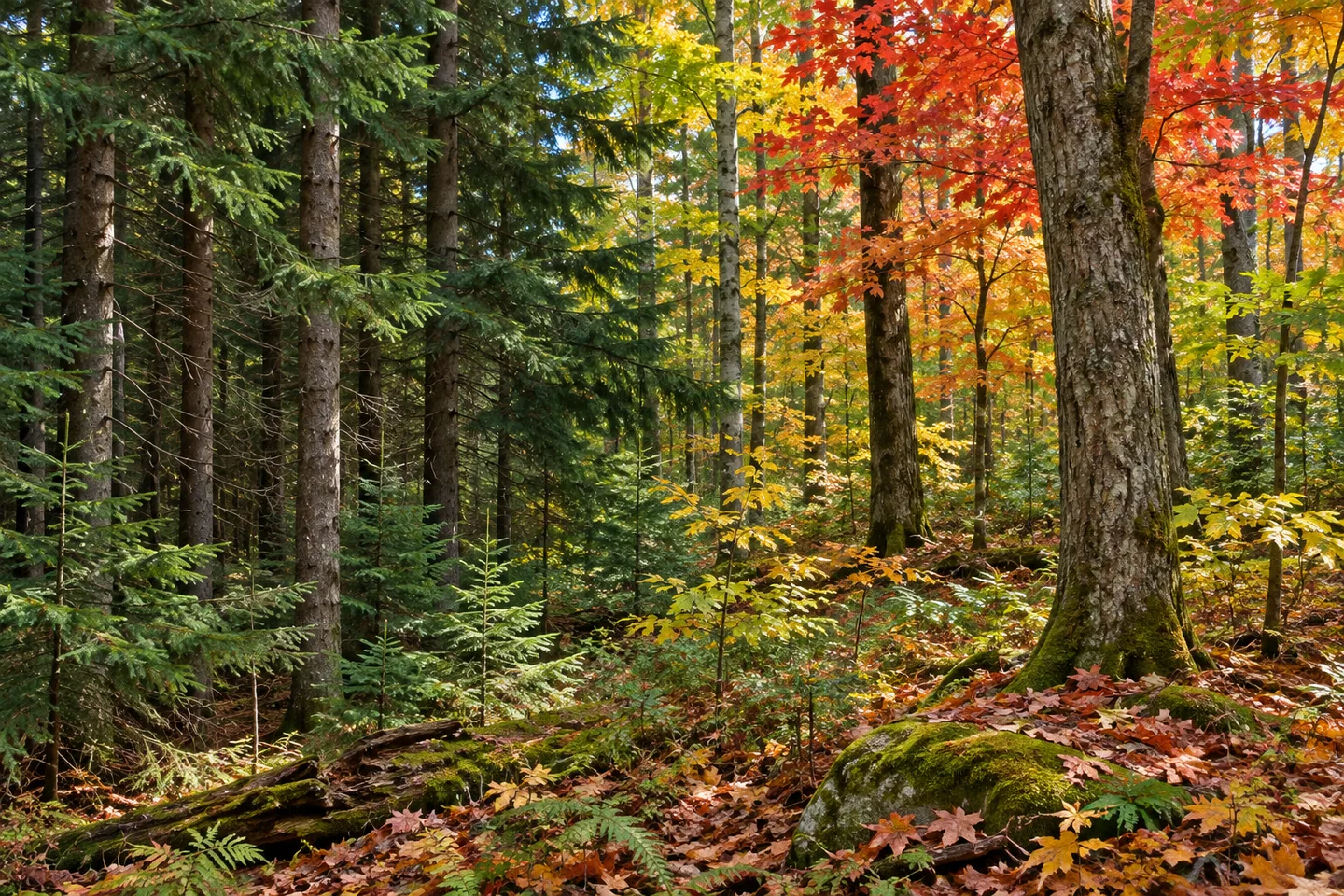
Orton Hollow State Forest offers a reforestation story on ground once used for crops and pasture. The 507-acre property in Williamstown and Amboy, Oswego County, was largely acquired by the state in the 1930s. Today, black cherry, red maple, white ash, sugar maple and hemlock share the landscape with planted conifers. Those layers make the forest more specific than a general invitation to walk through trees.
Farming here faced rocky soils and long, harsh winters, conditions that made agricultural work difficult. The later public-land chapter followed state reforestation legislation of 1929 and 1931, which enabled acquisition for forest purposes. Keep those events distinct: authorization for a program is not the date of every purchase, and a broader history should not be turned into one simplified moment when the whole landscape changed.
Civilian Conservation Corps workers planted thousands of conifer seedlings on newly acquired land. Pine, spruce and larch remain part of the forest's appearance in the New York State Department of Environmental Conservation (DEC) account. Those trees provide a tangible subject for an observation-focused outing without reconstructing the workers or equipment that established them. A planted stand can hold a history even when no separate monument or exhibit marks it.
Natural trees provide another woodland texture. Where an appropriate approach allows a view, compare broad tree forms and the structure of the stand rather than trying to identify the entire species list. The relationship between planted conifers and mixed woodland is enough to give the scene a theme. No promise of unusual wildlife, a large vista or exceptionally old trees is needed.
Infrastructure is limited. DEC describes only one short trail, associated with motorized access for people who hold the relevant mobility permit. That feature should not be presented as a general prepared hiking circuit or permission for every visitor to drive into the woods. Confirm the actual access arrangement and conditions for the visit intended rather than assuming the route's presence establishes universal access.
Road references include County Route 17, Finnerty Road and its spur, as well as Route 13 near Miller Road. Parking is limited along road shoulders, with an Orton Hollow Road location also provided by DEC. Match the chosen point to the current property map and resolve the stopping arrangement before traveling. A named parking reference should not be enlarged into a developed lot or visitor center.
Management is considered within the Fish Creek planning framework, alongside the forest's reforestation, water and recreation purposes. Those purposes are useful context rather than a guarantee of particular ecological outcomes. For photographs, woodland texture from an appropriate public position can relate directly to the planting story. Leave historical traces and vegetation undisturbed instead of seeking an off-route vantage point.
Follow posted conditions and Leave No Trace guidance, using current access information to decide whether this lightly developed setting fits the outing. Orton Hollow's particular interest lies in former agricultural ground and the practical work of establishing a forest on it. Let that grounded story shape expectations, with the real access arrangement kept central rather than replaced by an imagined trail system or a promised wildlife encounter.
Fun facts
- Orton Hollow State Forest covers 507 acres in Williamstown and Amboy, Oswego County.
- Most acquisition occurred in the 1930s on land formerly used for farming.
- CCC workers planted thousands of conifer seedlings.
- The one short described trail is associated with permit-based motorized mobility access.
- Road-shoulder parking is limited; a named reference does not establish a developed visitor lot.
Before you go
- Confirm the actual access arrangement before treating this as a hiking destination.
- Do not generalize a permit-based mobility route into public vehicle permission.
- Use the current property map to choose the road approach.
- Resolve limited shoulder parking before traveling.
- Follow posted conditions and Leave No Trace guidance.
Capture
- Use planted-conifer and mixed-woodland textures visible from appropriate public access.
- A close forest composition can suggest the reforestation story without historic reconstruction.
- Do not leave an appropriate route to seek a vista or wildlife encounter.
 Lower Salmon River State Forest
 Stave Mill State Forest
 Watkins Glen State Park
Social
Orton Hollow State Forest covers 507 acres in Williamstown and Amboy, Oswego County. #Cre8Travel
Former crop and pasture land was largely acquired in the 1930s for Orton Hollow's forest chapter. #Cre8Travel
CCC planting introduced thousands of conifer seedlings to the newly acquired land. #Cre8Travel
Pine, spruce and larch add a planted layer beside Orton Hollow's mixed woodland. #Cre8Travel
The short described mobility route is permit-based, not general permission to drive into the forest. #Cre8Travel
Road-shoulder parking is limited at Orton Hollow. Match the actual approach to a current map. #Cre8Travel
A planted stand can tell a history without an exhibit, monument or reconstructed scene. #Cre8Travel
At Orton Hollow, how would knowing the farming and planting history change a closer look at the woods? #Cre8Travel
Hashtags