 Cre8Travel
CRE8TRAVEL · NEW YORK PLACES
Stave Mill State Forest
Stave Mill State Forest: A Closer Look
Discover
Stave Mill State Forest carries the name of a former wood-processing use, but its public-land history is relatively recent. The 3,127-acre property in Orwell, Oswego County, was once known as the Kendall property. Its present name recalls a stave lumber mill that operated there, not a preserved industrial attraction promised beside a trail. The forest's story links earlier timber use with a later conservation acquisition.
The Conservation Fund purchased the land in 2015 at the state's request through its Working Forest Fund, with support from the Richard King Mellon Foundation. The Fund worked with local contractors on access improvements before DEC's later purchase using Environmental Protection Fund resources. Keep those stages separate: the 2015 acquisition was not the same transaction as the later transfer into state ownership.
The property lies on the edge of the Tug Hill Plateau. Shale and sandstone underlie the area, with glacial history part of its landscape context. That background need not be turned into a specific cliff, canyon or exposed rock feature at a visitor viewpoint. The land's setting can inform the outing without making the identification of a geological formation beside the route its purpose.
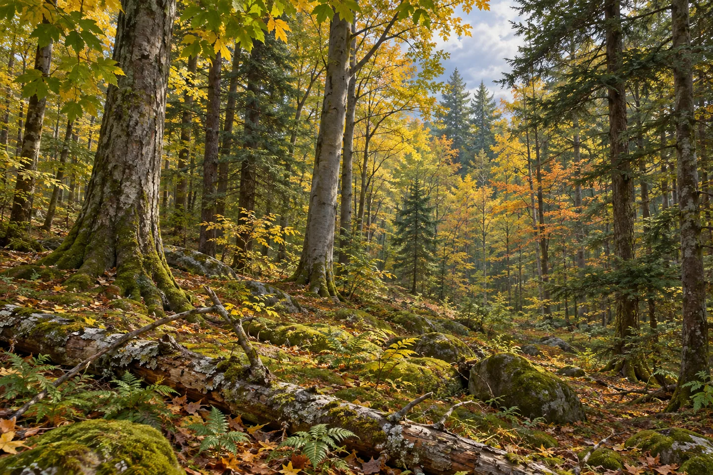
The New York State Department of Environmental Conservation (DEC) describes the forest as predominantly northern hardwood-hemlock cover, with maple, pine, spruce, beech and basswood among the trees. Compare broad woodland forms where they are visible from an appropriate route. The mixture gives a photograph a subject without requiring an unusually large tree or a promise that every named species occurs within one scene.
Habitat includes areas used by deer during winter, while raccoon, beaver, snowshoe hare, turkey and grouse are among wildlife in DEC's account. Those associations describe the forest across seasons rather than animals guaranteed on arrival. A quiet visit can still focus on woodland structure and the character of the ground. Give any wildlife actually observed space rather than moving closer to complete a photograph.
DEC identifies County Route 17 north of Redfield as the general access location, with a parking reference on that road. Match the chosen approach to the current property map and posted conditions. The visitor information permits hiking but does not provide a named circuit or mileage to add into an itinerary. Plan the actual section and return rather than borrowing a trail description from another nearby state forest.
The Upper Salmon River Unit Management Plan gives the wider management framework. Forestry aims include a mixture of young, middle-aged and older stands, a management direction rather than proof of the age of trees at a particular point. That approach connects the working-forest history with present public ownership, without calling the whole property untouched or making a guarantee about every ecological outcome.
Follow Leave No Trace guidance and posted conditions, leaving vegetation and earlier land-use traces undisturbed. For photographs, work with the woodland actually available from an appropriate position rather than an invented mill ruin. Stave Mill's particular story can be the sequence of past timber use, conservation purchase and later state ownership, held within a Tug Hill-edge forest whose practical access shapes what a visitor sees.
Fun facts
- Stave Mill State Forest covers 3,127 acres in Orwell, Oswego County.
- The Conservation Fund bought the former Kendall property in 2015 at the state's request.
- DEC acquired the property later using Environmental Protection Fund resources.
- The name recalls a former stave lumber mill, not a confirmed surviving visitor attraction.
- County Route 17 north of Redfield provides the general access and parking reference.
Before you go
- Keep the 2015 Conservation Fund acquisition distinct from the later DEC purchase.
- Do not expect an intact mill or a mapped industrial-history trail.
- Use current maps for the actual Route 17 approach and return.
- Treat wildlife and forestry aims as context rather than guaranteed sights.
- Follow posted conditions and Leave No Trace guidance.
Capture
- Use actual woodland textures rather than an invented mill ruin or historical reconstruction.
- A tree-form composition can suggest the working-forest story without staging forestry work.
- Photograph wildlife only if present, without moving closer or disturbing it.
 Orton Hollow State Forest
 Watkins Glen State Park
 Storm King Art Center
Social
Stave Mill State Forest covers 3,127 acres in Orwell on the Tug Hill Plateau edge. #Cre8Travel
The Conservation Fund bought the former Kendall property in 2015 at the state's request. #Cre8Travel
DEC's later purchase was a separate stage in Stave Mill's public-land history. #Cre8Travel
The name recalls a stave lumber mill; it does not establish an intact mill attraction today. #Cre8Travel
Maple, pine, spruce, beech and basswood are among the trees in DEC's forest description. #Cre8Travel
County Route 17 north of Redfield provides the general access reference for Stave Mill. #Cre8Travel
A woodland photograph can tell Stave Mill's story without a reconstructed industrial scene. #Cre8Travel
At Stave Mill, would the conservation acquisition or the earlier timber-use history guide your observations? #Cre8Travel
Hashtags