 Cre8Travel
CRE8TRAVEL · NEW YORK PLACES
Jenksville State Forest
Jenksville State Forest: A Family Name, Former Farms and Woodland Trails
Discover
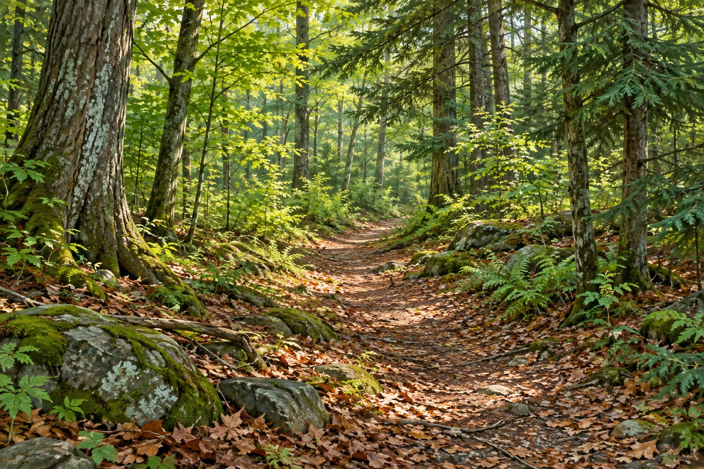
Jenksville State Forest combines a familiar place name with a landscape changed by farming, planting and recreation. Its 1,345 acres lie in Berkshire and Newark Valley in northeastern Tioga County. A marked multiple-use trail system now crosses land that was once largely pasture or cultivated ground. The forest is a place to follow an actual route, but its local history gives that movement another dimension: the woodland grew from properties with their own families, fields and earlier uses.
The Jenks name reaches back to the area's settlement history. In 1796, Laban and Elisha Jenks arrived from Berkshire County, Massachusetts, with their cousin Michael Jenks and Jonas Muzzy. The Tioga management plan, drawing on the Newark Valley Historical Society, places the brothers on land in the Boston Purchase, an early subdivision between the Owego and Chenango rivers. These are details of the surrounding community's history, not evidence that every event occurred within the present forest boundary.
By 1811 a Jenks farm and the settlement of Jenksville were recognizable in that account. Later moves and exchanges changed the family's holdings. The state purchased the Jenks family farm in 1940, and it became part of the forest bearing their name. Further parcels were added from 1941 to 1945. Keeping the community story and the later public acquisition distinct helps explain how a local name continued while the land itself took on a different purpose.
Reforestation addressed erosion and the condition of former agricultural ground. Civilian Conservation Corps workers carried out extensive hand planting in 1940 and 1941, using a mixture of pines, spruce, fir, cedar, larch and oak described in DEC's public account. Tree planting, public ownership and the later recreational network belong to different stages of that change. A woodland view can connect those stages without a restored farmstead or a surviving building being needed to tell the story.
The current trail system is approximately 12 miles long and maintained cooperatively by DEC and volunteers. Circular markers identify routes by both color and number, with beginner, intermediate and advanced classifications. A color alone does not indicate one consistent level: for example, the red routes include both beginner and intermediate sections, while the blue routes include more demanding choices. Use the map and the particular route's classification to choose an outing, rather than treating a color group as one loop or one level of difficulty.
The two principal parking approaches also differ. Shirley Road has a smaller lot, while Allison Hill Road provides a larger area that accommodates horse trailers. The multiple-use character is part of the practical setting, with walkers sharing the network with other permitted users. Horse and bicycle access is seasonal, from May through October in DEC's information, and the department asks those users to avoid wet conditions. Current signs and the actual route surface should guide the day’s plan.
Give the chosen section time to reveal the forest's structure: the form of an established stand, changes in tree canopy or the relationship between a walking corridor and surrounding growth. These observations can link the present woodland with the earlier planting effort without requiring every tree's origin to be identified. Jenksville's interest lies in the continuity of a local name through a substantial change in land use, with a varied trail network now providing several ways to encounter that history on the ground.
Fun facts
- The 1,345 acre forest lies in Berkshire and Newark Valley, Tioga County.
- The state bought the Jenks family farm in 1940.
- Further parcels were added between 1941 and 1945.
- Approximately 12 miles of trails use color, number and ability classifications.
Before you go
- Choose a specific numbered route and its ability classification.
- Shirley and Allison Hill parking areas have different capacities.
- Follow current seasonal and wet-condition rules for shared uses.
Capture
- Compose present woodland structure to suggest the reforestation story.
- Photograph from the established route while allowing other users to pass.
- Avoid reconstructing the Jenks farm or exact historical planting rows.
 Grantville State Forest
 Fulton Chain Wild Forest
 Ha-De-Ron-Dah Wilderness
Social
Jenksville State Forest covers 1,345 acres in northeastern Tioga County. #Cre8Travel
The local name connects the forest with the Jenks family’s earlier farming history. #Cre8Travel
A 1940 state purchase brought the family farm into public ownership. #Cre8Travel
Additional parcels acquired through 1945 expanded the forest. #Cre8Travel
CCC hand planting in 1940 and 1941 helped change former agricultural land into woodland. #Cre8Travel
The approximately 12 mile trail system uses both colors and numbers. #Cre8Travel
Choose the individual route classification: one color group can include different ability levels. #Cre8Travel
A woodland walk can connect a continuing local name with a changing landscape. #Cre8Travel
Hashtags