 Cre8Travel
CRE8TRAVEL · NEW YORK PLACES
Fulton Chain Wild Forest
Fulton Chain Wild Forest: Lakes, Rocky Hills and Different Routes
Discover
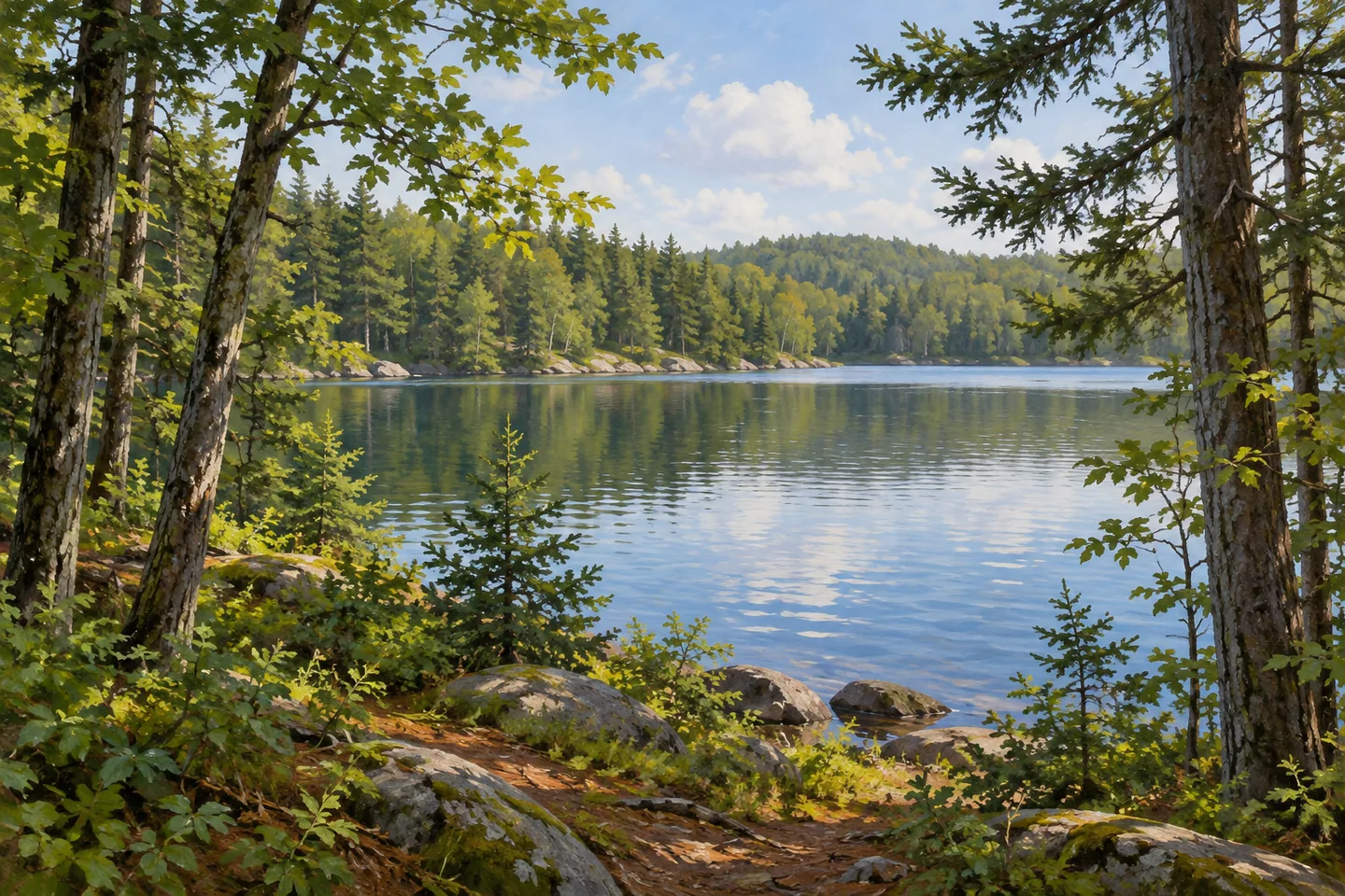
Fulton Chain Wild Forest places a varied Adirondack landscape near the communities of Old Forge, Eagle Bay and Inlet. Its 16,028 acres in Webb, Herkimer County, include rolling woodland, rocky hills and low ground crossed by streams and wetlands. The namesake chain of lakes supplies a familiar regional reference, while smaller waters and wooded ridges give individual outings their character. Choosing a particular route is a way into that larger setting, rather than an attempt to experience the whole unit at once.
Elevations range from about 1,700 to 2,500 feet. The strongest relief occurs along the southern ridge near Fourth Lake and the Route 28 corridor, with notable rock faces on Bald, Onondaga and Slide-off mountains. Other parts of the forest are more gently rolling, with streams, wetland and beaver meadows in low places. Those differences give the unit more than one visual identity: a rocky ascent and a lake circuit can belong to the same public landscape while making quite different outings.
Water is equally varied. DEC's account lists 22 lakes and ponds totaling 4,058 acres, together with 27 streams extending about 18 miles. Moss Lake offers a particularly clear example of a waterside destination. Its yellow-marked circuit runs 2.5 miles around the lake, while a separate short approach leads from the trailhead to the shore. The complete circuit and the short shore access should be considered separately when matching an outing to the time and conditions available.
The Bubb Lake–Sis Lake Trail provides another way to explore the smaller-water landscape, extending 2.3 miles from Route 28 to the Moss Lake circuit. Other routes reach more distant waters, including Razorback Pond from the southern end of Twitchell Lake. That 1.9 mile approach includes a substantial section on private land under a permanent easement. The connection provides passage along a route, not unrestricted use of every adjoining parcel. The map helps keep the experience of moving through a continuous-looking forest tied to the access actually provided.
Higher ground brings another aspect of the unit into view. Bald Mountain's trail leads toward the Rondaxe Fire Tower, while the longer Vista Trail connects through the rocky southern area and includes short spurs. These are specific routes with their own grades and destinations. Their presence does not make every rocky hill a maintained viewpoint, and total network mileage should not be assembled into an assumed loop. A woodland foreground can be part of a considered photograph wherever an established position offers a view.
Moss Lake also has documented accessible features, including a short firm-surface trail to a viewing platform and routes to two designated primitive campsites. Those features apply to particular approaches and sites, rather than the entire forest or every lakeside path. Check the operator's current accessibility information and the correct parking area for the intended visit. Several activities share parts of the wider trail system, so current designations remain useful even when a familiar lake name supplies the destination.
The management history includes a 1990 unit plan and later amendments, reflecting the continuing organization of recreation within the forest. For a present outing, use current maps and notices to select the approach and return. Nearby waters, private easements and neighboring public units all contribute to the setting without sharing identical access. Fulton Chain Wild Forest is best understood through one clearly chosen landscape at a time: lake shore, wet low ground or rocky wooded ridge, each expressing part of a diverse Adirondack whole.
Fun facts
- Fulton Chain Wild Forest covers 16,028 acres in Webb.
- Its elevations range from approximately 1,700 to 2,500 feet.
- DEC lists 22 lakes and ponds and 27 streams.
- Moss Lake has a 2.5 mile circuit trail.
Before you go
- Distinguish Moss Lake’s short shore approach from its complete circuit.
- Respect marked passage across private easement sections.
- Use current information for the particular accessible feature and parking approach.
Capture
- Frame modest lake water with woodland where an established route allows.
- Use ordinary rocky woodland foreground in a view available on the chosen outing.
- Avoid reconstructing an exact tower, shoreline or accessibility facility without a reference.
 Jenksville State Forest
 Ha-De-Ron-Dah Wilderness
 Hoffman Notch Wilderness
Social
Fulton Chain Wild Forest protects 16,028 acres near Old Forge, Eagle Bay and Inlet. #Cre8Travel
Rolling woodland, rocky hills and wet low ground give the unit several landscape characters. #Cre8Travel
DEC describes 22 lakes and ponds and 27 streams within its water resources. #Cre8Travel
Moss Lake’s 2.5 mile circuit is distinct from the short route to the shore. #Cre8Travel
Bubb and Sis lakes provide another trail-based encounter with the smaller-water landscape. #Cre8Travel
Some routes cross private land under easement; passage rights remain route-specific. #Cre8Travel
Documented accessible features at Moss Lake apply to particular trails and sites. #Cre8Travel
Choose one mapped outing and let its lake, woodland or rocky ridge reveal part of the larger forest. #Cre8Travel
Hashtags