 Cre8Travel
CRE8TRAVEL · NEW YORK PLACES
Ha-De-Ron-Dah Wilderness
Ha-De-Ron-Dah Wilderness: Rounded Hills and Forest Waters
Discover
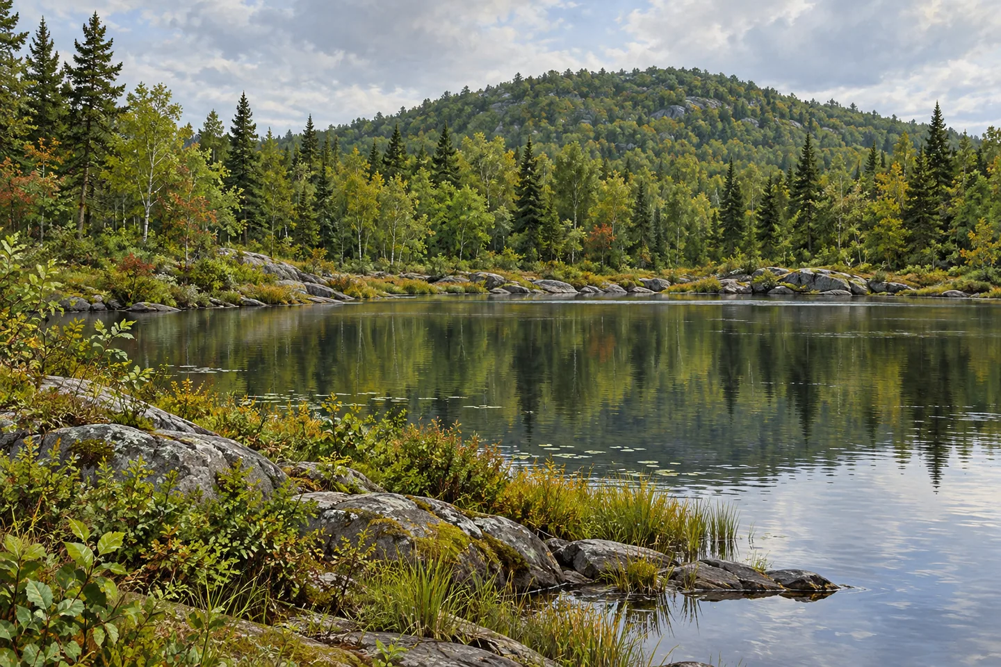
Ha-De-Ron-Dah Wilderness belongs to the western Adirondack foothills, where rounded rocky hills share the landscape with swamps, streams, meadows and ponds. The 26,600 acre unit lies west of Old Forge and the Fulton Chain of Lakes, extending through Webb in Herkimer County and Greig in Lewis County. Its character is expressed through wooded ground and smaller waters, with rock-faced pond shores providing particular detail. A route chosen for that setting can give a visit a focus beyond the pursuit of a high summit.
The general elevation pattern rises from about 1,500 feet in the west toward eastern hills that remain below 2,360 feet. That is a description of the property as a whole, rather than the climb along any one trail. Rounded hills, low wet ground and scattered water create a repeated arrangement of landforms. The visual interest can be in their relationship: a wooded rise behind a pond, a rock close to the water or a change in vegetation where the ground becomes wetter.
DEC identifies 5 lakes and 16 ponds of significant surface area within the unit. These waters are dispersed through the wilderness, and only some are reached by the trail system. Big Otter Lake, a prominent waterbody near the northwestern boundary, belongs to adjacent Independence River Wild Forest. Its place beside this wilderness helps orient the wider landscape without making it an interior lake. Keeping that boundary clear is useful when comparing a route name, its destination and the public unit through which it travels.
Approximately 35 miles of marked foot trails provide selected connections. Big Otter Trail follows a former truck route from Thendara toward Big Otter Lake, with barriers closing it to vehicles at the eastern approach. The old road surface supplies a trace of earlier access within the present wilderness setting. It also makes clear that the trail's physical origin and its current permitted use are different parts of the story. Plan the actual walking section and return with the official map.
Other routes turn toward interior waters. East Pond Trail reaches East Pond by way of Little Simon Pond, while connecting trails lead toward Middle Settlement Lake and Middle Branch Lake. Blackfoot Pond Trail adds a more specific historical detail, passing remnants of a mica mine on its way to the pond. Those remnants belong within the landscape rather than forming a reconstructed industrial attraction. Leave them undisturbed and give the surrounding woodland as much attention as the evidence of earlier work.
Streams contribute another layer. Part of the Independence River and smaller named waters including Lost Creek, Pine Creek, Indian Brook and Middle Settlement Creek occur in the area. Their presence adds context to the ponds and wet ground, but the map should decide which watercourse belongs to the selected outing. Trails receive limited maintenance, especially in the north. A long line on a map therefore calls for preparation appropriate to actual backcountry conditions, rather than an expectation of a uniformly developed walking surface.
Choose the correct eastern or western approach from current DEC information and check regional notices before traveling. A considered visit can concentrate on one pond or a manageable section of old route, allowing its woodland and water to become the subject. Ha-De-Ron-Dah's distinction lies in this recurring foothill pattern: rounded rocky ground, low wet places and scattered waters, with earlier access traces now forming part of a larger protected forest landscape.
Fun facts
- Ha-De-Ron-Dah Wilderness covers 26,600 acres in Herkimer and Lewis counties.
- Its terrain includes rounded rocky hills, wetlands and pond shores.
- DEC identifies 5 lakes and 16 ponds of significant surface area.
- Big Otter Trail follows a former truck route now closed to vehicles at Thendara.
Before you go
- Plan around current backcountry conditions and limited trail maintenance.
- Big Otter Lake belongs to adjacent Independence River Wild Forest.
- Leave mica-mine remnants and natural features undisturbed.
Capture
- Use ordinary rocky pond shore and woodland as subjects where appropriate access exists.
- Frame a modest rounded wooded hill rather than an alpine mountain panorama.
- Compose woodland texture along the actual route without entering wetland vegetation.
 Fulton Chain Wild Forest
 Hoffman Notch Wilderness
 Hurricane Mountain Wilderness
Social
Ha-De-Ron-Dah Wilderness protects 26,600 acres of western Adirondack foothills. #Cre8Travel
Rounded rocky hills and scattered waters give the landscape its particular rhythm. #Cre8Travel
Five lakes and 16 ponds of significant surface area are described within the unit. #Cre8Travel
Big Otter Lake is adjacent to this wilderness in a neighboring wild forest. #Cre8Travel
The Big Otter route follows a former truck trail with present-day vehicle restrictions. #Cre8Travel
Blackfoot Pond Trail passes remnants of a mica mine, adding a trace of earlier work. #Cre8Travel
Limited maintenance, especially in the north, makes current route planning essential. #Cre8Travel
A single pond and its wooded setting can reveal the character of the larger foothill wilderness. #Cre8Travel
Hashtags