 Cre8Travel
CRE8TRAVEL · NEW YORK PLACES
Indian River Wildlife Management Area
Indian River Wildlife Management Area: A Closer Look
Discover
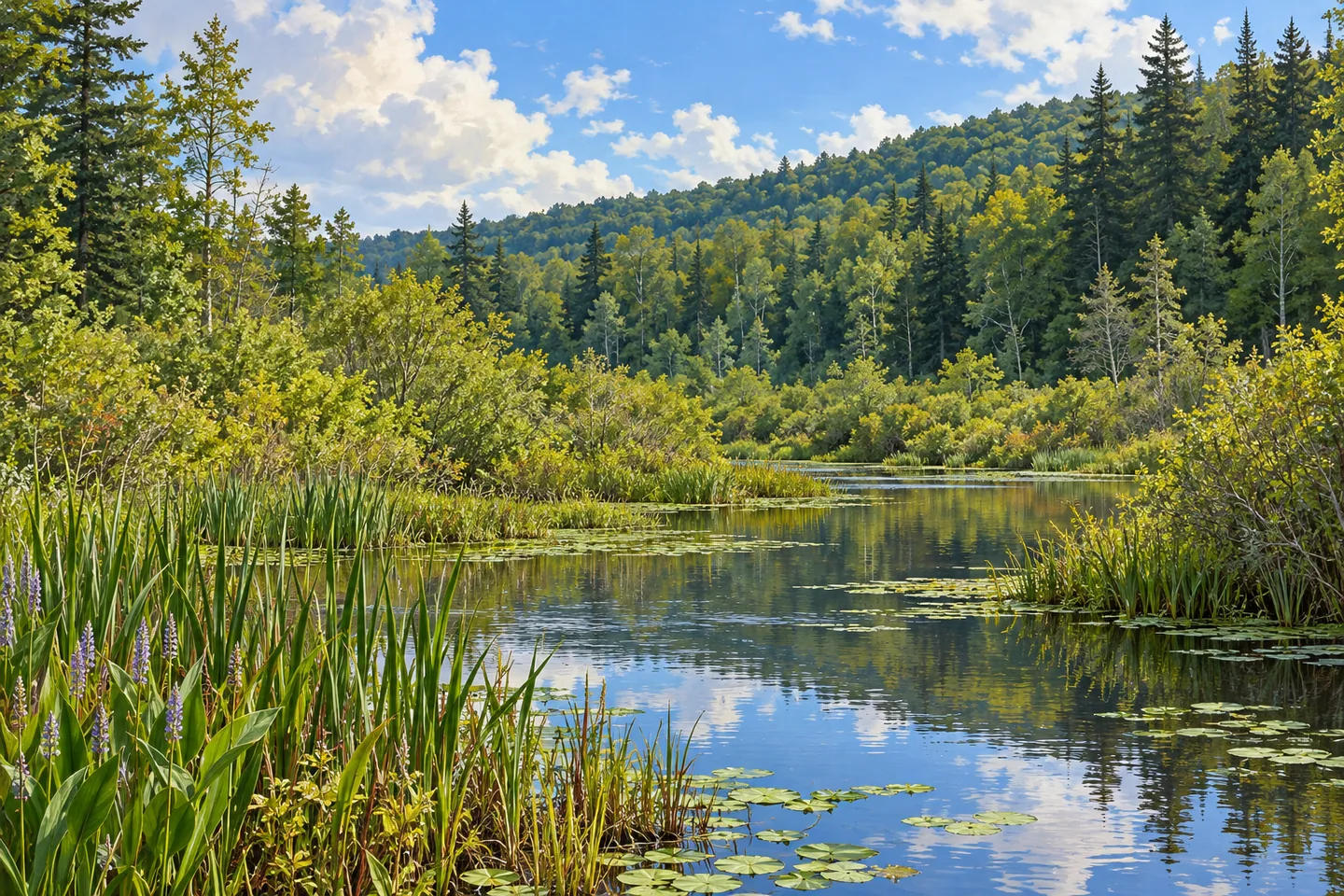
Indian River Wildlife Management Area is best understood as a collection of habitats rather than a single waterside scene. In the Town of Theresa, Jefferson County, its 968 acres include upland forest, fields and extensive wetlands. The New York State Department of Environmental Conservation (DEC) manages it for wildlife, habitat conservation and wildlife-dependent recreation. The variety of named communities gives a visit its focus: look for differences in the landscape instead of expecting one uniform kind of woodland.
The upland forest includes beech-maple, hemlock-northern hardwood and young northern hardwood communities. Those descriptions are useful prompts for observation. Compare broad woodland textures and the different shapes of conifer and hardwood foliage where they are visible from lawful public access. You do not need to identify every tree to appreciate that the forest component itself contains more than one kind of setting. Avoid treating a general habitat description as a map of a particular path.
The wetland component is similarly varied. DEC lists deep and shallow emergent marsh, shrub swamp, floodplain forest, red maple-hardwood swamp and impounded swamp. These are distinct habitat descriptions, not six viewing stops joined by a visitor route. They help explain why the property matters for wildlife even when much of it cannot be inspected from a single access point. A scene that initially looks simply wet or wooded can have a more complicated character on closer consideration.
Water access requires attention to names and locations. One car-top boat launch is at the end of Red Lake Road and serves Red Lake. The other is off Nelson Road and serves the Indian River. A car-top launch is a particular access provision; it does not establish a developed waterfront promenade or an all-purpose visitor facility. Match the correct waterbody to the correct point on the DEC map before planning a visit around either one.
DEC also lists gravel parking locations on Red Lake Road, including one beside the Indian River. Parking descriptions and boat-launch descriptions should not be collapsed into a single assumed entrance. The published information does not set out a maintained hiking itinerary, so this is an article about habitat and documented access rather than a promised trail circuit. Choose an approach that fits the actual map and posted conditions, not a route inferred from the property's acreage.
For wildlife observation, the agency's bird and vertebrate checklists offer a useful reference. They can help organize notes on what you see, while leaving room for an uneventful visit. No particular bird or mammal needs to appear to make the forest and wetland contrasts worth noticing. From an appropriate public position, a photograph can concentrate on layers of vegetation, the shape of an open-water edge, or the difference between a wooded background and a marsh foreground.
Management planning separates habitat goals from public access needs. The area's Habitat Management Plan identifies target species and habitat objectives; its Access and Public Use Plan addresses recreation and access features. Neither is a guarantee that a proposed improvement already exists. Follow DEC's Leave No Trace and tick guidance, respect the access actually provided, and let Indian River WMA's many habitat types shape expectations more than an imagined long walk through all of them.
Fun facts
- Indian River WMA covers 968 acres in Theresa, Jefferson County.
- DEC describes upland forest, fields and wetlands within the property.
- Wetland communities include emergent marsh, shrub swamp and floodplain forest.
- The Red Lake Road car-top launch serves Red Lake; the Nelson Road launch serves the Indian River.
- DEC provides separate habitat and public-access planning documents.
Before you go
- Match Red Lake Road and Nelson Road access to the correct waterbody on the DEC map.
- Treat gravel parking locations and car-top launches as distinct map features.
- Do not infer a maintained hiking circuit from the property's acreage.
- Use DEC bird and vertebrate checklists for actual observations.
- Follow posted conditions, Leave No Trace guidance and DEC tick precautions.
Capture
- Study layers of forest and marsh vegetation from an appropriate public access point.
- If a water view is available at your lawful position, frame vegetation against open water without entering sensitive habitat.
- Try a close composition of documented woodland textures without assuming every forest type is visible from one location.
 Honeyville Wildlife Management Area
 Balsam Creek State Forest
 Beartown State Forest
Social
Indian River WMA spans 968 acres in Theresa, Jefferson County, with forest, fields and varied wetlands. #Cre8Travel
Beech-maple and hemlock-northern hardwood communities are part of Indian River WMA's upland forest. #Cre8Travel
Indian River WMA's wetland habitats include emergent marsh, shrub swamp and floodplain forest. #Cre8Travel
At Indian River WMA, the Red Lake Road car-top launch serves Red Lake. The Nelson Road launch serves the Indian River. #Cre8Travel
A launch location is not a hiking itinerary. Match your Indian River WMA visit to documented public access. #Cre8Travel
DEC's bird and vertebrate checklists can help organize observations at Indian River WMA without promising sightings. #Cre8Travel
A WMA habitat plan describes goals; an access plan addresses public-use needs. Existing facilities still need checking. #Cre8Travel
Which landscape contrast would you look for at Indian River WMA: woodland textures or the edge of a marsh? #Cre8Travel
Hashtags