 Cre8Travel
CRE8TRAVEL · NEW YORK PLACES
Balsam Creek State Forest
Balsam Creek State Forest: A Closer Look
Discover
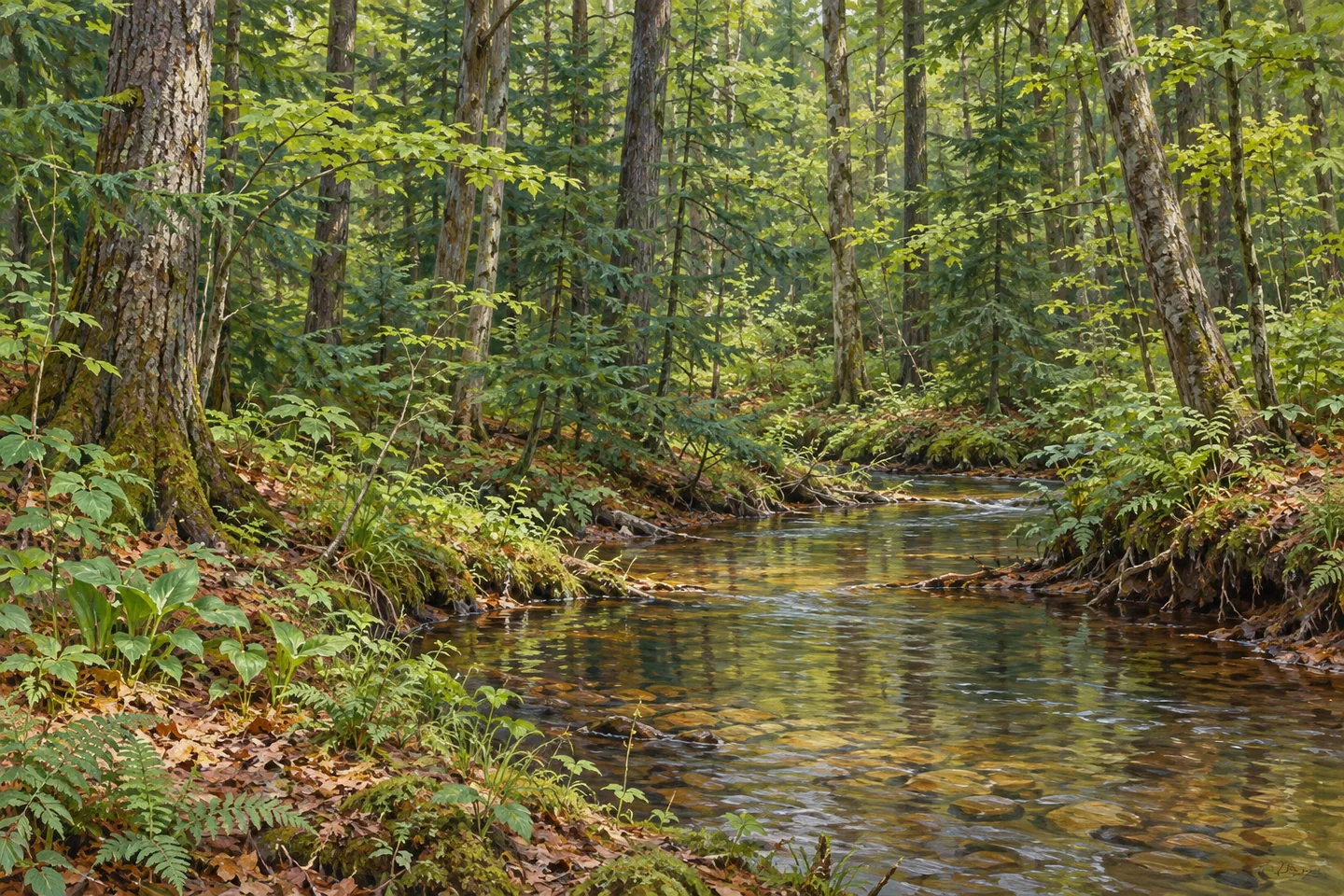
A valley gives Balsam Creek State Forest its shape, while old planting projects help tell its history. This 559-acre property in Croghan, Lewis County, lies in the Adirondack foothills and is divided by the 150-foot-deep Balsam Creek valley. The water and the trees deserve equal attention. One describes the terrain; the other records choices made when open fields were being planted in the twentieth century.
Balsam Creek and Cold Creek, its tributary to the north, are spring-fed trout streams. The names give the forest a more specific identity than a general promise of woodland scenery. They do not establish a waterfall, swimming place or waterside promenade. Approach the streams only where access and conditions allow, and let the map distinguish a watercourse from a walking route. A valley can define a landscape without offering an overlook at every turn.
For a documented walk, the Briar Hill Public Forest Access Road is the main reference. This unpaved, 1.53-mile road crosses the property from southwest to northeast and also serves as a multiple-use trail. That distance describes the access road, rather than a complete loop or a return journey. Consider which part suits your visit and how you will return before setting off; do not assume another path connects the ends.
The New York State Department of Environmental Conservation (DEC) lists three parking areas along unpaved Briar Hill Road, approached from Fish Creek Road. Fish Creek Road follows the forest's southern boundary. Those details are useful for matching the map to an actual starting point. The road is not plowed in winter, another reason to distinguish a line marked on a map from an approach that will suit every season or vehicle.
Near Fish Creek Road, tree planting began in open fields during the 1930s under the Conservation Department. The resulting plantations include white pine, red pine and Norway spruce. Notice that spruce belongs to the conifer story without being a kind of pine. The three names are worth keeping separate: they make the history more interesting than a blanket description of trees planted long ago. Where visible from your route, compare plantation structure with surrounding woodland.
The hardwood forest includes hard maple and black cherry valued for sawtimber and veneer. DEC describes controlled timber sales as part of its management, linking the forest to the supply of raw materials as well as recreation. That makes this a working state forest, rather than an untouched woodland. Its Westward Waters Unit Management Plan provides the wider management context. A useful question while walking is how a landscape can hold water, recreation and timber interests at the same time.
For photography, work with supported subjects: conifer and hardwood textures, the unpaved access road, or a stream view available from an appropriate position. No invented viewpoint is needed to make a thoughtful composition. Follow Leave No Trace guidance and the posted conditions, and keep expectations focused on the documented road and landscape. Balsam Creek's combination of valley, spring-fed water and planted forest gives a visit plenty to consider without a promised wildlife encounter or a guaranteed grand view.
Fun facts
- Balsam Creek State Forest covers 559 acres in Croghan, Lewis County.
- The forest is bisected by the 150-foot-deep Balsam Creek valley.
- Balsam Creek and Cold Creek are spring-fed trout streams.
- Briar Hill Public Forest Access Road crosses the forest southwest to northeast for 1.53 miles.
- Plantations near Fish Creek Road include white pine, red pine and Norway spruce following 1930s planting.
Before you go
- Use the Briar Hill access-road distance as a route reference, not a loop length.
- Match your starting point to one of DEC's three Briar Hill Road parking areas.
- Account for the unplowed winter access road when checking conditions.
- Treat any stream approach as separate from the mapped road; do not assume a waterside trail.
- Follow Leave No Trace guidance and posted conditions.
Capture
- Compare conifer and hardwood textures where visible from your chosen route.
- Use the unpaved access road as a line in the composition without inventing a specific viewpoint.
- If a stream view is available from an appropriate position, frame water with the surrounding woodland rather than seeking a bank descent.
 Indian River Wildlife Management Area
 Beartown State Forest
 East Branch Fish Creek State Forest
Social
Balsam Creek State Forest spans 559 acres in the Adirondack foothills at Croghan, Lewis County. #Cre8Travel
The 150-foot-deep Balsam Creek valley divides the forest. A defining landform does not mean a designated overlook. #Cre8Travel
Balsam Creek and Cold Creek are spring-fed trout streams. Water helps shape this forest's identity. #Cre8Travel
The unpaved Briar Hill access road crosses the forest southwest to northeast over 1.53 miles. #Cre8Travel
Briar Hill Road is not plowed in winter. Check the approach rather than assuming year-round vehicle access. #Cre8Travel
White pine, red pine and Norway spruce plantations near Fish Creek Road trace a story of 1930s planting. #Cre8Travel
Hard maple and black cherry are part of Balsam Creek's working-forest story alongside planted conifers. #Cre8Travel
Valley, water or forest history: which would guide your observations at Balsam Creek State Forest? #Cre8Travel
Hashtags