 Cre8Travel
CRE8TRAVEL · NEW YORK PLACES
Beartown State Forest
Beartown State Forest: A Closer Look
Discover
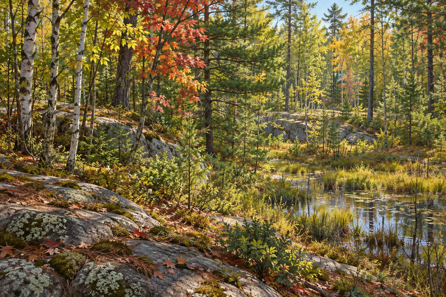
Granite sits beneath the story of Beartown State Forest. Across this 7,205-acre northern New York property, shallow, poor soils and frequent rock outcrops help explain the character of the woods. Lower ground includes wetlands flooded by beavers. Rather than looking for a single headline attraction, consider the contrast between rock, trees and wetland: three elements that make the place more specific than its name alone suggests.
The forest takes its name from a former small settlement nearby. It lies in the towns of Wilna and Croghan, so use the DEC map to identify the property rather than confusing it with the different Beartown State Forest in Massachusetts. A shared name is not a shared destination. This is a working New York state forest managed by the New York State Department of Environmental Conservation (DEC), with its own landscape and access information.
DEC describes approximately 7.45 miles of hiking opportunities across trails and unpaved roads. That combined mileage is not the length of one waymarked circuit. Choose a route from the map with the return in mind, and resist filling in connections that the published information does not establish. The mixture of roads and trails is part of the visiting context, not evidence that every route has the same surface, difficulty or conditions.
The vegetation reflects the ground beneath it. Aspen, gray birch, scrub white pine and red maple are among the common trees identified in DEC's description. These are not presented as the makings of a commercially valuable timber stand; the agency describes much of the timber as lower quality. That observation offers another way to look at the woods. A forest's interest need not depend on exceptionally large trees or the value of its timber.
Aspen has a particular habitat role here, with DEC noting its value for grouse. Take that as context for the forest, rather than a wildlife sighting promised along your walk. The beaver-flooded lowlands provide a second subject for close observation. Water and woodland can make an interesting composition without visible beavers, exposed dams or lodges. None of those structures needs to be invented to explain why the wetland component belongs in the forest's description.
Weatherhead Creek in the north and Swiss Creek in the south, together with their tributaries, are the streams DEC identifies for trout fishing. Their separate positions matter for planning: they are not two names for one waterside walk. Check the map and actual access before building a visit around a particular stream. For an observation-focused outing, their role can simply be to add a watercourse to your understanding of a landscape otherwise described by granite and trees.
Management falls within the Westward Waters Unit Management Plan, and low-quality timber sales are part of the working-forest context. Leave No Trace guidance and posted rules apply to a visit. Plan around the real routes and respect the boundaries you encounter rather than assuming neighboring public lands form one connected walk. Beartown rewards attention to the ground-level details: an outcrop, the mixture of tree forms, or a change from wooded ground to wetland can be enough to give the landscape its character.
Fun facts
- Beartown State Forest covers 7,205 acres in northern New York.
- It is named for a former small settlement nearby.
- Granite bedrock, shallow poor soils and rock outcrops characterize the property.
- Trails and unpaved roads provide approximately 7.45 miles of hiking opportunities in total.
- Weatherhead Creek lies in the northern portion and Swiss Creek in the southern portion.
Before you go
- Use the New York DEC map to distinguish this forest from its Massachusetts namesake.
- Plan a mapped route; combined hiking mileage does not establish a loop.
- Consider the mix of unpaved roads and trails when checking present conditions.
- Match Weatherhead Creek and Swiss Creek to their separate parts of the property.
- Respect posted conditions and follow Leave No Trace guidance.
Capture
- Make rock texture and woodland the main subjects from your existing route.
- Where a wetland is visible, contrast water with the surrounding tree forms without approaching animals or assuming a visible beaver lodge.
- Compare the shapes of documented hardwoods and conifers as an observation exercise rather than a promised viewpoint.
 Balsam Creek State Forest
 East Branch Fish Creek State Forest
 East Osceola State Forest
Social
New York's Beartown State Forest covers 7,205 acres and takes its name from a former nearby settlement. #Cre8Travel
Granite bedrock and shallow soils are central to Beartown State Forest's character. Look for the rock-and-woodland relationship. #Cre8Travel
Beartown's approximately 7.45 miles of hiking opportunities include trails and unpaved roads, not one declared loop. #Cre8Travel
Aspen, gray birch, scrub white pine and red maple feature in DEC's description of Beartown. #Cre8Travel
Beaver-flooded wetlands occupy Beartown's low ground. A wetland photograph need not include a visible animal. #Cre8Travel
Weatherhead Creek is in northern Beartown; Swiss Creek is in the south. Match the stream to your map. #Cre8Travel
There is also a Beartown State Forest in Massachusetts. Use New York DEC information for the Wilna-Croghan property. #Cre8Travel
Rock outcrop, tree forms or wetland contrast: what would make you pause at Beartown State Forest? #Cre8Travel
Hashtags