 Cre8Travel
CRE8TRAVEL · NEW YORK PLACES
Grant Powell State Forest
Grant Powell State Forest: A Closer Look
Discover
A forester's name gives Grant Powell State Forest a human starting point. The 8,077-acre property honors the first state district forester appointed to the Lewis-Jefferson County area, whose work helped establish local state forests through early land acquisitions. His friends and colleagues placed a memorial plaque with a small parking site on the south side of State Route 177. It is a modest introduction to a much larger landscape.
The forest stretches across the towns of Montague, Pinckney, Harrisburg and Martinsburg in Lewis County. On the Tug Hill Plateau, poor soils and severe winters are important parts of its character. Those conditions help frame the woodland story: this is a place to consider how trees grow under constraints, rather than arrive expecting an exhibition of exceptionally valuable timber. The landscape can be interesting without fitting a familiar picture of towering, commercially prized trees.
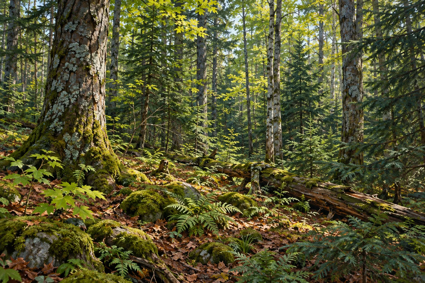
The New York State Department of Environmental Conservation (DEC) describes a mixture of natural hardwood and spruce-fir stands, with smaller areas of planted pine and spruce. Keep the distinction between natural and planted stands in mind when looking at the woods. Different tree forms can suggest different questions: which parts belong to the natural forest mixture, and which reflect an earlier planting decision? A photograph can concentrate on those textures without needing an expansive overlook.
Much of the timber is described as having low value. Planned harvesting is part of DEC's work to improve timber quality, alongside the forest's other management needs. That makes Grant Powell an example of a working state forest, where a history of acquisition and ongoing forestry belongs to the landscape's identity. It is worth considering the effort behind the word forest, rather than treating it as a place that simply appeared fully formed.
The Tug Hill Wildlife Management Area adjoins the state forest to the south. It covers more than 5,000 acres and has its own wildlife-focused purpose. The neighboring designation adds context to the map, but the two properties remain distinct. If a visit includes both, plan each approach separately instead of assuming the adjoining boundary provides a continuous trail or an entrance. Similar-looking green areas on a map can represent different visiting arrangements.
For orientation, the Route 177 memorial site and the Huck Berry unpaved parking area are separate references. DEC's approach to the latter uses Sears Pond Road from Route 177. Check the map and present conditions before choosing your stop; neither parking reference establishes a maintained hiking circuit. A visitor interested in the forest's namesake can begin with the memorial, while a wider outing requires a route suited to the actual public access.
The Tug Hill North Unit Management Plan provides the management framework for these lands. Follow posted conditions and Leave No Trace guidance, with the plateau's winter setting in mind when checking the approach. Grant Powell's interest lies in the relationship between one person's early forestry work, thousands of acres of public land and the demanding conditions in which its trees grow. Let that relationship guide the visit, whether the focus is the memorial or the woodland itself.
Fun facts
- Grant Powell State Forest covers 8,077 acres in Lewis County.
- It honors the first state district forester appointed to the Lewis-Jefferson County area.
- A memorial plaque and small parking site are on the south side of State Route 177.
- Natural hardwood and spruce-fir stands predominate, with lesser planted pine and spruce.
- Tug Hill Wildlife Management Area adjoins the state forest to the south.
Before you go
- Use the DEC map to distinguish the Route 177 memorial stop from Huck Berry parking.
- Check present access and select a route rather than assuming a maintained walking circuit.
- Treat adjoining Tug Hill WMA as a separate destination with its own approach.
- Consider the plateau's severe winters when checking access conditions.
- Follow posted rules and Leave No Trace guidance.
Capture
- Study the contrast between hardwood forms and conifers from a position you can lawfully reach.
- Use a close woodland composition rather than assuming an elevated panoramic viewpoint.
- Compare tree textures as a visual interpretation of the working-forest story without staging management activity.
 East Osceola State Forest
 Hogsback State Forest
 Mohawk Springs State Forest
Social
Grant Powell State Forest honors an early district forester whose acquisition work helped establish local public forests. #Cre8Travel
The Route 177 memorial plaque offers a human starting point for Grant Powell's larger woodland story. #Cre8Travel
Grant Powell State Forest spans 8,077 acres across four Lewis County towns. #Cre8Travel
Poor soils and severe winters are part of Grant Powell's Tug Hill Plateau setting. #Cre8Travel
Natural hardwood and spruce-fir stands mix with smaller planted pine and spruce areas at Grant Powell. #Cre8Travel
Tug Hill Wildlife Management Area lies south of Grant Powell State Forest. They remain distinct public properties. #Cre8Travel
The memorial parking site and Huck Berry unpaved parking area are separate map references at Grant Powell. #Cre8Travel
Would you begin Grant Powell State Forest's story with the forester it honors or the trees growing on the plateau? #Cre8Travel
Hashtags