 Cre8Travel
CRE8TRAVEL · NEW YORK PLACES
Hoffman Notch Wilderness
Hoffman Notch Wilderness: A Valley between Adirondack Ridges
Discover
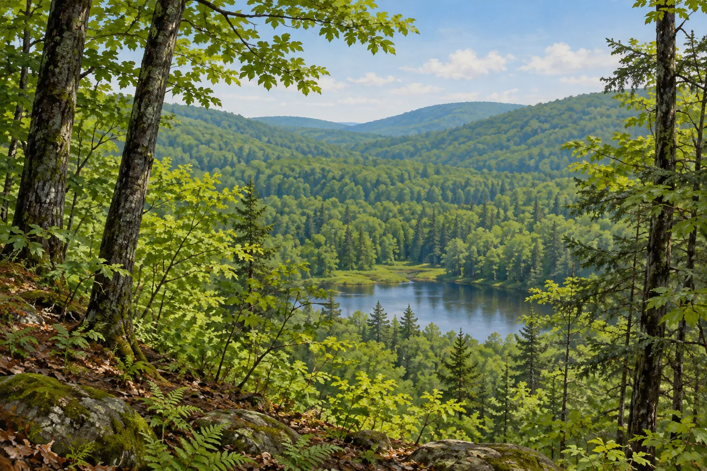
The name Hoffman Notch describes a valley between ridges, a useful beginning for understanding this Adirondack wilderness. On one side lies the Blue Ridge Range, including Hoffman Mountain; on the other is Washburn Ridge. Between and around them,38,488 acres of protected land extend through Schroon, Minerva and North Hudson in Essex County. Ponds, streams and selected trails give visitors different ways to encounter that setting, while the notch itself provides a geographical thread linking the place's name with the shape of the land.
Hoffman Notch Trail follows a 7.4 mile passage between northern and southern trailheads. Its through-route character matters: the two ends are separate starting points, with a return or onward arrangement to plan independently. The northern 1.2 miles cross private land, where public passage remains confined to the trail. Looking at the line on the map as a route through a valley, rather than a circular woodland outing, helps place both the distance and the access within the landscape's actual structure.
Pond destinations provide another approach. Bailey Pond is reached by a listed 0.8 mile trail from the southern Hoffman Notch trailhead. The relatively short destination route offers a different scale from a through-hike of the notch. A more distant unmarked path continues toward Marion Pond, but that continuation has a different status and should not be assumed to have the same preparation or maintenance as the marked approach. A visit centered on Bailey Pond can be considered on its own terms.
Big Pond and North Pond belong to the area's network of waters, together with North Branch Trout Brook and Hoffman Notch Brook. The ponds and streams give the wooded terrain a sequence of individual features rather than one continuous waterside corridor. DEC describes the Big Pond Trail as linking into the notch route, while noting that East Branch Trout Brook has no bridge on that approach. Check current route information before selecting it; a mapped connection does not supply an assumed built crossing.
Higher destinations offer a different perspective. Mount Severance Trail travels under the Northway before climbing toward its summit, with a listed 1.2 mile length and 740 feet of ascent. The view includes Schroon Lake and Pharaoh Lake Wilderness. The contrast is distinctive: a route begins beside a major travel corridor, passes beneath it and then gains a wooded mountain setting. Plan the return separately from the ascent distance, using the current trail map and conditions.
Jones Hill provides a longer traverse through varied relief. Its route climbs to a 1,860 foot summit, descends toward Platt Brook and continues along Smith Hill before reaching the Route 9 approach. The full 7.3 mile description covers several changes in ground, rather than a short summit loop. Together, these alternatives show how the same wilderness can be approached through a valley passage, a pond visit or higher terrain, each with an individual scale and practical arrangement.
Use the appropriate trailhead and current DEC backcountry notices to choose one of those encounters. The 2012 management plan supplies historical planning context, while current access and conditions govern a present visit. From an established route, a wooded pond margin or a view linking ridge and valley can be enough to express the landscape. Hoffman Notch Wilderness offers a particular meeting of passage and enclosure: routes connect selected features, while the two ridges and the valley between them retain the larger geographical story.
Fun facts
- Hoffman Notch Wilderness covers 38,488 acres in Essex County.
- Its name refers to a valley between the Blue Ridge Range and Washburn Ridge.
- Hoffman Notch Trail extends 7.4 miles between separate trailheads.
- Bailey Pond has a listed 0.8 mile approach from the southern trailhead.
Before you go
- Plan the return separately for through-routes and summit ascents.
- Remain on the permitted trail across the private northern section.
- Check current conditions; the retained Big Pond description reports no bridge over East Branch Trout Brook.
Capture
- Frame ordinary wooded pond margin from an appropriate established position.
- Use ridge and valley relationships rather than reconstructing exact summits.
- Do not approach a steep edge to obtain a more dramatic composition.
 Ha-De-Ron-Dah Wilderness
 Hurricane Mountain Wilderness
 Galen Wildlife Management Area
Social
Hoffman Notch Wilderness protects 38,488 acres around a valley between two ridge systems. #Cre8Travel
The notch lies between the Blue Ridge Range and Washburn Ridge. #Cre8Travel
The 7.4 mile notch route connects separate northern and southern approaches. #Cre8Travel
The northern section crosses private land where passage is confined to the trail. #Cre8Travel
Bailey Pond offers a shorter destination route from the southern trailhead. #Cre8Travel
A Big Pond route requires current access checks because a brook crossing has no bridge in the retained description. #Cre8Travel
Mount Severance’s approach passes beneath the Northway before climbing toward a view. #Cre8Travel
Choose a valley passage, pond destination or higher route according to its actual scale and conditions. #Cre8Travel
Hashtags