 Cre8Travel
CRE8TRAVEL · NEW YORK PLACES
Galen Wildlife Management Area
Galen Wildlife Management Area: A Clyde River Floodplain Landscape
Discover
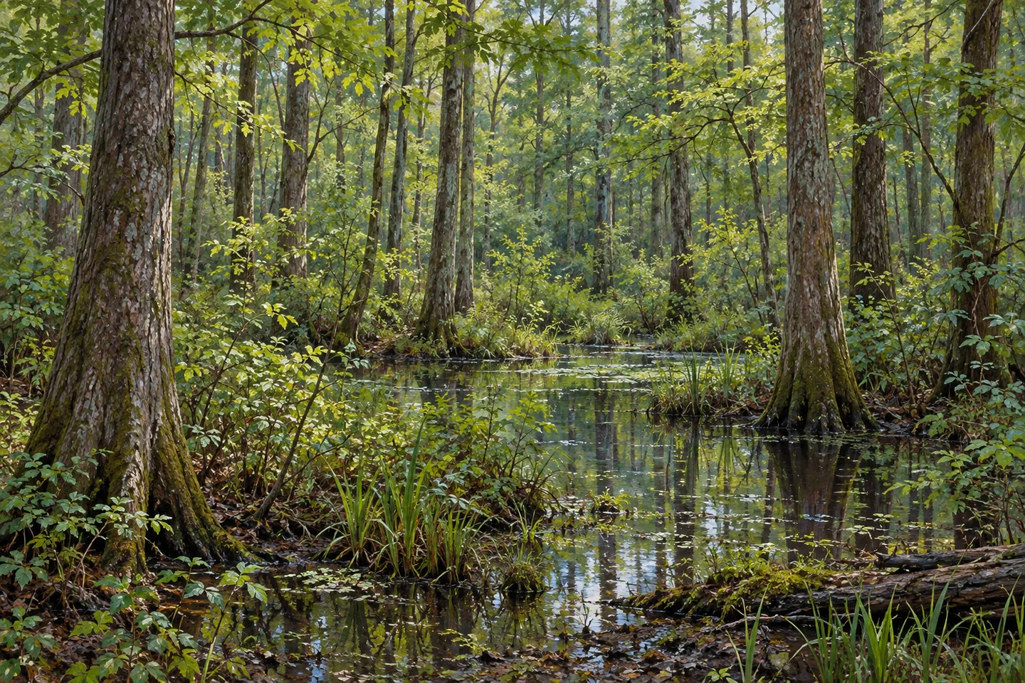
Galen Wildlife Management Area protects part of a larger wetland landscape along the Clyde River in Wayne County. In the Town of Galen, the property combines forested floodplain, shrub swamp, smaller open wetlands and patches of agricultural ground. Its 2023 habitat plan describes 763 acres, including roughly 151 acres of Creager Island and about 3 miles of river shoreline. Those features give a visit a particular geographical setting: low wooded ground connected with the river, rather than a single open marsh viewed from one standard lookout.
The state acquired the area in 1980 using wetland-preservation funding. A partial gift from former owner William Heit formed part of the conservation story, and the main portion was named the Ezra and Kate Heit Marsh unit at his request. The protected land belongs to the larger Marengo Marsh, linking the local property with a broader wetland system. Its acquisition retained habitat within a region where agriculture, timber use and river travel have all shaped the land.
Water is central to the woodland's character. The habitat plan identifies seasonally inundated floodplain forest influenced by water levels in the Clyde River and Erie Canal. It also describes shrub swamp as a significant natural community. These categories provide useful ways to look at a scene: tall trees occupy some wet ground, while lower shrubs mark another kind of cover. A wetland therefore need not look like an uninterrupted expanse of reeds or open water to be important to the landscape.
The terrain reinforces that relationship. Most of the property is very flat, generally at or below 400 feet in elevation, with a few gentle hills on its eastern and southern sides. The plan's soils account shows a substantial proportion of poorly drained ground. Together, those observations explain why water, trees and low vegetation recur across the setting. From appropriate access, differences in vegetation height and density can be more revealing than a distant panorama or a particular wildlife sighting.
Earlier land use remains part of the pattern. Agriculture and forest-product harvesting have long been associated with the area, and some fields continued in cultivation after state acquisition. An abandoned Old West Shore Railroad grade bisects the WMA and is specifically identified in the habitat plan as providing public access into the interior. This former transport line is part of the property's access history, distinct from assuming that an active railway elsewhere would be a permitted walking route.
The 2019 habitat inventory used by the 2023 plan records woodland alongside smaller agricultural, grassland and shrubland areas. Proposed management seeks to retain much mature and intermediate forest while developing more young growth. Those are management objectives, rather than a guarantee that a particular field or stand has already changed. For a present visit, the important observation is the mixture actually encountered, with current signs and the designated route determining where it can be viewed.
DEC provides River Road access references and asks walkers to remain on designated trails to protect plant communities. Use the current map and notices when choosing an approach, keeping the protected property distinct from the surrounding marsh and neighboring lands. A woodland-wetland composition can connect directly with Galen's story without an animal entering the frame. The WMA's interest lies in the meeting of river water, floodplain trees and earlier working ground, preserved within a larger landscape that continues to change.
Fun facts
- The 2023 habitat plan describes a 763 acre WMA in the Town of Galen.
- The state acquired the property in 1980.
- The plan identifies about 3 miles of Clyde River shoreline.
- An abandoned Old West Shore Railroad grade provides documented interior access.
Before you go
- Use the current map for the River Road access points.
- Remain on designated trails to protect vegetation.
- Treat plan targets as proposed management rather than completed landscape changes.
Capture
- Frame taller wetland woodland and lower shrub cover from permitted access.
- Use modest water and forest texture rather than a promised bird encounter.
- Avoid reconstructing exact field boundaries or a historic railway scene.
 Hurricane Mountain Wilderness
 Serpentine Art and Nature Commons
 Sherwood House Museum
Social
Galen Wildlife Management Area protects a Clyde River wetland landscape in Wayne County. #Cre8Travel
Its 2023 habitat plan describes 763 acres within the larger Marengo Marsh setting. #Cre8Travel
The 1980 acquisition combined wetland-preservation funding with a partial gift. #Cre8Travel
Floodplain forest changes with water levels in the river and canal system. #Cre8Travel
Shrub swamp and smaller open areas add another scale to the wooded wetland. #Cre8Travel
An abandoned railway grade provides access specifically documented in the habitat plan. #Cre8Travel
Habitat-management targets describe intended change, not proof that every project is complete. #Cre8Travel
A view of water, trees and low vegetation can reveal the character of this protected floodplain. #Cre8Travel
Hashtags