 Cre8Travel
CRE8TRAVEL · NEW YORK PLACES
Fish Creek State Forest
Fish Creek State Forest: A Closer Look
Discover
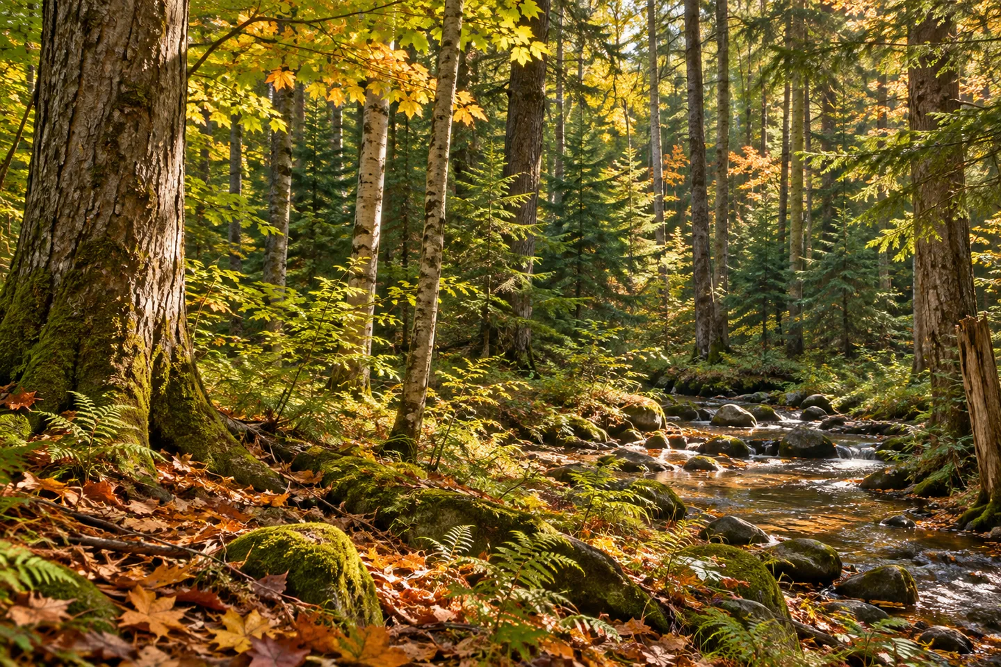
The West Branch of Fish Creek forms the western boundary of Fish Creek State Forest, giving this 679-acre property a clear geographical edge. The stream is protected trout water, while the surrounding woods contain both natural hardwoods and plantations. In Annsville and Camden, Oneida County, that combination offers a visit shaped by water and forestry history rather than an extensive prepared trail system.
Most of the property was purchased in the 1940s, with two further pieces added in the 1960s. Planting also took place during the 1940s and 1960s. Keeping those two kinds of date in mind helps avoid a simplified story in which all the land and all its trees began together. The forest's present outline includes more than one acquisition, while its planted woodland has its own sequence of work.
The New York State Department of Environmental Conservation (DEC) identifies red, white and Scotch pine and Norway spruce remaining from those planting projects. Natural woodland includes red and sugar maple, red oak, black cherry, beech, eastern hemlock, aspen and black birch. Looking at those different forest forms gives a woodland walk a particular focus. You do not have to identify every tree to notice a contrast between a planted stand and a more mixed woodland scene.
There are no trails on the property. Instead, approximately 1.1 miles of unpaved forest access roads may be used for hiking. Plan around that actual arrangement, using the map to choose a section and a return rather than expecting a creekside loop. The stream's place along the boundary is an important part of the setting, but does not create a path running beside it throughout the forest.
DEC describes brown trout and occasional wild brook trout in the West Branch. For a visit focused on observation, those names add context to the water rather than a promise of fish visible from a road. Public fishing rights are mapped separately. Respect those boundaries and the access actually provided, without assuming that following the water is the same as remaining on public forest land.
Approach references include Bones, Forward and Trestle roads. DEC locates the Bones and Forward road intersection near the northeastern corner of the property. Match the chosen approach to your map and present conditions before setting out. That northeastern reference and the stream on the western boundary describe different parts of the forest; they should not be combined into an invented short walk or a convenient access claim.
The Vienna Woods Unit Management Plan provides the wider framework for these lands. Follow posted conditions and Leave No Trace guidance, leaving vegetation and any land-use traces undisturbed. For photographs, woodland texture can connect with the planting story, while a water view can be used wherever appropriate access actually provides one. Fish Creek's scale, boundary stream and two periods of planting offer a grounded outing without a promised overlook, a maintained trail or an animal encounter. Let the route and the trees that are really present set the pace of the visit.
Fun facts
- Fish Creek State Forest covers 679 acres in Annsville and Camden, Oneida County.
- The protected West Branch of Fish Creek forms the western boundary.
- Most land was purchased in the 1940s, with two additions in the 1960s.
- There are no trails; about 1.1 miles of unpaved access roads may be hiked.
- Pine and Norway spruce plantings date from the 1940s and 1960s.
Before you go
- Plan a road-based walk rather than expecting a creekside trail or loop.
- Match Bones, Forward or Trestle Road access to the map.
- Respect public boundaries and separately mapped fishing-access rights.
- Do not make visible fish a condition of a worthwhile visit.
- Follow posted conditions and Leave No Trace guidance.
Capture
- Compare plantation forms with natural woodland textures along the appropriate route.
- Use a water view only where access actually provides one; no full creekside trail is implied.
- A close composition can show forest character without relying on wildlife or a distant panorama.
 Fall Brook State Forest
 Florence Hill State Forest
 Furnace Creek State Forest
Social
Fish Creek State Forest covers 679 acres in Annsville and Camden, Oneida County. #Cre8Travel
The West Branch of Fish Creek forms the forest's western edge and is protected trout water. #Cre8Travel
There are no trails at Fish Creek State Forest; about 1.1 miles of unpaved access roads may be hiked. #Cre8Travel
Land purchases in the 1940s and 1960s helped create today's Fish Creek State Forest. #Cre8Travel
Pines and Norway spruce from the 1940s and 1960s add a planting history to the natural woodland. #Cre8Travel
Bones, Forward and Trestle roads are Fish Creek access references, distinct from the western boundary stream. #Cre8Travel
A boundary stream does not establish a continuous waterside visitor path. Plan around the actual road access. #Cre8Travel
At Fish Creek, would the water or the contrast between planted and natural trees guide your attention? #Cre8Travel
Hashtags