 Cre8Travel
CRE8TRAVEL · NEW YORK PLACES
Fire-Fall State Forest
Fire-Fall: Rock, Lichens and a Long Woodland Recovery
Discover
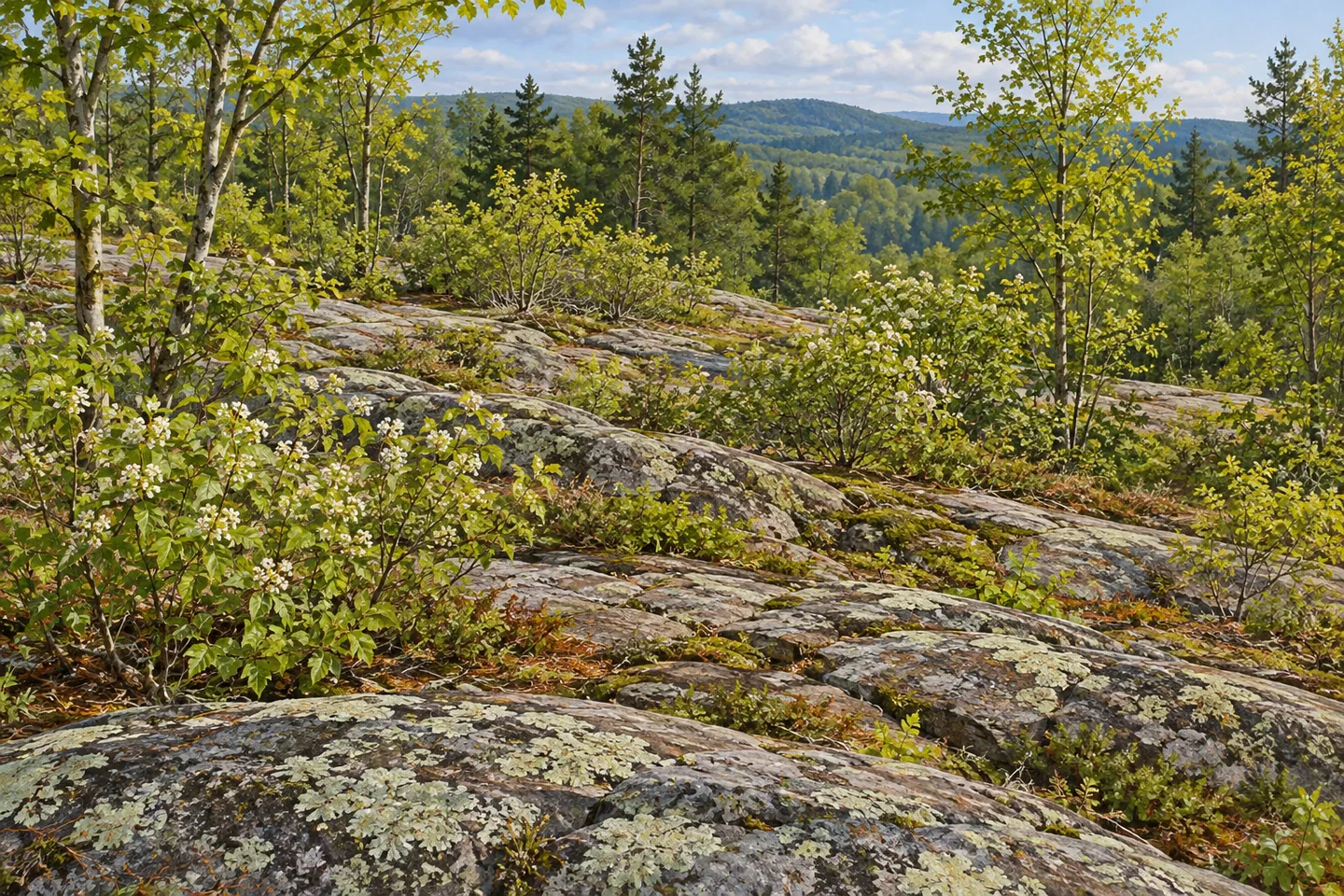
Fire-Fall State Forest makes the ground beneath the trees part of the story. Its 1,570 acres in Edwards and Hermon, St. Lawrence County, include thin soils, exposed rocky ridges and a large area where lichens and young woody growth cover bedrock. These features give the property a different character from a uniformly enclosed mature forest. A short named trail provides one walking option, while the broader landscape invites attention to how woodland develops under demanding conditions.
The public holding consists of four parcels purchased between 1950 and 1965. Those dates describe the assembly of the present state forest. Its name reaches further back, to repeated severe fires in the surrounding region during the early twentieth century. DEC's historical account identifies a wider Fire-Fall area northwest of Edwards that later contributed land to both Fire-Fall and Wolf Lake state forests. The regional history should not be compressed into one event within today's parcel boundaries.
The effects described in that account were profound. In places, the loss of tree roots and organic soil material allowed already thin ground to erode, exposing bedrock. DEC identifies a stand of more than 600 acres in Fire-Fall where lichens, shadbush and scattered young hardwoods remain important parts of the cover. The useful theme for a visit is the continuing relationship between rock, soil and growth, rather than an imagined reconstruction of the original disturbance.
That open character is only one part of the property. Better upland sites support a mixture of northern hardwoods, hemlock and white pine. Drier, less fertile ground carries red oak, eastern hophornbeam and hickories among other trees suited to those conditions. Different vegetation can therefore express differences in the land itself. Observe the contrasts where they are visible from appropriate access, without assuming that every low tree or exposed rock has exactly the same history.
Flatter ground introduces wetlands and shrub swamps. These grade toward swamp hardwoods and white cedar in places that flood seasonally. Pine and spruce plantations also occur on former fields and pastures. The variety matters: the forest contains rocky uplands, wetter communities and planted stands, rather than one simple sequence from bare rock to mature trees. Let the visible setting suggest questions instead of assigning a precise age or origin to each patch of vegetation.
For a defined walking feature, the Big Maple trail runs 0.26 mile south from County Route 19 in the northern portion of the forest. Its name and length identify a particular trail, not a promise of one exceptional tree or a circuit through every habitat described by DEC. Use the current official map to understand the chosen route and return travel. Other parts of this public holding remain largely undeveloped, without maintained trails for several permitted activities.
The southeastern portion shares a boundary with Trout Lake State Forest, which remains a separate destination. Keep that distinction when selecting a starting point or reading descriptions of nearby water access. Fire-Fall's own identity is unusually grounded in the surface of the landscape: thin soil, bedrock, lichens, shadbush, different woodland forms and a documented history of public acquisition. A modest outing can give those relationships time, without needing a dramatic landmark to carry the visit.
Fun facts
- Fire-Fall State Forest comprises four parcels purchased between 1950 and 1965.
- Its 1,570 acres lie in Edwards and Hermon, St. Lawrence County.
- DEC describes a stand of more than 600 acres with bedrock, lichens, shadbush and young hardwood cover.
- The 0.26-mile Big Maple trail leads south from County Route 19 in the northern portion.
Before you go
- Use the current map to locate the short Big Maple trail and plan return travel.
- Observe rocky and wetland vegetation from appropriate ground without entering sensitive areas.
- Keep the wider regional history and neighboring Trout Lake property distinct from the present forest’s boundaries.
Capture
- Use ordinary rock, lichen and woody-growth textures as a close landscape subject from suitable access.
- Compare visible dry-ground woodland and wetter vegetation without promising that all habitats appear on one route.
- Try a close composition of rock and lichen textures alongside a wider woodland view, staying on suitable ground and leaving vegetation undisturbed.
 Degrasse State Forest
 Stammer Creek State Forest
 Taylor Creek State Forest
Social
At Fire-Fall State Forest, rock and soil help explain the woodland’s character. #Cre8Travel
The 1,570-acre property consists of four parcels purchased between 1950 and 1965.
Its name recalls a wider regional landscape history, rather than one event inside today’s boundaries.
DEC describes extensive bedrock with lichens, shadbush and young hardwood growth.
Other ground supports hardwoods, hemlock, white pine and planted conifers.
Wetlands and shrub swamps add another part of the habitat mosaic.
The Big Maple trail is a specific 0.26-mile walking feature in the northern portion.
Choose one mapped objective and look closely. The relationship between ground and vegetation is the story here.
Hashtags