 Cre8Travel
CRE8TRAVEL · NEW YORK PLACES
Degrasse State Forest
Degrasse: A River Forest with a Detailed Planting History
Discover
Degrasse State Forest has a particularly detailed account of how part of its woodland began. In 1936 and 1937, Civilian Conservation Corps crews planted more than 896,000 trees on 606 acres here. The present 1,180-acre forest lies in Russell, St. Lawrence County, with upland woodland, wet ground and frontage on the South Branch of the Grass River. A visit can connect that planting history with a landscape whose different parts continue to develop in different ways.
The crews came from Camp S-134 in Pierrepont. White pine, red pine and white spruce were the principal species in their planting program. Naming the camp, the years and the area gives the reforestation story a local scale: this was work undertaken on particular ground, rather than simply an example of a statewide policy. The planted acreage is not the whole extent of the forest, and the historical species list does not date every conifer visible today.
Planting was accompanied by protection work. The crews cleared and maintained 5.5 miles of fireline and constructed three waterholes for fire control. Those were practical elements of establishing and caring for the new forest. They belong to its working history, separate from the modern recreation routes. An old fireline measurement should therefore not become an extra trail distance, and the waterhole record should not be treated as a promise of a present interpretive stop.
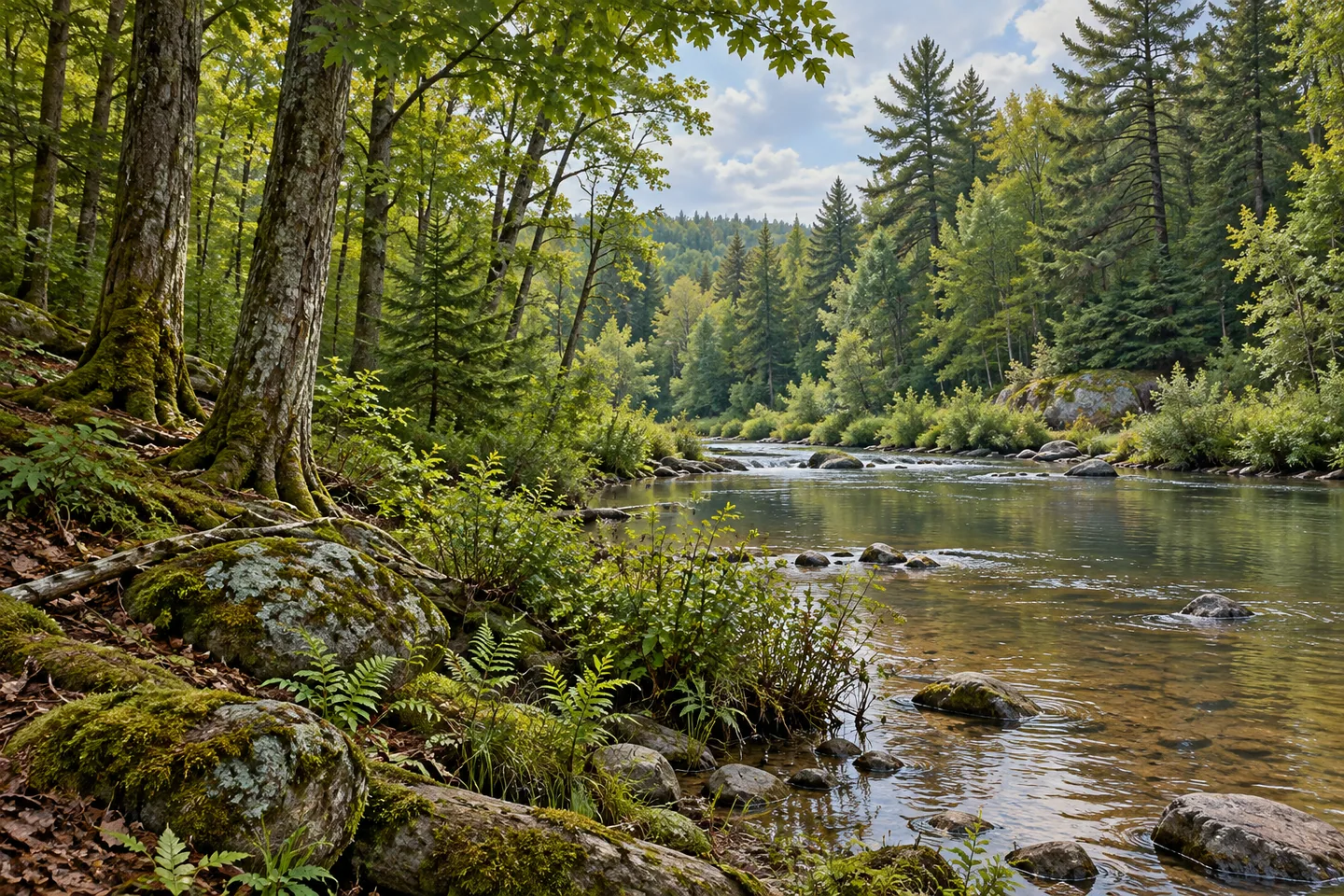
The ground supports several kinds of woodland. Northern hardwoods, hemlock and white pine occur on uplands, with pine and spruce plantations on former fields and pastures. Flatter areas support wetlands and shrub swamps, grading toward swamp hardwoods and white cedar in seasonally flooded places. The differences give a useful observation theme: where access and visibility permit, notice how tree form and vegetation change with the ground beneath them, without needing an animal encounter to make the habitat interesting.
Windstorms in 2004 and 2008 added another chapter. DEC records salvage work on 79 acres of storm-damaged timber in the following years. The dates describe a documented disturbance and response, rather than the condition of every stand now. They also show why a forest's history does not stop when its original seedlings become established. Planting, natural development, disturbance and later management all contribute to the woodland a visitor is trying to understand.
For walking, 3.44 miles of multiple-use trails provide access from Nolan and Cole roads. Treat that as a network total, then select a particular route and return journey using the current official map. A primitive campsite with a lean-to, picnic table and privy is described at the end of the unpaved access road off Cole Road. That specific facility is different from a developed campground with a wider range of services or a guarantee of space on arrival.
The river gives the forest another focus. DEC identifies a hand launch and more than 3.7 miles of frontage on the South Branch of the Grass River. Frontage measures a relationship to the water, not a continuous maintained riverside trail. Choose the actual access serving the intended outing. Degrasse's particular appeal lies in keeping its layers together: a well-recorded planting program, varied ground, later storm history and a river edge within one public woodland.
Fun facts
- CCC crews from Camp S-134 planted more than 896,000 trees on 606 acres in 1936 and 1937.
- The same program included 5.5 miles of fireline work and three waterholes for fire control.
- The current forest covers 1,180 acres in Russell, St. Lawrence County.
- DEC identifies more than 3.7 miles of frontage on the South Branch of the Grass River.
Before you go
- Select a particular route from the current official map rather than treating the full trail mileage as one circuit.
- Keep historic firelines and waterholes distinct from present recreation facilities.
- Use a specified river access rather than assuming the frontage provides a continuous walking path.
Capture
- Compare visible conifer stands and naturally developed woodland without assigning dates to individual trees.
- Use a change between upland trees and wetter vegetation as a subject from appropriate access.
- Use gentle side light to separate layers of tree trunks and branches from the selected public route.
 Volunteer Firemen Museum
 Fire-Fall State Forest
 Stammer Creek State Forest
Social
Degrasse State Forest has a detailed 1930s planting story. #Cre8Travel
Crews from Camp S-134 planted more than 896,000 trees on 606 acres in 1936 and 1937.
White pine, red pine and white spruce were the main planting species.
Firelines and waterholes formed a separate part of the early protection work.
Upland woodland and wetter communities give the present forest several different forms.
Windstorms in 2004 and 2008 added another chapter to its management history.
More than 3.7 miles of frontage connect the property with the South Branch of the Grass River.
Choose one mapped outing and look for the landscape’s layers: planting, water, ground and changing tree cover.
Hashtags