 Cre8Travel
CRE8TRAVEL · NEW YORK PLACES
East Branch Fish Creek State Forest
East Branch Fish Creek State Forest: A Closer Look
Discover
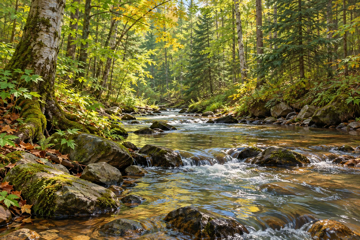
East Branch Fish Creek State Forest is a place to read through its watercourse. Its 1,350 acres form two parcels, an upper portion and a lower portion, both beside the East Branch of Fish Creek in Lewis County. The land was purchased to establish a corridor along the creek. That purpose gives the property its focus, but it should not be mistaken for a promise of one uninterrupted public walking route between the parcels.
The creek's banks vary. DEC describes gentler stretches with occasional deposits near entering streams, as well as steep drops below overhanging cliffs. Some sections of the channel have a braided appearance. Those contrasts make water and landform interesting subjects, while also calling for restraint about where to stand. A description of a dramatic bank is not a recommendation to descend it or an assurance that a viewpoint can be reached from a trail.
For walking, there are two named references: the East Branch Fish Creek Trail in the northern portion and the Heron Brook Foot Trail in the southern portion. Together they account for 3.5 miles of hiking trails. Unpaved forest access roads offer other walking possibilities. Choose the relevant parcel and route from the map, rather than turning the combined mileage into a single circuit or assuming a connector between the named trails.
The New York State Department of Environmental Conservation (DEC) describes Michigan Mills Road as the principal motor-vehicle approach. The signed public road ends at a turnaround and parking area short of the bridge over the creek. Wee Road and Michigan Mills Extension are listed parking locations. Let the signed access limit determine where the drive ends; the bridge is a map reference, not permission to keep driving into the woods.
The trees carry a history of earlier paper-company ownership. Much of the forest was heavily cut, and DEC describes a developing mixture of yellow birch, red maple, hard maple, hemlock and balsam fir, with some pine and spruce. The combination is worth considering without calling the property pristine wilderness. A working forest can have a strong sense of place precisely because its present appearance is connected to earlier uses of the land.
Forest inventories and controlled timber sales are part of DEC's management here. Its purposes include water quality, habitat, recreation and forest resources. That is a set of management interests, not proof that every ecological outcome has been achieved. Along a chosen route, compare tree forms and the relationship between woods and water. Such observations keep attention on what the place actually presents, rather than on an invented narrative of complete recovery.
The creek supports brown, rainbow and brook trout and Atlantic salmon, according to DEC. An observation-focused visit need not turn those names into a promise of visible fish. Follow Leave No Trace guidance, check posted conditions and use the appropriate map for the parcel you intend to visit. With its separate walking areas, changing banks and documented forest history, East Branch Fish Creek offers a specific landscape to consider without requiring an imagined loop, a wildlife spectacle or a descent toward the water.
Fun facts
- East Branch Fish Creek State Forest covers 1,350 acres in two parcels adjoining the creek.
- The East Branch Fish Creek Trail is in the northern portion and Heron Brook Foot Trail in the southern portion.
- The two named hiking trails provide 3.5 miles in total.
- Michigan Mills Road public vehicle access ends at a turnaround and parking area short of the bridge.
- Much of the forest was heavily cut during earlier paper-company ownership.
Before you go
- Choose a parcel and mapped route rather than assuming the two portions form a continuous walk.
- Treat the 3.5 miles as combined trail mileage, not a single loop.
- Stop driving at the signed public access limit near the bridge.
- Do not use steep-bank descriptions as directions to a viewpoint or water access.
- Follow Leave No Trace guidance and posted conditions.
Capture
- Compare creek and woodland from a position already permitted by the route and conditions.
- Study the contrasting forms of documented hardwoods and conifers without inventing a particular tree stand at a viewpoint.
- Where safely visible from your existing position, use the line of the water as a composition element; no bank descent is needed.
 Beartown State Forest
 East Osceola State Forest
 Grant Powell State Forest
Social
East Branch Fish Creek State Forest has two parcels, both beside the creek, totaling 1,350 acres. #Cre8Travel
Northern East Branch Fish Creek Trail and southern Heron Brook Foot Trail provide 3.5 miles combined. #Cre8Travel
A corridor purchase does not establish a continuous visitor route. Choose the right parcel on the East Branch Fish Creek map. #Cre8Travel
Michigan Mills Road public motor access ends at a turnaround and parking area short of the creek bridge. #Cre8Travel
DEC describes varied creek banks here, including steep drops. Dramatic scenery is not a route instruction. #Cre8Travel
Earlier paper-company logging is part of East Branch Fish Creek State Forest's history. This is a working forest. #Cre8Travel
Yellow birch, maples, hemlock and balsam fir belong to the documented woodland mix at East Branch Fish Creek. #Cre8Travel
What would hold your attention at East Branch Fish Creek: the channel's shape or the forest's working history? #Cre8Travel
Hashtags