 Cre8Travel
CRE8TRAVEL · NEW YORK PLACES
Earlville State Forest
Earlville State Forest: A Closer Look
Discover
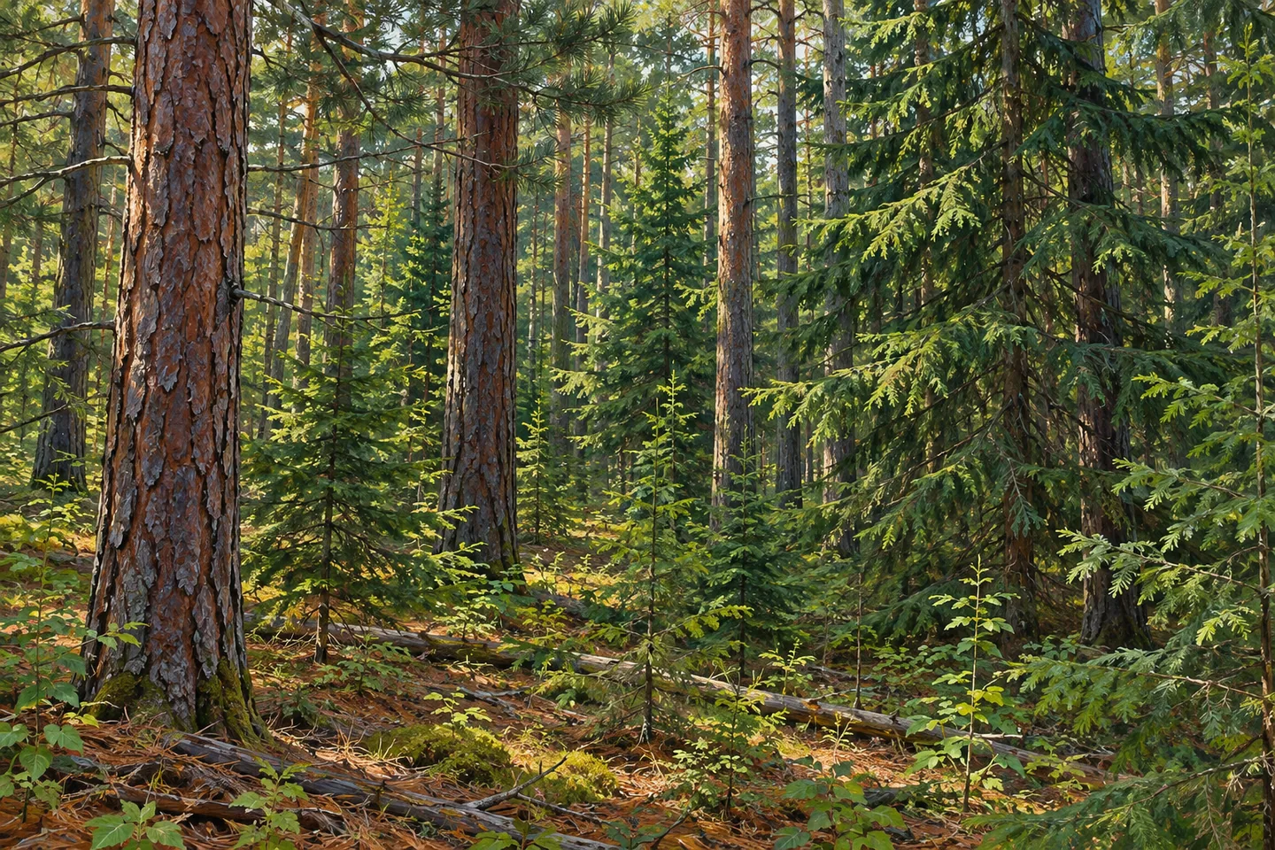
Earlville State Forest has a planting history with an unusual mechanical detail. When the state established the forest in 1929 after acquiring a farm from Floyd Nowers, old fields became the setting for conifer planting. Many trees were planted using a Duplex reforesting machine designed by a company in Cortland. That practical connection between a machine, a field and a forest gives a walk here a distinctive historical thread.
The property now covers 634 acres in the Town of Lebanon, Madison County, at an elevation approaching 1,600 feet. The New York State Department of Environmental Conservation (DEC) describes a public forest access road as the walking approach. There are no formal trails. Plan around the road and the property map, rather than expecting a set of signed loops or assuming the whole acreage can be covered by one prepared walking route.
The management history records planting on 400 acres of old fields, including red pine and Norway spruce. Keep the planting area distinct from the total size of the forest. The difference makes the story more specific: public acquisition did not mean every acre was planted in the same way. It offers a useful question while looking at the woods, about how the landscape in front of you relates to decisions made on former agricultural ground.
The Duplex machine was developed by the Champion Sheet Metal Company of Cortland. There is no need to imagine a surviving machine displayed in the forest; the interest is in the work it helped accomplish. Reforestation involved tools and practical choices as well as the passage of time. Thinking about the planting process can turn repeated tree forms from a general woodland pattern into a reminder of how a state forest was established.
For an outing on foot, choose the public access road and a return that match your plans and the posted conditions. Hiking is permitted elsewhere unless posted otherwise, but that permission is different from the presence of a maintained trail. A modest road-based visit can leave space for close observation without inventing an overlook or promising a view across the surrounding countryside. Let the actual setting provide the subjects for attention.
Western and eastern parking references appear in DEC's visitor information. Its approach from Earlville uses Lebanon Road and Morgan Road. Trapporgan Road and the public forest access road are not plowed in winter, so check the route before relying on a seasonal drive. The forest's hilltop elevation is part of its location, not a guarantee that a chosen approach will suit every condition or every visitor.
The Lebanon Hills management framework provides the wider context for these lands. Follow posted rules and Leave No Trace guidance, leaving trees and any historical features undisturbed. For photographs, woodland texture and the rhythm of conifer trunks can suggest the planting story without reconstructing a farm or a machine at work. Earlville offers a particular way to think about public forest: acreage acquired, fields planted and practical forestry decisions that still inform how the place can be understood.
Fun facts
- Earlville State Forest covers 634 acres in Lebanon, Madison County, near 1,600 feet elevation.
- The state established it in 1929 after acquiring a farm property from Floyd Nowers.
- Red pine and Norway spruce were planted on 400 acres of old fields.
- Many trees were planted with a Duplex reforesting machine designed by Champion Sheet Metal Company of Cortland.
- There are no formal trails; the public forest access road provides a walking approach and is not plowed in winter.
Before you go
- Plan around the public forest access road rather than expecting formal hiking loops.
- Use the property map to select the western or eastern parking approach.
- Check winter conditions because Trapporgan Road and the access road are unplowed.
- Treat the planting-machine story as history, not an on-site machinery exhibit.
- Follow posted conditions and Leave No Trace guidance.
Capture
- Study conifer trunk patterns from your chosen route as an interpretation of planting history.
- Use tree detail rather than an assumed hilltop panorama.
- Photograph the actual woodland without staging machinery, historic fields or an imagined restoration scene.
 DeRuyter State Forest
 Lebanon State Forest
 Morrow Mountain State Forest
Social
Earlville State Forest covers 634 acres near 1,600 feet elevation in Lebanon, Madison County. #Cre8Travel
Earlville's state-forest story began in 1929 with the acquisition of a farm from Floyd Nowers. #Cre8Travel
Red pine and Norway spruce were planted on 400 acres of Earlville's old fields, distinct from the forest's total acreage. #Cre8Travel
A Duplex reforesting machine designed in Cortland helped plant many of Earlville's conifers. #Cre8Travel
There are no formal trails at Earlville State Forest; the public forest access road provides the walking approach. #Cre8Travel
Trapporgan Road and Earlville's public forest access road are not plowed in winter. Check the approach before visiting. #Cre8Travel
A planting machine can be part of a forest's story without surviving as an on-site exhibit. #Cre8Travel
At Earlville, repeated tree forms offer a way to think about the practical work behind reforestation. #Cre8Travel
Hashtags