 Cre8Travel
CRE8TRAVEL · NEW YORK PLACES
DeRuyter State Forest
DeRuyter State Forest: A Closer Look
Discover
DeRuyter State Forest invites a walk through two different pictures of the same land. Today, its 972 acres occupy a narrow ridge in Madison County, with a channel feeding the Middle Branch of Tioughnioga Creek. In the nineteenth century, the wider town was a much more open farming landscape. The contrast between that earlier setting and today's woods gives the forest a story beyond the route underfoot.
The 1875 county atlas records farms in and around land that later became the state forest. Cheese factories, sawmills and tanneries belonged to the town's economy, with railways connecting local goods to distant markets. Keep that history at the town scale; it is not a list of factory ruins inside the forest. It helps explain the surroundings in which land was farmed, left behind and eventually given a different purpose.
One historical view brings the change into focus. In the open landscape, a person looking west from Stanton Road could see DeRuyter Reservoir, built in 1863 as a feeder for the Erie Canal. The date belongs to the reservoir, not the construction of the canal. Treat the view as part of the historical account rather than a panorama promised through present woodland. Imagining a former openness can be more revealing than expecting it to survive unchanged.
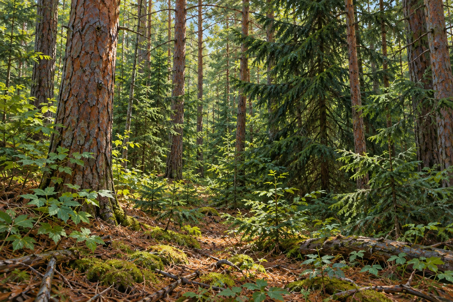
Land purchases using funds authorized by the State Reforestation Act of 1929 created DeRuyter State Forest. Beginning in 1935, Civilian Conservation Corps workers from Camp S-103 planted hundreds of acres with red pine and Norway spruce. That sequence links public acquisition and planting without making them the same event. It also gives two particular tree names to consider while walking, rather than describing the forest simply as a blanket of evergreens.
The New York State Department of Environmental Conservation (DEC) identifies a section of the North Country National Scenic Trail crossing the forest from east to west. Other recreational corridors run north to south, making direction a useful part of map reading here. Select a walking route and return from the actual trail map; the intersecting directions do not themselves establish a convenient loop. Hiking is allowed elsewhere unless a location is posted otherwise.
The forest lies west of State Route 13, with approaches associated with Fairbanks, Stanton and Tromp roads. Match the chosen access location to your route before setting out. The ridge and channel can give the terrain a specific character, while the planted woodland offers texture and repetition for a photograph. Neither requires an invented overlook or a claim that every part of the reservoir is visible from the trees.
Management follows the Tioughnioga planning framework. Follow posted conditions and Leave No Trace guidance, keeping historical features and vegetation undisturbed. An outing at DeRuyter can move between close observation and a longer view of land use: the present trail, the trees planted from 1935 and the farms described in the atlas. Those layers make a grounded narrative of change, without turning the town's industries into on-site relics or the historical view into a guaranteed modern attraction.
Fun facts
- DeRuyter State Forest covers 972 acres on a narrow ridge in Madison County.
- A channel feeds the Middle Branch of Tioughnioga Creek.
- A section of the North Country National Scenic Trail crosses east to west.
- CCC workers from Camp S-103 began planting red pine and Norway spruce in 1935.
- DeRuyter Reservoir was built in 1863 as an Erie Canal feeder; that historical view is not a present overlook guarantee.
Before you go
- Choose a route from the actual North Country Trail and property maps.
- Keep east-west trail direction distinct from north-south recreational corridors.
- Match Fairbanks, Stanton or Tromp Road access to the route you intend.
- Read the town's industrial history as context, not instructions to find forest ruins.
- Follow posted conditions and Leave No Trace guidance.
Capture
- Where visible along the route, use planted conifer forms to interpret the reforestation story.
- Study forest texture without assuming the old Stanton Road reservoir view remains open.
- A grounded composition can focus on the present ridge woodland rather than invented factories or historical structures.
 Charles E. Baker State Forest
 Earlville State Forest
 Lebanon State Forest
Social
DeRuyter State Forest occupies a narrow ridge across 972 acres in Madison County. #Cre8Travel
The North Country National Scenic Trail crosses DeRuyter from east to west. #Cre8Travel
The 1875 atlas records the farming landscape in and around today's DeRuyter State Forest. #Cre8Travel
Red pine and Norway spruce planting began in 1935, carried out by CCC workers from Camp S-103. #Cre8Travel
DeRuyter Reservoir was built in 1863 as an Erie Canal feeder. The date is the reservoir's, not the canal's. #Cre8Travel
A historical view from open farmland is not a promised present-day viewpoint through the woods. #Cre8Travel
Fairbanks, Stanton and Tromp roads help orient a DeRuyter visit west of State Route 13. #Cre8Travel
At DeRuyter, how would you connect today's wooded trail with the earlier farming and reforestation story? #Cre8Travel
Hashtags